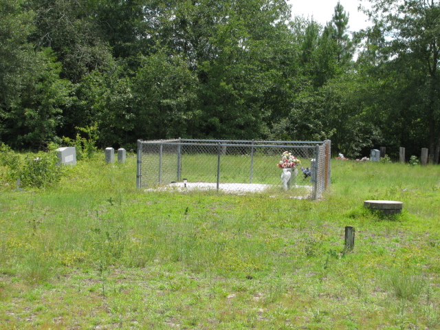
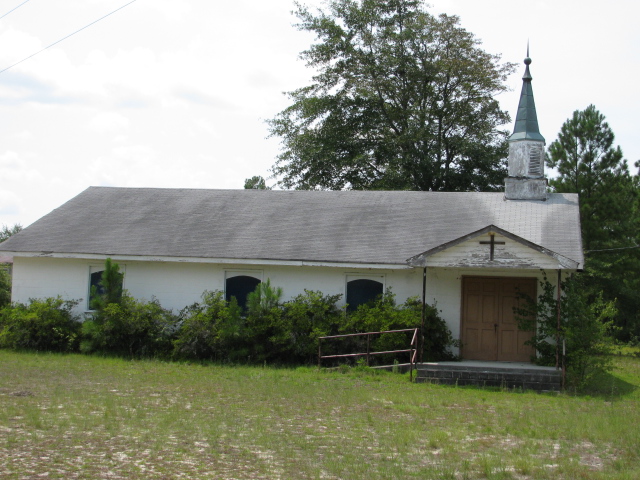
| Memorials | : | 16 |
| Location | : | Cheraw, Chesterfield County, USA |
| Coordinate | : | 34.6717450, -79.9451980 |
| Description | : | From Cheraw, S.C. take West Market Street Extension going towards Teals Mill. The church will be on the left just before you cross Thompson Creek bridge. Cemetery will be behind the church. The church is no longer being used. |
frequently asked questions (FAQ):
-
Where is Faith Freewill Baptist Church Cemetery?
Faith Freewill Baptist Church Cemetery is located at West Market Street Extension Cheraw, Chesterfield County ,South Carolina ,USA.
-
Faith Freewill Baptist Church Cemetery cemetery's updated grave count on graveviews.com?
0 memorials
-
Where are the coordinates of the Faith Freewill Baptist Church Cemetery?
Latitude: 34.6717450
Longitude: -79.9451980
Nearby Cemetories:
1. J. C. Broome Memorial Garden
Cheraw, Chesterfield County, USA
Coordinate: 34.6753830, -79.9346970
2. Fisher Hill Community Cemetery
Cheraw, Chesterfield County, USA
Coordinate: 34.6738360, -79.9319040
3. Progressive Church of Our Lord Jesus Christ Cemete
Cheraw, Chesterfield County, USA
Coordinate: 34.6910300, -79.9387430
4. Pleasant Grove United Methodist Church Cemetery
Cheraw, Chesterfield County, USA
Coordinate: 34.7048630, -79.9539520
5. Chatham Hill Memorial Gardens
Cheraw, Chesterfield County, USA
Coordinate: 34.6719017, -79.9019012
6. Prince Of Peace Church Cemetery
Cheraw, Chesterfield County, USA
Coordinate: 34.7076230, -79.9484660
7. Smithville Cemetery
Chesterfield County, USA
Coordinate: 34.7047005, -79.9669037
8. Pleasant Hill Baptist Church Cemetery
Cheraw, Chesterfield County, USA
Coordinate: 34.6372990, -79.9684310
9. Forest Pine Freewill Independent Church Cemetery
Cheraw, Chesterfield County, USA
Coordinate: 34.6324050, -79.9585820
10. First Southern Methodist Church Cemetery
Cheraw, Chesterfield County, USA
Coordinate: 34.6692090, -79.9958000
11. Mount Olivet United Methodist Church Cemetery
Hunts Mill, Chesterfield County, USA
Coordinate: 34.6623192, -79.9972763
12. Foundry Hill Cemetery
Cheraw, Chesterfield County, USA
Coordinate: 34.6957350, -79.8998800
13. Saint Paul Missionary Baptist Church
Cheraw, Chesterfield County, USA
Coordinate: 34.7109260, -79.9745410
14. Saint Josephs Cemetery
Cheraw, Chesterfield County, USA
Coordinate: 34.7175410, -79.9702010
15. Lower Macedonia Memorial Garden
Chesterfield, Chesterfield County, USA
Coordinate: 34.6688470, -80.0077090
16. Midway Baptist Church Cemetery
Cheraw, Chesterfield County, USA
Coordinate: 34.7170570, -79.9826580
17. Curry Family Cemetery
Chesterfield, Chesterfield County, USA
Coordinate: 34.6478430, -80.0053170
18. Old Saint Davids Episcopal Church Cemetery
Cheraw, Chesterfield County, USA
Coordinate: 34.6956140, -79.8794250
19. Erasmus Powe Family Cemetery
Cheraw, Chesterfield County, USA
Coordinate: 34.7041400, -79.8822950
20. Pee Dee Union Baptist Church Cemetery
Cheraw, Chesterfield County, USA
Coordinate: 34.6968440, -79.8775160
21. Piney Grove Baptist Church Cemetery
Patrick, Chesterfield County, USA
Coordinate: 34.6144500, -79.9728500
22. Robinson Zion Church
Cheraw, Chesterfield County, USA
Coordinate: 34.7328090, -79.9323420
23. Goodman Creek Missionary Baptist Church
Cheraw, Chesterfield County, USA
Coordinate: 34.7356390, -79.9347530
24. Montrose Cemetery
Chesterfield County, USA
Coordinate: 34.6255989, -79.8842010


