
| Memorials | : | 3054 |
| Location | : | Cheraw, Chesterfield County, USA |
| Phone | : | 843-537-8425 |
| Coordinate | : | 34.6956140, -79.8794250 |
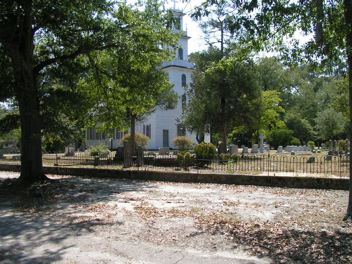
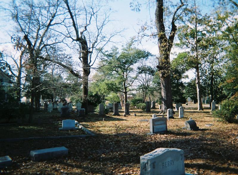
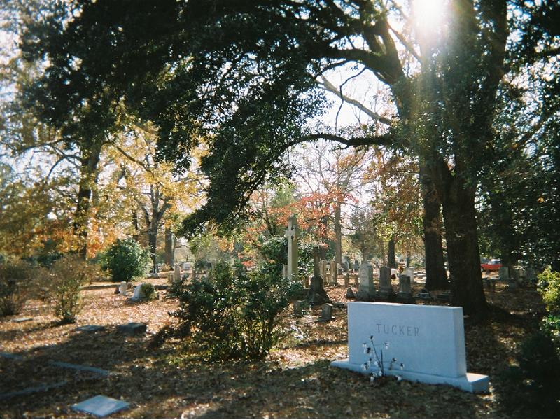
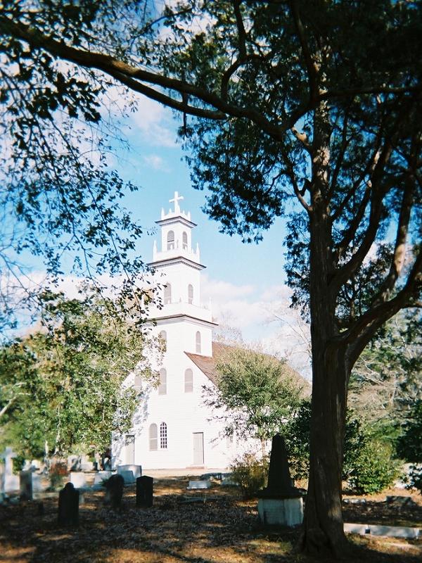
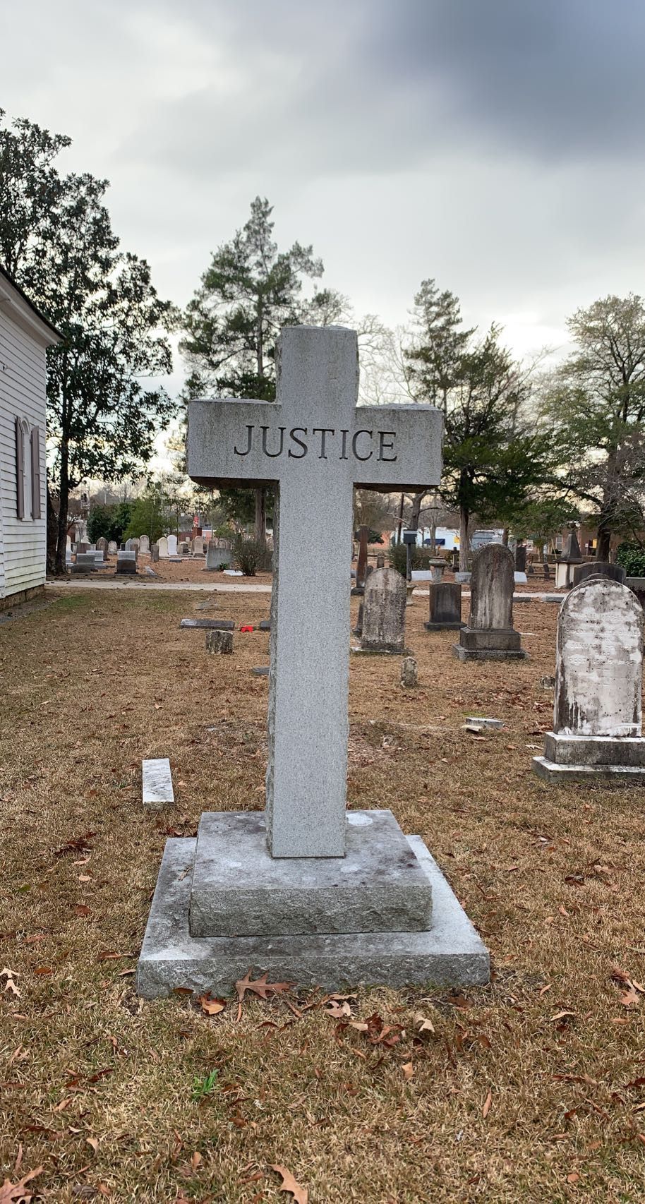
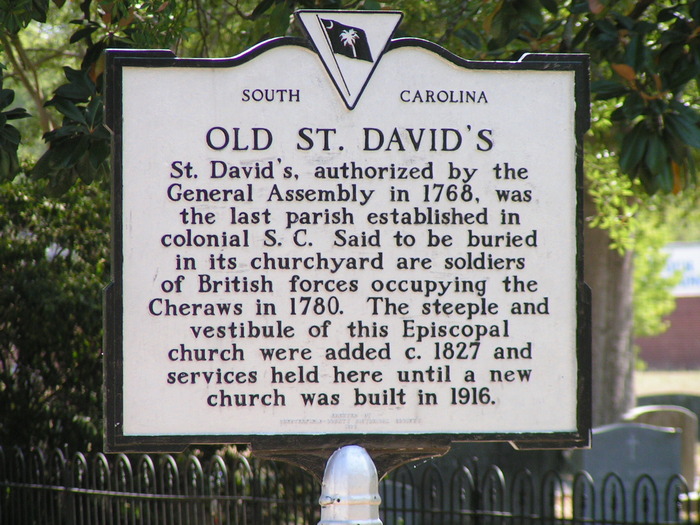
| Description | : | The church was the last Anglican or "State" church built (c.1770) in South Carolina under King George III. This historic church was used by the Americans and the British during the American Revolution and later by both the Confederate and Union armies. The first Confederate monument ever built is located in the cemetery, erected (c.1867) in memory of those who had fallen in the Civil War. The original inscription did not mention Confederate soldiers directly because Union forces still occupied the area. There are soldiers from almost every American War buried in the cemetery. Also in the cemetery are the... Read More |
frequently asked questions (FAQ):
-
Where is Old Saint Davids Episcopal Church Cemetery?
Old Saint Davids Episcopal Church Cemetery is located at 91 Church Street Cheraw, Chesterfield County ,South Carolina ,USA.
-
Old Saint Davids Episcopal Church Cemetery cemetery's updated grave count on graveviews.com?
3054 memorials
-
Where are the coordinates of the Old Saint Davids Episcopal Church Cemetery?
Latitude: 34.6956140
Longitude: -79.8794250
Nearby Cemetories:
1. Pee Dee Union Baptist Church Cemetery
Cheraw, Chesterfield County, USA
Coordinate: 34.6968440, -79.8775160
2. Erasmus Powe Family Cemetery
Cheraw, Chesterfield County, USA
Coordinate: 34.7041400, -79.8822950
3. Foundry Hill Cemetery
Cheraw, Chesterfield County, USA
Coordinate: 34.6957350, -79.8998800
4. Gillespie - Shipp Family Graveyard
Wallace, Marlboro County, USA
Coordinate: 34.7179060, -79.8657610
5. Wallace Baptist Church Cemetery
Wallace, Marlboro County, USA
Coordinate: 34.7199530, -79.8609130
6. Chatham Hill Memorial Gardens
Cheraw, Chesterfield County, USA
Coordinate: 34.6719017, -79.9019012
7. Mission of Faith Church Cemetery
Wallace, Marlboro County, USA
Coordinate: 34.7246090, -79.8598550
8. Greater White Creek Baptist Church Cemetery
Wallace, Marlboro County, USA
Coordinate: 34.7346600, -79.8667400
9. Fisher Hill Community Cemetery
Cheraw, Chesterfield County, USA
Coordinate: 34.6738360, -79.9319040
10. Progressive Church of Our Lord Jesus Christ Cemete
Cheraw, Chesterfield County, USA
Coordinate: 34.6910300, -79.9387430
11. J. C. Broome Memorial Garden
Cheraw, Chesterfield County, USA
Coordinate: 34.6753830, -79.9346970
12. Hickory Grove Road Cemetery
Wallace, Marlboro County, USA
Coordinate: 34.6950640, -79.8162270
13. Robinson Zion Church
Cheraw, Chesterfield County, USA
Coordinate: 34.7328090, -79.9323420
14. Prince Of Peace Church Cemetery
Cheraw, Chesterfield County, USA
Coordinate: 34.7076230, -79.9484660
15. Smith Family Cemetery
Wallace, Marlboro County, USA
Coordinate: 34.7216060, -79.8162530
16. Faith Freewill Baptist Church Cemetery
Cheraw, Chesterfield County, USA
Coordinate: 34.6717450, -79.9451980
17. Goodman Creek Missionary Baptist Church
Cheraw, Chesterfield County, USA
Coordinate: 34.7356390, -79.9347530
18. Pleasant Grove United Methodist Church Cemetery
Cheraw, Chesterfield County, USA
Coordinate: 34.7048630, -79.9539520
19. Ebenezer United Methodist Church Cemetery
Wallace, Marlboro County, USA
Coordinate: 34.7326498, -79.8078380
20. Oak Grove United Methodist Church Cemetery
Wallace, Marlboro County, USA
Coordinate: 34.7430992, -79.8174973
21. Montrose Cemetery
Chesterfield County, USA
Coordinate: 34.6255989, -79.8842010
22. True Gospel Emanuel Holiness Church Cemetery
Wallace, Marlboro County, USA
Coordinate: 34.7146900, -79.7958800
23. Gibson Family Cemetery
Wallace, Marlboro County, USA
Coordinate: 34.7425300, -79.8137700
24. Smithville Cemetery
Chesterfield County, USA
Coordinate: 34.7047005, -79.9669037