
| Memorials | : | 0 |
| Location | : | Erp, Veghel Municipality, Netherlands |
| Coordinate | : | 51.5986800, 5.6056100 |
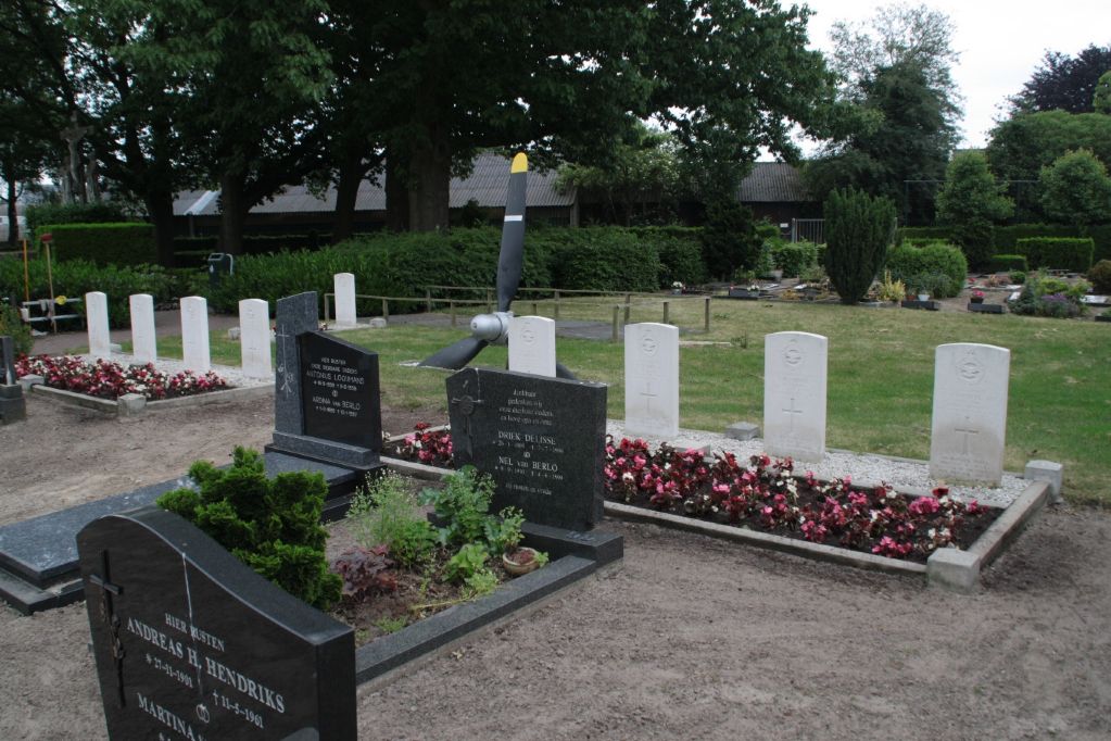
| Description | : | Erp is a village 8 kilometres north-west of Gemert and 4.8 kilometres south-west of Veghel. The cemetery is south of the Veghel-Gemert road, about 270 metres from the church. |
frequently asked questions (FAQ):
-
Where is Erp Roman Catholic Cemetery?
Erp Roman Catholic Cemetery is located at Erp, Veghel Municipality ,Noord-Brabant ,Netherlands.
-
Erp Roman Catholic Cemetery cemetery's updated grave count on graveviews.com?
0 memorials
-
Where are the coordinates of the Erp Roman Catholic Cemetery?
Latitude: 51.5986800
Longitude: 5.6056100
Nearby Cemetories:
1. Veghel Roman Catholic Churchyard
Veghel, Veghel Municipality, Netherlands
Coordinate: 51.6183100, 5.5424300
2. Heilig Hart van Jesus Kerk, Fransiscusparochie
Veghel Municipality, Netherlands
Coordinate: 51.6143569, 5.5389391
3. Mariahout Roman Catholic Churchyard
Mariahout, Laarbeek Municipality, Netherlands
Coordinate: 51.5396100, 5.5720200
4. Uden War Cemetery
Uden, Uden Municipality, Netherlands
Coordinate: 51.6638800, 5.6118500
5. Gemert War Memorial Grave
Gemert, Gemert-Bakel Municipality, Netherlands
Coordinate: 51.5538200, 5.6821400
6. Eerde Roman Catholic Churchyard
Eerde, Veghel Municipality, Netherlands
Coordinate: 51.6053300, 5.4982100
7. Uden General Cemetery
Uden, Uden Municipality, Netherlands
Coordinate: 51.6659500, 5.6256500
8. Odiliapeel Roman Catholic Cemetery
Odiliapeel, Uden Municipality, Netherlands
Coordinate: 51.6435700, 5.7031100
9. Lieshout Begraafplaats
Lieshout, Laarbeek Municipality, Netherlands
Coordinate: 51.5184300, 5.5936500
10. Begraafplaats Missieklooster Heilig Bloed
Aarle-Rixtel, Laarbeek Municipality, Netherlands
Coordinate: 51.5258926, 5.6629537
11. Wijbosch Zusters van Liefde Schijndel
Wijbosch, Schijndel Municipality, Netherlands
Coordinate: 51.6167377, 5.4654452
12. Aarle-Rixtel kerkhof
Aarle-Rixtel, Laarbeek Municipality, Netherlands
Coordinate: 51.5102394, 5.6384168
13. Joodse Begraafplaats
Schijndel Municipality, Netherlands
Coordinate: 51.6110200, 5.4535900
14. Sint-Oedenrode Roman Catholic Churchyard
Sint-Oedenrode, Sint-Oedenrode Municipality, Netherlands
Coordinate: 51.5629900, 5.4611600
15. Zeeland Roman Catholic Churchyard
Zeeland, Landerd Municipality, Netherlands
Coordinate: 51.6975100, 5.6731500
16. Stiphout Churchyard
Stiphout, Helmond Municipality, Netherlands
Coordinate: 51.4858437, 5.6170421
17. Natuurbegraafplaats Maashorst
Schaijkse Hoek, Landerd Municipality, Netherlands
Coordinate: 51.7235808, 5.6372385
18. Rooms Katholieke begraafplaats
Helmond, Helmond Municipality, Netherlands
Coordinate: 51.4782400, 5.6680400
19. Nuenen Sint Clemens Roman Catholic Cemetery
Nuenen, Nuenen, Gerwen en Nederwetten Municipality, Netherlands
Coordinate: 51.4732800, 5.5508100
20. Nuenen Oude Toren Begraafplaats
Nuenen, Nuenen, Gerwen en Nederwetten Municipality, Netherlands
Coordinate: 51.4719100, 5.5572500
21. Sint-Lucia Rooms-Katholieke Begraafplaats
Mierlo-Hout, Helmond Municipality, Netherlands
Coordinate: 51.4669500, 5.6329900
22. R.K. Begraafplaats
Vinkel, 's-Hertogenbosch Municipality, Netherlands
Coordinate: 51.7046305, 5.4636537
23. Heesch Roman Catholic Cemetery
Heesch, Bernheze Municipality, Netherlands
Coordinate: 51.7331400, 5.5200100
24. Schaijk Antonius Abt Kerkhof
Schaijk, Landerd Municipality, Netherlands
Coordinate: 51.7467200, 5.6321400