
| Memorials | : | 0 |
| Location | : | Coffeeville, Clarke County, USA |
| Coordinate | : | 31.8118650, -88.0944660 |
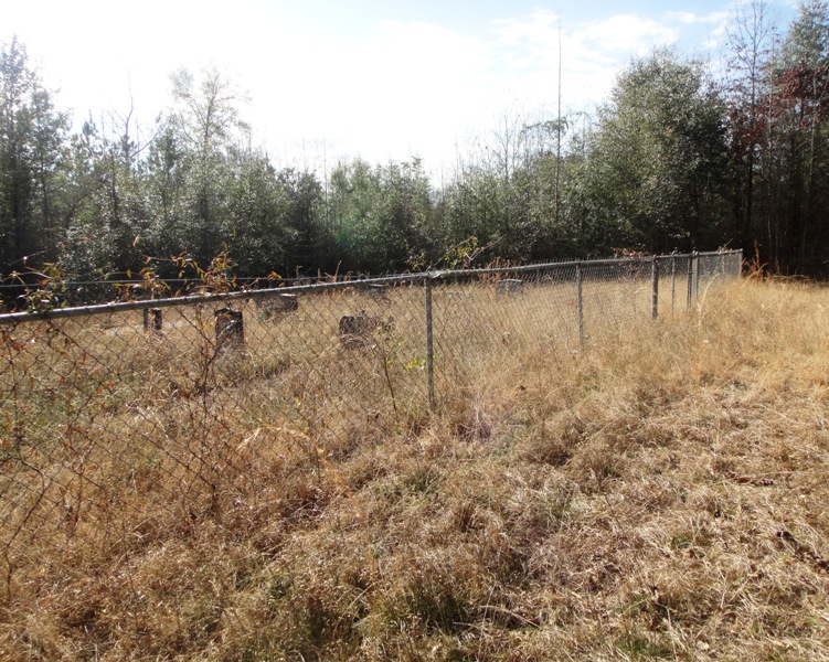
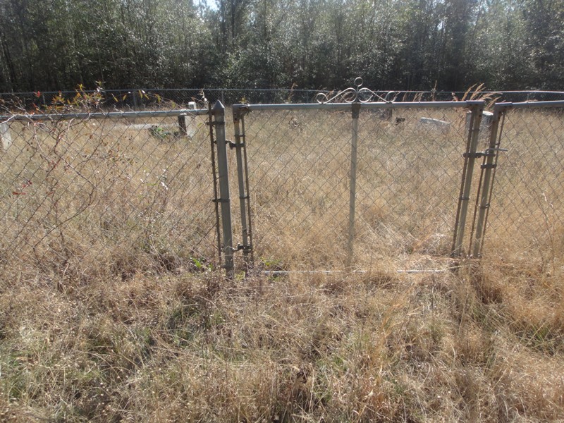
| Description | : | Highway 69 north of Coffeeville , turn right on Bethel Cut - Off RD. (dirt road ). before the first house on the right walk in woods back right. The Cemetery has a good fence. |
frequently asked questions (FAQ):
-
Where is Estes Cemetery?
Estes Cemetery is located at Coffeeville, Clarke County ,Alabama ,USA.
-
Estes Cemetery cemetery's updated grave count on graveviews.com?
0 memorials
-
Where are the coordinates of the Estes Cemetery?
Latitude: 31.8118650
Longitude: -88.0944660
Nearby Cemetories:
1. Bethel Baptist Church Cemetery
Coffeeville, Clarke County, USA
Coordinate: 31.8196780, -88.0899880
2. Estes Family Cemetery
Coffeeville, Clarke County, USA
Coordinate: 31.8312660, -88.0986650
3. Ulcanush Cemetery
Coffeeville, Clarke County, USA
Coordinate: 31.7868996, -88.0768967
4. Cedar Point Baptist Church Cemetery
Coffeeville, Clarke County, USA
Coordinate: 31.8240550, -88.1256040
5. Friddle Cemetery
Chilton, Clarke County, USA
Coordinate: 31.7872200, -88.0592700
6. Turner Cemetery
Clarke County, USA
Coordinate: 31.8363991, -88.1389008
7. Anderson Cemetery
Clarke County, USA
Coordinate: 31.8267002, -88.0363998
8. Friendship Baptist Church Cemetery
Clarke County, USA
Coordinate: 31.8271770, -88.0354700
9. Coffeeville Cemetery
Coffeeville, Clarke County, USA
Coordinate: 31.7593994, -88.0871964
10. Mitchell Field Cemetery
Clarke County, USA
Coordinate: 31.8681730, -88.1003480
11. Rainey-Barney Cemetery
Coffeeville, Clarke County, USA
Coordinate: 31.8684590, -88.1008260
12. Rock Bar Cemetery
Coffeeville, Clarke County, USA
Coordinate: 31.8732140, -88.0754300
13. Jones Chapel Church of Christ Cemetery
Coffeeville, Clarke County, USA
Coordinate: 31.7858960, -88.0218050
14. Kiels Cemetery
Coffeeville, Clarke County, USA
Coordinate: 31.7591991, -88.0449982
15. Thornton Cemetery
Coffeeville, Clarke County, USA
Coordinate: 31.7453003, -88.0796967
16. Center Point Cemetery
Coffeeville, Clarke County, USA
Coordinate: 31.7866370, -88.0202550
17. James Cemetery
Clarke County, USA
Coordinate: 31.7581005, -88.0330963
18. Moore Cemetery
Choctaw County, USA
Coordinate: 31.7577991, -88.1635971
19. Fluker Cemetery
Clarke County, USA
Coordinate: 31.7435640, -88.0434140
20. Hatchet Cemetery
Clarke County, USA
Coordinate: 31.8950005, -88.1074982
21. Deas Cemetery
Center Point, Clarke County, USA
Coordinate: 31.7918730, -87.9981650
22. Martin Cemetery
Womack Hill, Choctaw County, USA
Coordinate: 31.8850100, -88.1550600
23. Womack Hill Cemetery
Womack Hill, Choctaw County, USA
Coordinate: 31.8549995, -88.1893997
24. Grace Chapel Cemetery
Coffeeville, Clarke County, USA
Coordinate: 31.7291230, -88.0434990