
| Memorials | : | 0 |
| Location | : | Clay County, USA |
| Coordinate | : | 39.3271200, -94.3870500 |
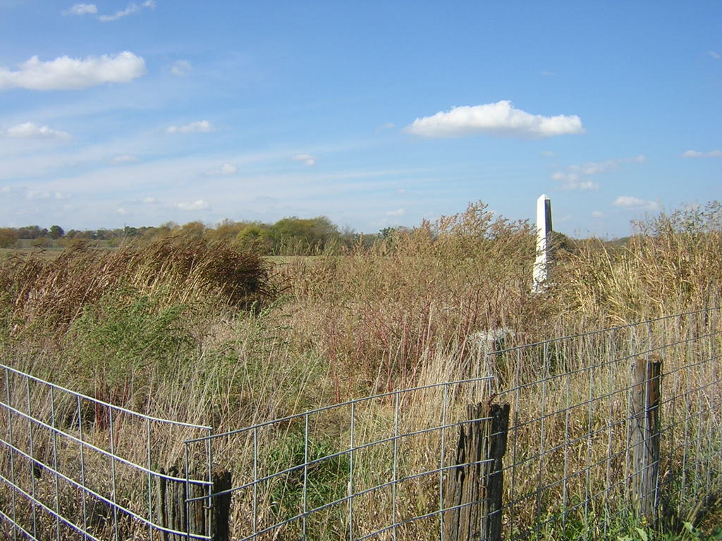
| Description | : | This cemetery is north of 128th Street, and less than a mile east of I-35. The cemetery sits on top of a hill in a pasture .2 of a mile north of 128th Street. The cemetery is overgrown with grass and brush. Many of the stones have been tipped over, and are face down. |
frequently asked questions (FAQ):
-
Where is Estes-Thomason Cemetery?
Estes-Thomason Cemetery is located at Clay County ,Missouri ,USA.
-
Estes-Thomason Cemetery cemetery's updated grave count on graveviews.com?
0 memorials
-
Where are the coordinates of the Estes-Thomason Cemetery?
Latitude: 39.3271200
Longitude: -94.3870500
Nearby Cemetories:
1. Stollings Graveyard
Kearney, Clay County, USA
Coordinate: 39.3220711, -94.3946533
2. Old Liberty Cemetery
Kearney, Clay County, USA
Coordinate: 39.3246994, -94.3700027
3. Tapp Cemetery
Kearney, Clay County, USA
Coordinate: 39.3342000, -94.3669000
4. Wade Cemetery
Liberty, Clay County, USA
Coordinate: 39.3106900, -94.4002850
5. Clay County Cemetery
Chandler, Clay County, USA
Coordinate: 39.3072300, -94.3776000
6. Chandler Church Cemetery
Chandler, Clay County, USA
Coordinate: 39.2986412, -94.3818207
7. Robertson Cemetery
Clay County, USA
Coordinate: 39.2952995, -94.3964005
8. Richard Simms Burying Grounds
Liberty, Clay County, USA
Coordinate: 39.3449000, -94.4310000
9. Munkirs Cemetery
Mosby, Clay County, USA
Coordinate: 39.3246994, -94.3371964
10. Mount Olivet Cemetery
Kearney, Clay County, USA
Coordinate: 39.3671989, -94.3632965
11. Pickett Cemetery
Liberty, Clay County, USA
Coordinate: 39.2963982, -94.4285965
12. Newlee-Soper Cemetery
Kearney, Clay County, USA
Coordinate: 39.3713989, -94.4011002
13. Means Cemetery
Clay County, USA
Coordinate: 39.2921982, -94.3419037
14. Glenridge Cemetery
Liberty, Clay County, USA
Coordinate: 39.2775002, -94.3927994
15. Estes Cemetery
Clay County, USA
Coordinate: 39.3722038, -94.3583755
16. Hodges Graveyard
Clay County, USA
Coordinate: 39.2883500, -94.3374900
17. Lincoln Cemetery
Liberty, Clay County, USA
Coordinate: 39.2788600, -94.4198900
18. Fairview Cemetery
Kearney, Clay County, USA
Coordinate: 39.3774986, -94.3597031
19. Mount Gilead Cemetery
Kearney, Clay County, USA
Coordinate: 39.3826942, -94.4129410
20. Baldwin Cemetery
Excelsior Springs, Clay County, USA
Coordinate: 39.2956009, -94.3197021
21. Old Providence Cemetery
Clay County, USA
Coordinate: 39.3097000, -94.4638977
22. Baker Cemetery
Liberty, Clay County, USA
Coordinate: 39.2678700, -94.4171600
23. Providence Church Graveyard
Liberty, Clay County, USA
Coordinate: 39.3136101, -94.4736099
24. McQuiddy Family Cemetery
Liberty, Clay County, USA
Coordinate: 39.2639000, -94.3519000