
| Memorials | : | 1 |
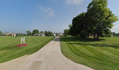
| Location | : | Jerome, Union County, USA |
| Coordinate | : | 40.1131750, -83.2829720 |
| Description | : | Alternate names: Lower Liberty Cemetery; Lower Liberty Presbyterian Cemetery; Lower Liberty Presbyterian Church Cemetery Approximately .5 miles northwest of Plain City on Big Darby Creek Lower Liberty Cemetery is located on private property on the south bank of Big Darby Creek in Plain City. There were only a few broken pieces of stones left in 1982 when the Union County Genealogical Society took readings of all they could find. The cemetery was probably associated with the Lower Liberty Presbyterian Church, which was located near this site. There are almost certainly more remains located in the cemetery as pieces of gravestones have been... Read More |
frequently asked questions (FAQ):
-
Where is Ewing Cemetery?
Ewing Cemetery is located at 760 West Main Street (Ohio State Route 161) Jerome, Union County ,Ohio , 43064USA.
-
Ewing Cemetery cemetery's updated grave count on graveviews.com?
1 memorials
-
Where are the coordinates of the Ewing Cemetery?
Latitude: 40.1131750
Longitude: -83.2829720
Nearby Cemetories:
1. United Bethel Cemetery
Plain City, Madison County, USA
Coordinate: 40.1086006, -83.2874985
2. Jerome Township Unidentified Cemetery #1
Jerome Township, Union County, USA
Coordinate: 40.1238060, -83.2785000
3. Bigelow Cemetery
Plain City, Madison County, USA
Coordinate: 40.1076851, -83.2585144
4. Darby Township Cemetery
Plain City, Madison County, USA
Coordinate: 40.0985985, -83.2624969
5. Bethesda Fellowship Cemetery
Plain City, Madison County, USA
Coordinate: 40.0939910, -83.3088920
6. Forest Grove Cemetery
Plain City, Madison County, USA
Coordinate: 40.0938988, -83.2528000
7. Smith Cemetery
Madison County, USA
Coordinate: 40.1031222, -83.3240097
8. Haven Fellowship Cemetery
Madison County, USA
Coordinate: 40.0833244, -83.2466736
9. Sharon Cemetery
Plain City, Madison County, USA
Coordinate: 40.0724983, -83.2683029
10. Finch Cemetery
Madison County, USA
Coordinate: 40.0722008, -83.2686005
11. Lighthouse Mennonite Fellowship Church Cemetery
Unionville Center, Union County, USA
Coordinate: 40.1425944, -83.3378769
12. Old Darby Cemetery
Unionville Center, Union County, USA
Coordinate: 40.1394005, -83.3432999
13. New Darby Cemetery
Unionville Center, Union County, USA
Coordinate: 40.1403008, -83.3447037
14. New California Cemetery
Jerome, Union County, USA
Coordinate: 40.1569672, -83.2379303
15. Converse-Huff Cemetery
Rosedale, Madison County, USA
Coordinate: 40.0764008, -83.3394012
16. Big Darby Cemetery
Plain City, Madison County, USA
Coordinate: 40.0430984, -83.2624969
17. Converse Cemetery
Plain City, Madison County, USA
Coordinate: 40.0363998, -83.2613983
18. Darby Township Unidentified Cemetery #2
Darby Township, Union County, USA
Coordinate: 40.1515580, -83.3732780
19. Saint Paul Lutheran Cemetery
Chuckery, Union County, USA
Coordinate: 40.1510773, -83.3819427
20. Mitchell Cemetery
Darby Township, Union County, USA
Coordinate: 40.1513280, -83.3822250
21. Rings Cemetery
Hilliard, Franklin County, USA
Coordinate: 40.0628014, -83.1831970
22. Brown-Harris Cemetery
Washington Township, Franklin County, USA
Coordinate: 40.0986894, -83.1648537
23. Saint Johns Cemetery
Marysville, Union County, USA
Coordinate: 40.1878014, -83.3553009
24. Pleasant Hill Cemetery
Jerome, Union County, USA
Coordinate: 40.1632740, -83.1765960