
| Memorials | : | 0 |
| Location | : | Johns Island, Charleston County, USA |
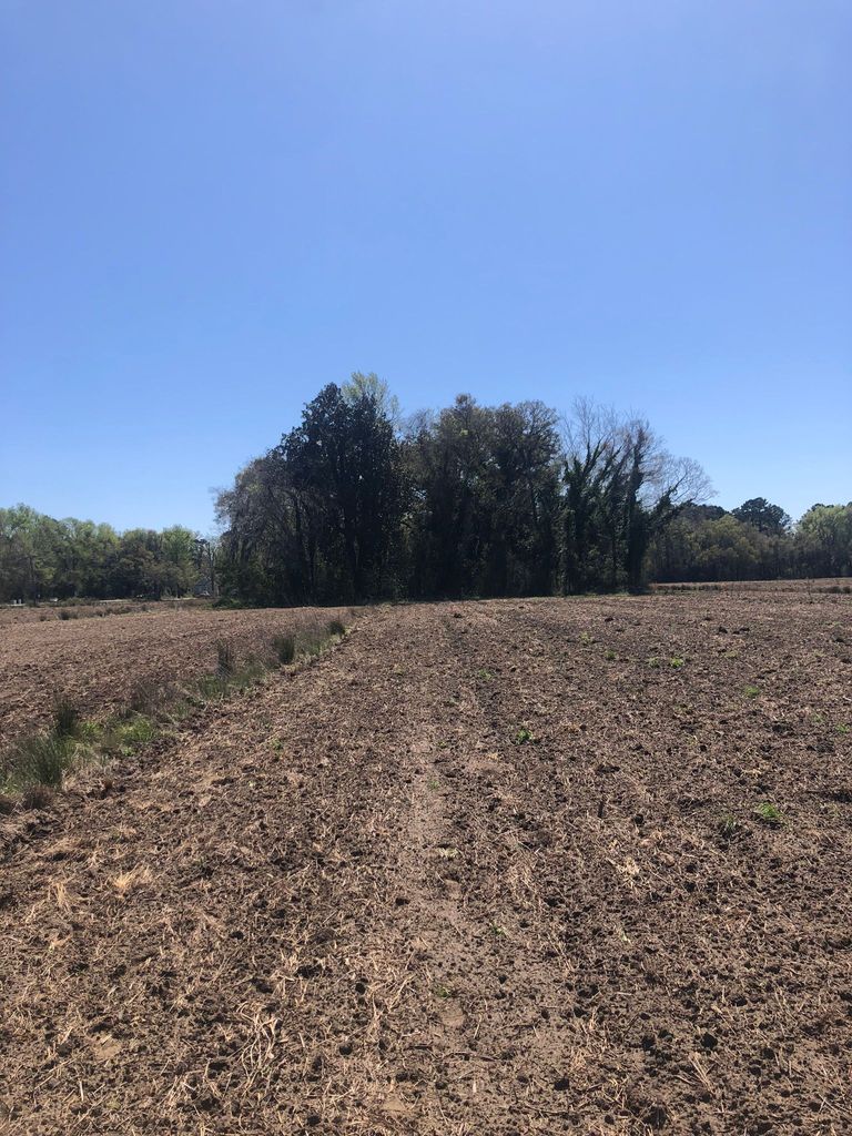
| Description | : | This hidden cemetery is located in a cluster of trees in the middle of an agricultural field at the corner of River Road and Plow Ground Road on Johns Island. This is a burial ground on the former Exchange Plantation which was located on the site in the mid 1800s. This cemetery contains one marked grave for an enslaved man and members of other families. Access to the site is somewhat difficult due to overgrowth. |
frequently asked questions (FAQ):
-
Where is Exchange Plantation Cemetery?
Exchange Plantation Cemetery is located at No GPS information available Add GPSNorthwest Corner of River Road and Plow Ground Road Johns Island, Charleston County ,South Carolina , 29455USA.
-
Exchange Plantation Cemetery cemetery's updated grave count on graveviews.com?
0 memorials
Nearby Cemetories:
1. African Burial Grounds
Charleston County, USA
Coordinate: 32.6908226, -80.0743637
2. Blessed Sacrament Church
Avondale, Charleston County, USA
Coordinate: 32.6334640, -80.1356246
3. African Baptist Cemetery
Charleston Heights, Charleston County, USA
Coordinate: 32.6870260, -80.0779940
4. Happoldt Burying Grounds
Charleston Heights, Charleston County, USA
Coordinate: 32.7128900, -80.0432400
5. Jenkins Orphanage Cemetery
Charleston Heights, Charleston County, USA
Coordinate: 32.7715470, -80.1053950
6. Field of Rest
Charleston County, USA
Coordinate: 32.6150000, -80.1555100
7. First Baptist Church Cemetery
Charleston County, USA
Coordinate: 32.7837600, -79.9416100
8. Greater Saint Luke AME Church Cemetery
Charleston County, USA
Coordinate: 32.7236700, -80.0738200
9. Hillcrest Cemetery
Charleston County, USA
Coordinate: 32.6685556, -80.0421479
10. I'on Cemetery
Hobcaw Point, Charleston County, USA
Coordinate: 32.7516320, -80.0379747
11. Abundant Life Church of God in Christ Cemetery
Johns Island, Charleston County, USA
Coordinate: 32.6183000, -80.1535100
12. Bethel Presbyterian Church Cemetery
Johns Island, Charleston County, USA
Coordinate: 32.6339000, -80.1489300
13. Bethlehem United Methodist Church Cemetery
Johns Island, Charleston County, USA
Coordinate: 32.6908226, -80.0743637
14. Bishop-Chisolm Cemetery
Johns Island, Charleston County, USA
Coordinate: 32.6334640, -80.1356246
15. Calvary AME Church Cemetery
Johns Island, Charleston County, USA
Coordinate: 32.6870260, -80.0779940
16. Cedar Spring Baptist Church Cemetery
Johns Island, Charleston County, USA
Coordinate: 32.7128900, -80.0432400
17. Christ Reformed Episcopal Cemetery
Johns Island, Charleston County, USA
Coordinate: 32.7715470, -80.1053950
18. Church of Our Saviour Churchyard
Johns Island, Charleston County, USA
Coordinate: 32.6150000, -80.1555100
19. Ferry Field Baptist Church Cemetery
Johns Island, Charleston County, USA
Coordinate: 32.7837600, -79.9416100
20. First Baptist Churchyard
Johns Island, Charleston County, USA
Coordinate: 32.7236700, -80.0738200
21. Freer Family Cemetery
Johns Island, Charleston County, USA
Coordinate: 32.6685556, -80.0421479
22. Gibbes Family Burial Ground
Johns Island, Charleston County, USA
Coordinate: 32.7516320, -80.0379747
23. Greater Saint John AME Church Cemetery
Johns Island, Charleston County, USA
Coordinate: 32.6183000, -80.1535100
24. Hebron Zion Presbyterian Church Cemetery
Johns Island, Charleston County, USA
Coordinate: 32.6339000, -80.1489300