
| Memorials | : | 14 |
| Location | : | Friendswood, Hendricks County, USA |
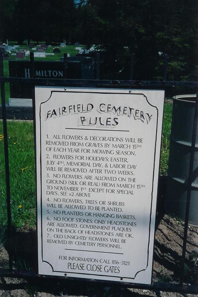
| Phone | : | 317-856-3121 |
| Coordinate | : | 39.6606026, -86.3355865 |
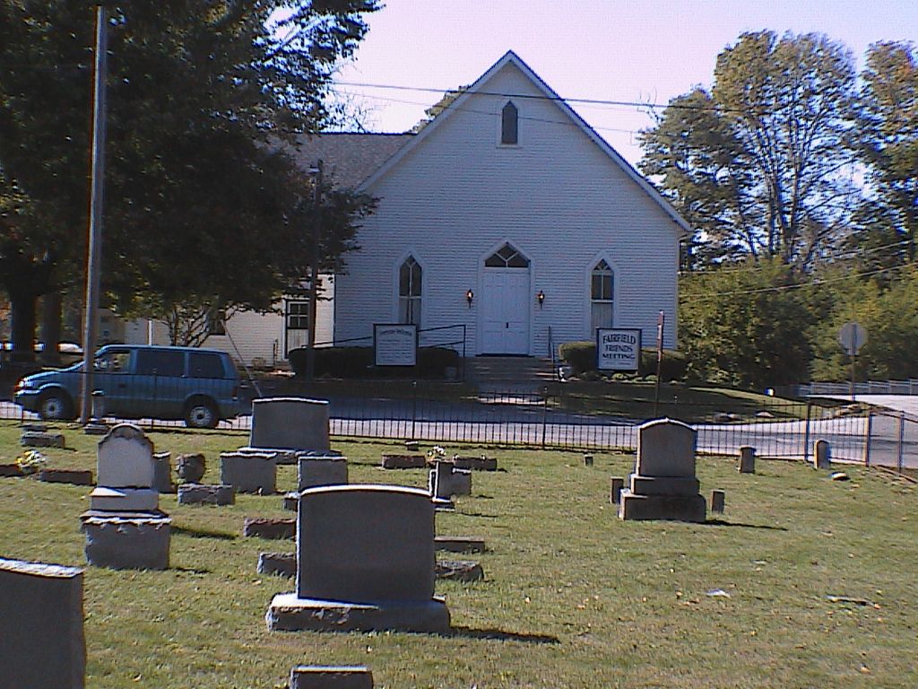
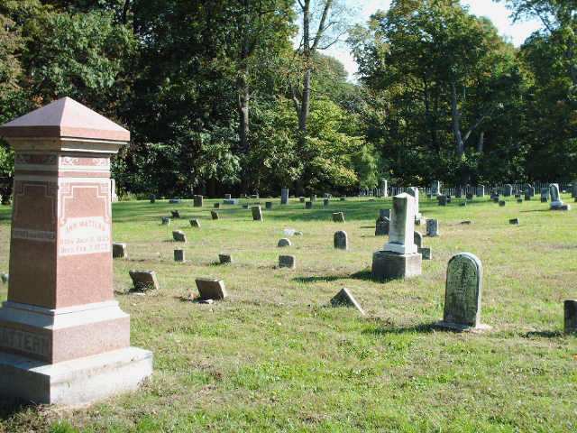
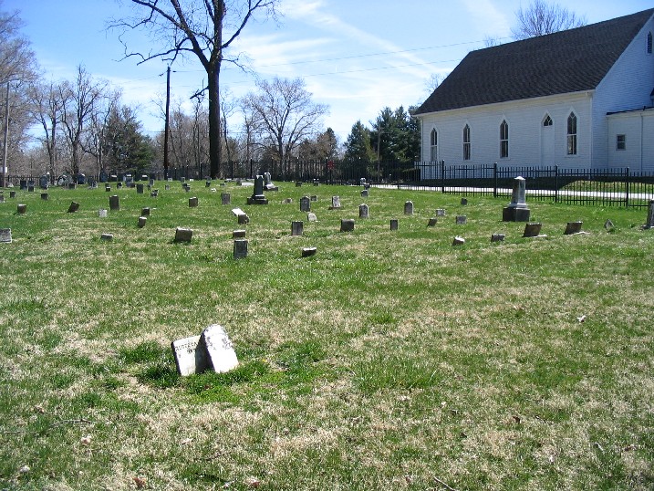
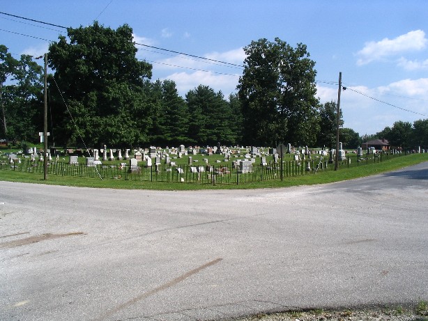
| Description | : | This cemetery is on the northwest and southeast corners of the intersection of 700S and 1050E. Both sections are visible from the road. The Fairfield Friends church is located on a cross road-near both Camby (Marion Co) and Plainfield (Hendricks Co). In the late 1960's the town of Fairfield was flooded by the construction of what became Brookville Lake. In order to build the lake, it was necessary to relocate the cemeteries from Fairfield to "New Fairfield Cemetery". |
frequently asked questions (FAQ):
-
Where is Fairfield Friends Cemetery?
Fairfield Friends Cemetery is located at 7040 S County Road 1050 E Friendswood, Hendricks County ,Indiana , 46113USA.
-
Fairfield Friends Cemetery cemetery's updated grave count on graveviews.com?
13 memorials
-
Where are the coordinates of the Fairfield Friends Cemetery?
Latitude: 39.6606026
Longitude: -86.3355865
Nearby Cemetories:
1. Lick Branch Cemetery
Guilford Township, Hendricks County, USA
Coordinate: 39.6598800, -86.3357040
2. Lick Branch Cemetery
Plainfield, Hendricks County, USA
Coordinate: 39.6598663, -86.3356476
3. Siloam Cemetery
Morgan County, USA
Coordinate: 39.6286011, -86.3236008
4. Center Friends Cemetery
Bridgeport, Marion County, USA
Coordinate: 39.6975784, -86.3258438
5. Easton Friends Cemetery
West Newton, Marion County, USA
Coordinate: 39.6539450, -86.2797060
6. White Lick Friends Cemetery
Friendswood, Hendricks County, USA
Coordinate: 39.6375313, -86.3846130
7. West Newton Cemetery
West Newton, Marion County, USA
Coordinate: 39.6502037, -86.2781982
8. Old Friends Cemetery (Defunct)
Marion County, USA
Coordinate: 39.6966270, -86.2885390
9. Ramsey Cemetery
Plainfield, Hendricks County, USA
Coordinate: 39.6386337, -86.3955002
10. Sugar Grove Cemetery
Plainfield, Hendricks County, USA
Coordinate: 39.6747665, -86.3998184
11. Lick Branch Cemetery (Defunct)
Decatur Township, Marion County, USA
Coordinate: 39.7067000, -86.3025000
12. Mooresville Cemetery
Mooresville, Morgan County, USA
Coordinate: 39.6108055, -86.3671951
13. Old Methodist Episcopal Cemetery
Mooresville, Morgan County, USA
Coordinate: 39.6141510, -86.3759079
14. McNabb Cemetery
Morgan County, USA
Coordinate: 39.6219720, -86.2825830
15. Plainfield United Methodist Church Columbarium
Plainfield, Hendricks County, USA
Coordinate: 39.7004170, -86.3881710
16. White Lick Cemetery
Mooresville, Morgan County, USA
Coordinate: 39.6210785, -86.3939285
17. Maple Hill Cemetery
Plainfield, Hendricks County, USA
Coordinate: 39.6984863, -86.3963165
18. Saint Marks Episcopal Church Columbarium
Plainfield, Hendricks County, USA
Coordinate: 39.7039980, -86.3916880
19. Indianapolis International Airport
Indianapolis, Marion County, USA
Coordinate: 39.7170600, -86.2949700
20. Carpenter Cemetery
Mooresville, Morgan County, USA
Coordinate: 39.5949040, -86.3395920
21. Mount Pleasant Baptist Cemetery
West Newton, Marion County, USA
Coordinate: 39.6702160, -86.2503010
22. Indiana Boys School Cemetery
Plainfield, Hendricks County, USA
Coordinate: 39.6967506, -86.4089127
23. Carter Evans Cemetery
Morgan County, USA
Coordinate: 39.5956670, -86.3073330
24. Mount Olive Cemetery
Landersdale, Morgan County, USA
Coordinate: 39.6108017, -86.2716980