
| Memorials | : | 0 |
| Location | : | Plainfield, Hendricks County, USA |
| Coordinate | : | 39.6598663, -86.3356476 |
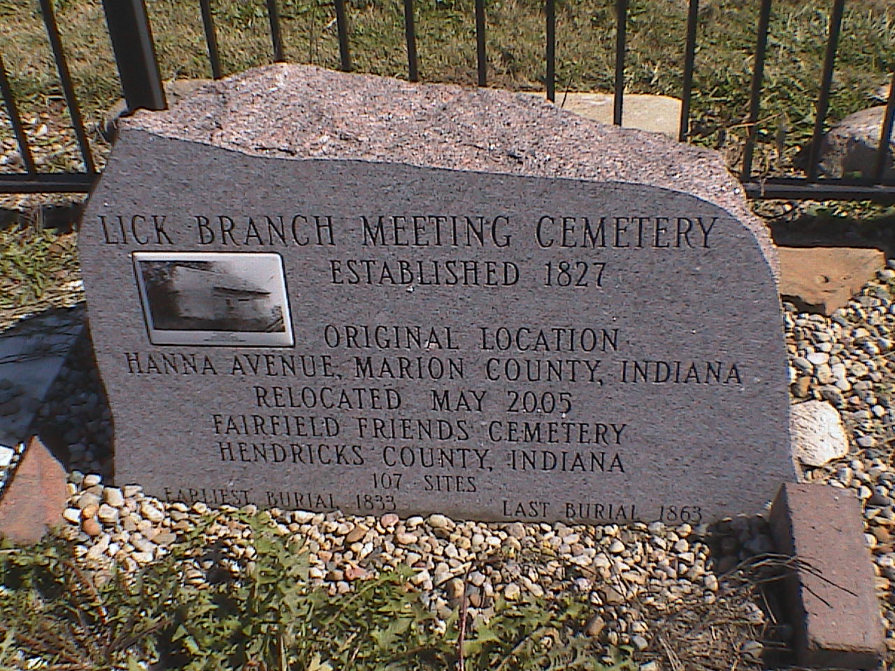
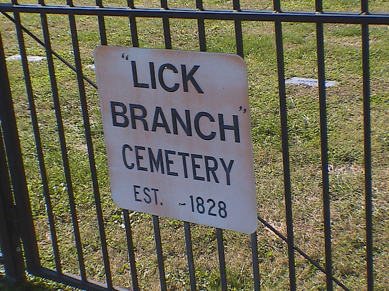
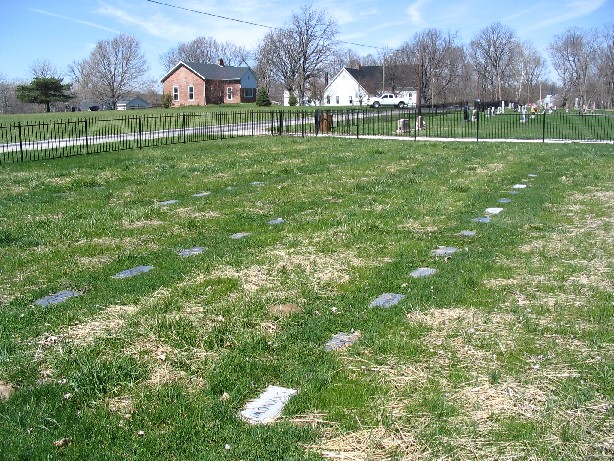
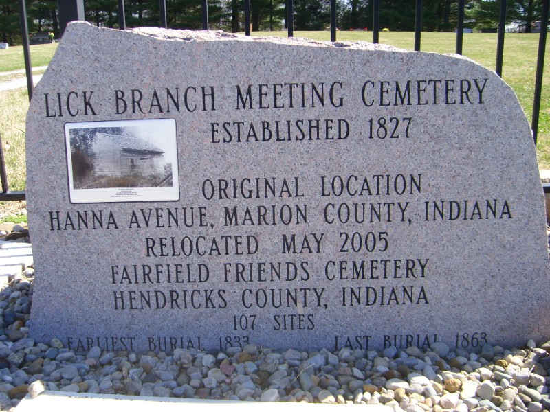
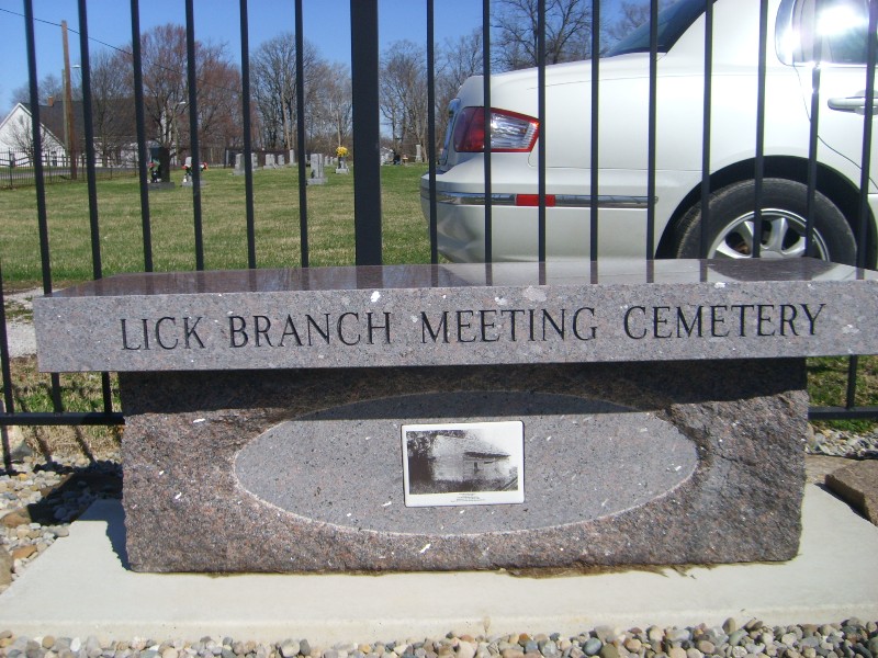
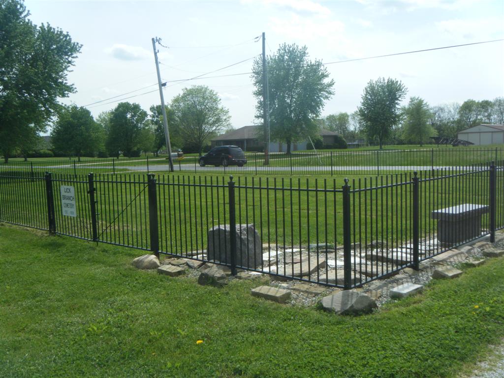
| Description | : | This cemetery is in the southeast corner of the intersection of 700S (Camby Road) and 1050E. It is in the southwest corner of the southeast section of Fairfield Friends Cemetery. It is surrounded by a separate fence. There is a sign on the gate but it is not visible from the road. This cemetery was moved from its original location in Marion County during the building of the airport (about 1998). It was near the new tower. Many graves were marked by illegible early limestone tablets, fieldstones or nothing at all. Fortunately, an accurate plot... Read More |
frequently asked questions (FAQ):
-
Where is Lick Branch Cemetery?
Lick Branch Cemetery is located at Plainfield, Hendricks County ,Indiana ,USA.
-
Lick Branch Cemetery cemetery's updated grave count on graveviews.com?
0 memorials
-
Where are the coordinates of the Lick Branch Cemetery?
Latitude: 39.6598663
Longitude: -86.3356476
Nearby Cemetories:
1. Lick Branch Cemetery
Guilford Township, Hendricks County, USA
Coordinate: 39.6598800, -86.3357040
2. Fairfield Friends Cemetery
Friendswood, Hendricks County, USA
Coordinate: 39.6606026, -86.3355865
3. Siloam Cemetery
Morgan County, USA
Coordinate: 39.6286011, -86.3236008
4. Center Friends Cemetery
Bridgeport, Marion County, USA
Coordinate: 39.6975784, -86.3258438
5. Easton Friends Cemetery
West Newton, Marion County, USA
Coordinate: 39.6539450, -86.2797060
6. White Lick Friends Cemetery
Friendswood, Hendricks County, USA
Coordinate: 39.6375313, -86.3846130
7. West Newton Cemetery
West Newton, Marion County, USA
Coordinate: 39.6502037, -86.2781982
8. Ramsey Cemetery
Plainfield, Hendricks County, USA
Coordinate: 39.6386337, -86.3955002
9. Sugar Grove Cemetery
Plainfield, Hendricks County, USA
Coordinate: 39.6747665, -86.3998184
10. Old Friends Cemetery (Defunct)
Marion County, USA
Coordinate: 39.6966270, -86.2885390
11. Lick Branch Cemetery (Defunct)
Decatur Township, Marion County, USA
Coordinate: 39.7067000, -86.3025000
12. Mooresville Cemetery
Mooresville, Morgan County, USA
Coordinate: 39.6108055, -86.3671951
13. Old Methodist Episcopal Cemetery
Mooresville, Morgan County, USA
Coordinate: 39.6141510, -86.3759079
14. McNabb Cemetery
Morgan County, USA
Coordinate: 39.6219720, -86.2825830
15. Plainfield United Methodist Church Columbarium
Plainfield, Hendricks County, USA
Coordinate: 39.7004170, -86.3881710
16. White Lick Cemetery
Mooresville, Morgan County, USA
Coordinate: 39.6210785, -86.3939285
17. Maple Hill Cemetery
Plainfield, Hendricks County, USA
Coordinate: 39.6984863, -86.3963165
18. Saint Marks Episcopal Church Columbarium
Plainfield, Hendricks County, USA
Coordinate: 39.7039980, -86.3916880
19. Carpenter Cemetery
Mooresville, Morgan County, USA
Coordinate: 39.5949040, -86.3395920
20. Indianapolis International Airport
Indianapolis, Marion County, USA
Coordinate: 39.7170600, -86.2949700
21. Mount Pleasant Baptist Cemetery
West Newton, Marion County, USA
Coordinate: 39.6702160, -86.2503010
22. Indiana Boys School Cemetery
Plainfield, Hendricks County, USA
Coordinate: 39.6967506, -86.4089127
23. Carter Evans Cemetery
Morgan County, USA
Coordinate: 39.5956670, -86.3073330
24. Mount Olive Cemetery
Landersdale, Morgan County, USA
Coordinate: 39.6108017, -86.2716980