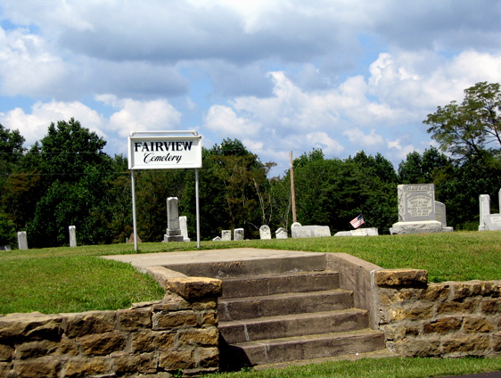
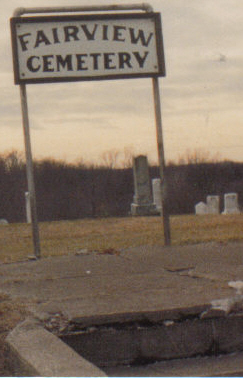
| Memorials | : | 17 |
| Location | : | Center Township, Monroe County, USA |
| Coordinate | : | 39.7139015, -81.1014023 |
| Description | : | The cemetery is located on the west side of Ohio State Route 800 about 0.3 miles south of its intersection with Plainview Road (County Road 40). The cemetery is located in Center Township, Monroe County, Ohio, and is # 8063 (Fairview Methodist Cemetery / Fairview Cemetery) in “Ohio Cemeteries 1803-2003”, compiled by the Ohio Genealogical Society. The U.S. Geological Survey (USGS) Geographic Names Information System (GNIS) feature ID for the cemetery is 1075824 (Fairview Cemetery / Fairview Methodist Cemetery). |
frequently asked questions (FAQ):
-
Where is Fairview Cemetery?
Fairview Cemetery is located at Ohio State Route 800 Center Township, Monroe County ,Ohio , 43793USA.
-
Fairview Cemetery cemetery's updated grave count on graveviews.com?
17 memorials
-
Where are the coordinates of the Fairview Cemetery?
Latitude: 39.7139015
Longitude: -81.1014023
Nearby Cemetories:
1. Moffett Cemetery
Woodsfield, Monroe County, USA
Coordinate: 39.7228508, -81.0978851
2. Baker Cemetery
Woodsfield, Monroe County, USA
Coordinate: 39.7313250, -81.1196140
3. Steed Cemetery
Monroe County, USA
Coordinate: 39.7314000, -81.1197000
4. Cox-Gray-Myers Cemetery
Woodsfield, Monroe County, USA
Coordinate: 39.6967170, -81.1256170
5. Drum Cemetery
Monroe County, USA
Coordinate: 39.7010994, -81.1414032
6. Neuhart Cemetery
Woodsfield, Monroe County, USA
Coordinate: 39.7462000, -81.0828000
7. Plainview Cemetery
Plainview, Monroe County, USA
Coordinate: 39.6781311, -81.1064987
8. Barnard Cemetery
Antioch, Monroe County, USA
Coordinate: 39.6750720, -81.1169730
9. Saint Sylvester Catholic Church Cemetery
Woodsfield, Monroe County, USA
Coordinate: 39.7564621, -81.1176071
10. Old Otts Cemetery
Monroe County, USA
Coordinate: 39.7099991, -81.0432968
11. Fletcher Cemetery
Cranenest, Monroe County, USA
Coordinate: 39.7074780, -81.0430260
12. Valley Cemetery
Woodsfield, Monroe County, USA
Coordinate: 39.7464700, -81.1426520
13. Conners Ridge Cemetery
Monroe County, USA
Coordinate: 39.7016983, -81.1613998
14. Dougherty Cemetery
Monroe County, USA
Coordinate: 39.6767006, -81.1406021
15. McGrary Cemetery
Woodsfield, Monroe County, USA
Coordinate: 39.7585983, -81.1299973
16. Beardmore Cemetery
Perry Township, Monroe County, USA
Coordinate: 39.6706009, -81.1342010
17. Moose Ridge Cemetery
Monroe County, USA
Coordinate: 39.7430992, -81.1544037
18. Adamson Cemetery
Laings, Monroe County, USA
Coordinate: 39.6991000, -81.0384500
19. Mount Carrick Cemetery
Mount Carrick, Monroe County, USA
Coordinate: 39.7494011, -81.0539017
20. Gillespie Cemetery
Monroe County, USA
Coordinate: 39.7528000, -81.0571976
21. Pioneer Cemetery
Woodsfield, Monroe County, USA
Coordinate: 39.7647018, -81.1175003
22. Antioch Cemetery
Antioch, Monroe County, USA
Coordinate: 39.6647949, -81.0692749
23. Oaklawn Cemetery
Woodsfield, Monroe County, USA
Coordinate: 39.7663994, -81.1232986
24. Goudy Cemetery
Woodsfield, Monroe County, USA
Coordinate: 39.7503014, -81.0436020


