
| Memorials | : | 0 |
| Location | : | Monclova Township, Lucas County, USA |
| Website | : | www.fallentimbersbattlefield.org/ |
| Coordinate | : | 41.5541972, -83.6899056 |
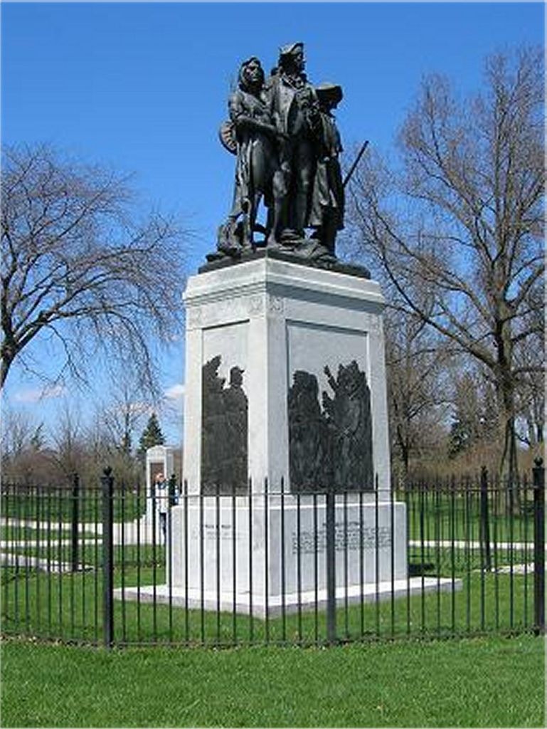
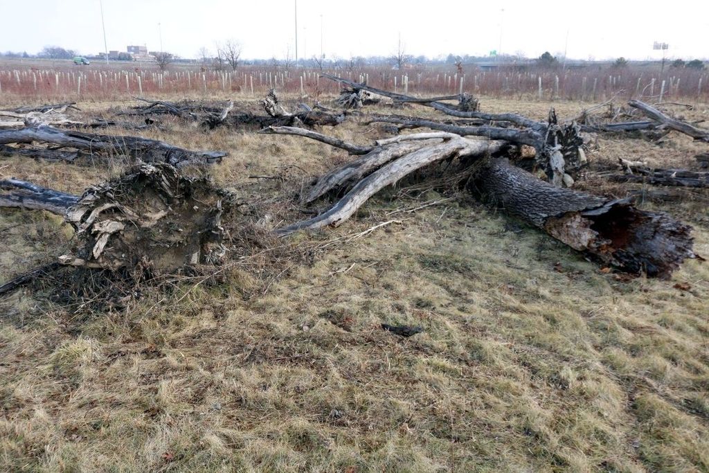
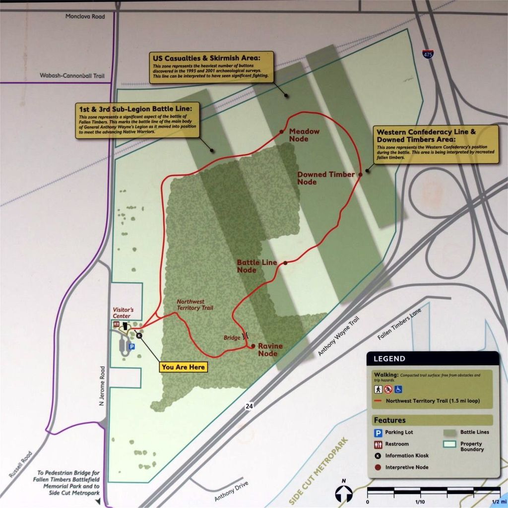
| Description | : | The battlefield burial ground is located west of the interchange of Interstate I-475 and US 24 (Anthony Wayne Trail) in Lucas County, Ohio, and is Cemetery #7034 in “Ohio Cemeteries 1803-2003”, compiled by the Ohio Genealogical Society. Fought on August 20, 1794, the Battle of Fallen Timbers was the final battle for control of the Old Northwest Territory. Native American tribes affiliated with the Western Confederacy and their British allies went up against the United States, the battle taking place in a wood where the trees had been toppled by a tornado near the Miami of the Lake (Maumee River) in... Read More |
frequently asked questions (FAQ):
-
Where is Fallen Timbers Battlefield Memorial Park?
Fallen Timbers Battlefield Memorial Park is located at 4949 Jerome Road Monclova Township, Lucas County ,Ohio ,USA.
-
Fallen Timbers Battlefield Memorial Park cemetery's updated grave count on graveviews.com?
0 memorials
-
Where are the coordinates of the Fallen Timbers Battlefield Memorial Park?
Latitude: 41.5541972
Longitude: -83.6899056
Nearby Cemetories:
1. Riverside Cemetery
Maumee, Lucas County, USA
Coordinate: 41.5491982, -83.6810989
2. Saint Joseph Cemetery
Maumee, Lucas County, USA
Coordinate: 41.5578003, -83.6706009
3. Karnik Memorial Garden Pet Cemetery
Waterville, Lucas County, USA
Coordinate: 41.5435980, -83.7174500
4. Swan Creek Cemetery
Monclova, Lucas County, USA
Coordinate: 41.5738983, -83.7089005
5. Fort Meigs State Memorial
Perrysburg, Wood County, USA
Coordinate: 41.5496380, -83.6517710
6. Heffelbower Cemetery
Lucas County, USA
Coordinate: 41.5534248, -83.7308426
7. First Presbyterian Church Memorial Garden
Maumee, Lucas County, USA
Coordinate: 41.5617060, -83.6500830
8. Saint Pauls Episcopal Church Memorial Garden
Maumee, Lucas County, USA
Coordinate: 41.5633830, -83.6496470
9. Lyon Cemetery
Perrysburg, Wood County, USA
Coordinate: 41.5205200, -83.7035500
10. Fort Meigs Cemetery
Perrysburg, Wood County, USA
Coordinate: 41.5517006, -83.6402969
11. Allen-Lloyd Cemetery
Monclova Township, Lucas County, USA
Coordinate: 41.5415130, -83.7492190
12. Burchfield Cemetery
Springfield Township, Lucas County, USA
Coordinate: 41.5951170, -83.7190140
13. Roth Cemetery
Monclova, Lucas County, USA
Coordinate: 41.5549270, -83.7526420
14. Holloway Cemetery (Defunct)
Springfield Township, Lucas County, USA
Coordinate: 41.5964900, -83.7208270
15. Zoar Lutheran Memorial Garden
Perrysburg, Wood County, USA
Coordinate: 41.5585480, -83.6228730
16. Saint Mary Mother of Sorrows Cemetery
Roachton, Wood County, USA
Coordinate: 41.5075970, -83.6607170
17. Old Perrysburg Township Cemetery
Perrysburg, Wood County, USA
Coordinate: 41.5595820, -83.6214290
18. Saint Rose Cemetery
Perrysburg, Wood County, USA
Coordinate: 41.5633011, -83.6149979
19. Saint Timothys Episcopal Church Memorial Garden
Perrysburg, Wood County, USA
Coordinate: 41.5558000, -83.6115300
20. Springfield Township Cemetery
Holland, Lucas County, USA
Coordinate: 41.6110992, -83.7230988
21. Wakeman Cemetery
Waterville, Lucas County, USA
Coordinate: 41.4978300, -83.7263300
22. Miltonville Cemetery
Haskins, Wood County, USA
Coordinate: 41.4853400, -83.7162500
23. Rupp Cemetery
Whitehouse, Lucas County, USA
Coordinate: 41.5323067, -83.7855759
24. Mennonite Cemetery
Whitehouse, Lucas County, USA
Coordinate: 41.5235176, -83.7817841