
| Memorials | : | 0 |
| Location | : | Perrysburg, Wood County, USA |
| Coordinate | : | 41.5496380, -83.6517710 |
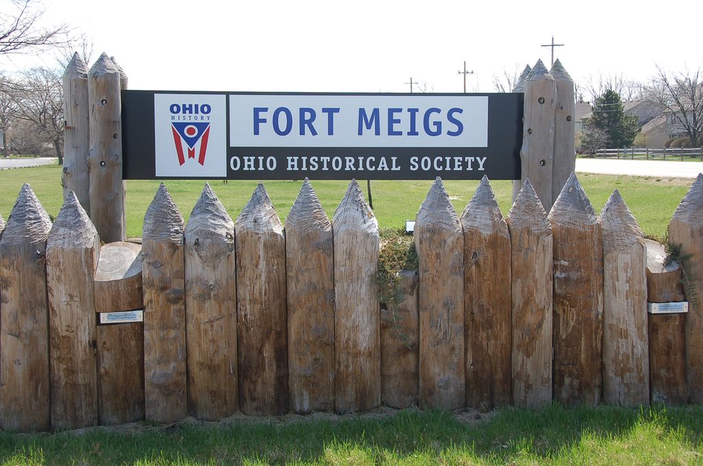
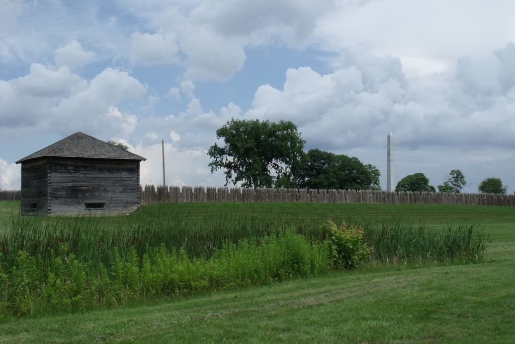
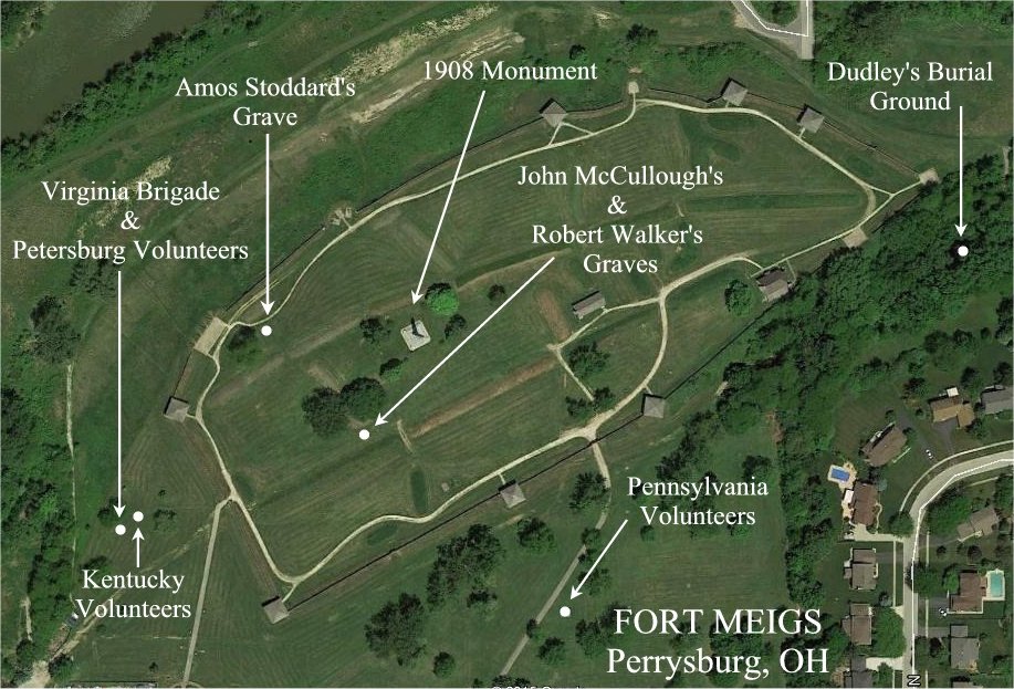
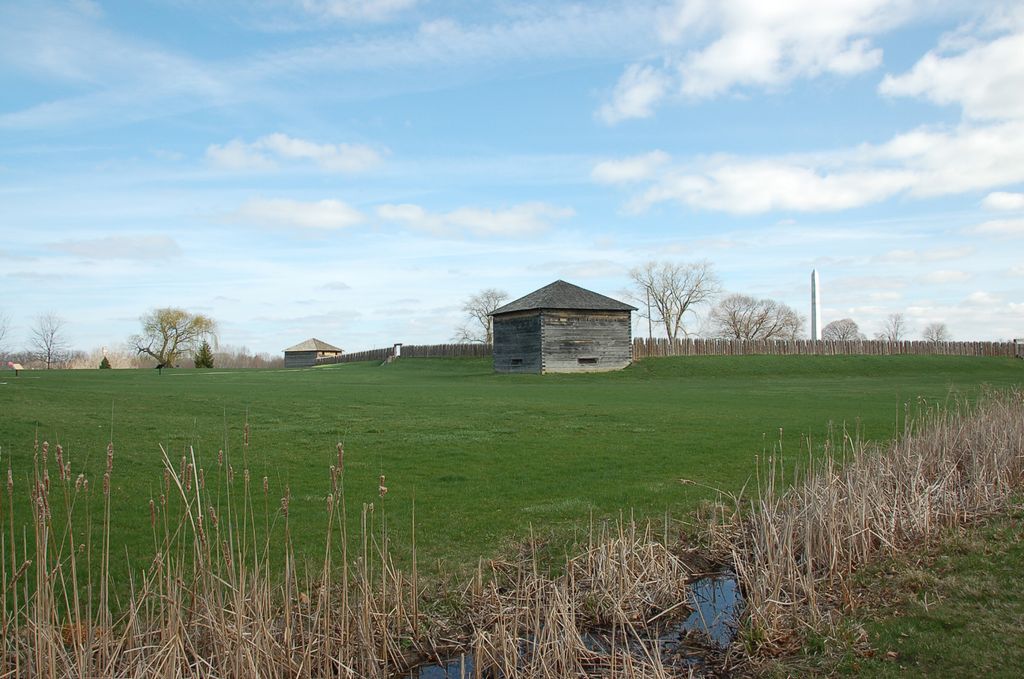
| Description | : | Fort Meigs, named after then Governor of Ohio, Return Jonathan Meigs, Jr, was first built as a reaction to British attacks on American forts in the Northwest Territory during the War of 1812. It was built in what is now Perrysburg, Ohio, on a bluff overlooking the Maumee River rapids. Ground was broken on February 2, 1813 under the orders of General William Henry Harrison, who wanted to fortify the region. Throughout the next three months professional soldiers and militiamen alike persevered through cold winter weather and mud that would at times be knee-deep. Despite horrid weather and disease in... Read More |
frequently asked questions (FAQ):
-
Where is Fort Meigs State Memorial?
Fort Meigs State Memorial is located at 29100 W River Rd Perrysburg, Wood County ,Ohio , 43551USA.
-
Fort Meigs State Memorial cemetery's updated grave count on graveviews.com?
0 memorials
-
Where are the coordinates of the Fort Meigs State Memorial?
Latitude: 41.5496380
Longitude: -83.6517710
Nearby Cemetories:
1. Fort Meigs Cemetery
Perrysburg, Wood County, USA
Coordinate: 41.5517006, -83.6402969
2. First Presbyterian Church Memorial Garden
Maumee, Lucas County, USA
Coordinate: 41.5617060, -83.6500830
3. Saint Pauls Episcopal Church Memorial Garden
Maumee, Lucas County, USA
Coordinate: 41.5633830, -83.6496470
4. Saint Joseph Cemetery
Maumee, Lucas County, USA
Coordinate: 41.5578003, -83.6706009
5. Riverside Cemetery
Maumee, Lucas County, USA
Coordinate: 41.5491982, -83.6810989
6. Zoar Lutheran Memorial Garden
Perrysburg, Wood County, USA
Coordinate: 41.5585480, -83.6228730
7. Old Perrysburg Township Cemetery
Perrysburg, Wood County, USA
Coordinate: 41.5595820, -83.6214290
8. Fallen Timbers Battlefield Memorial Park
Monclova Township, Lucas County, USA
Coordinate: 41.5541972, -83.6899056
9. Saint Rose Cemetery
Perrysburg, Wood County, USA
Coordinate: 41.5633011, -83.6149979
10. Saint Timothys Episcopal Church Memorial Garden
Perrysburg, Wood County, USA
Coordinate: 41.5558000, -83.6115300
11. Saint Mary Mother of Sorrows Cemetery
Roachton, Wood County, USA
Coordinate: 41.5075970, -83.6607170
12. Lyon Cemetery
Perrysburg, Wood County, USA
Coordinate: 41.5205200, -83.7035500
13. Hufford Cemetery
Perrysburg, Wood County, USA
Coordinate: 41.5649986, -83.5896988
14. Swan Creek Cemetery
Monclova, Lucas County, USA
Coordinate: 41.5738983, -83.7089005
15. Karnik Memorial Garden Pet Cemetery
Waterville, Lucas County, USA
Coordinate: 41.5435980, -83.7174500
16. Heffelbower Cemetery
Lucas County, USA
Coordinate: 41.5534248, -83.7308426
17. Burchfield Cemetery
Springfield Township, Lucas County, USA
Coordinate: 41.5951170, -83.7190140
18. Holloway Cemetery (Defunct)
Springfield Township, Lucas County, USA
Coordinate: 41.5964900, -83.7208270
19. Toledo State Hospital New Cemetery
Toledo, Lucas County, USA
Coordinate: 41.6171048, -83.6135627
20. Allen-Lloyd Cemetery
Monclova Township, Lucas County, USA
Coordinate: 41.5415130, -83.7492190
21. Roth Cemetery
Monclova, Lucas County, USA
Coordinate: 41.5549270, -83.7526420
22. Wakeman Cemetery
Waterville, Lucas County, USA
Coordinate: 41.4978300, -83.7263300
23. Maplewood Cemetery
Toledo, Lucas County, USA
Coordinate: 41.6241110, -83.6245500
24. Toledo Hebrew Cemetery
Rossford, Wood County, USA
Coordinate: 41.6040550, -83.5741780