
| Memorials | : | 22 |
| Location | : | Falstone, Northumberland Unitary Authority, England |
| Coordinate | : | 55.1769800, -2.4372200 |
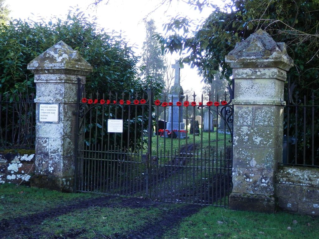
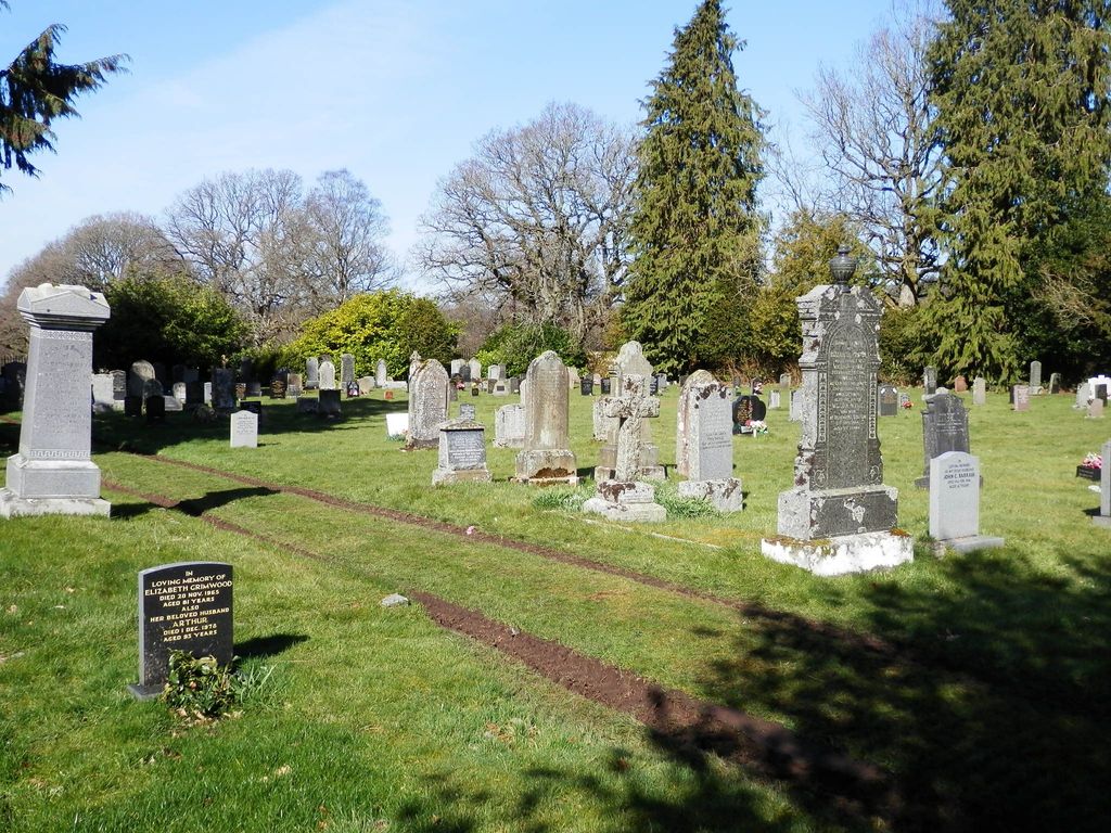
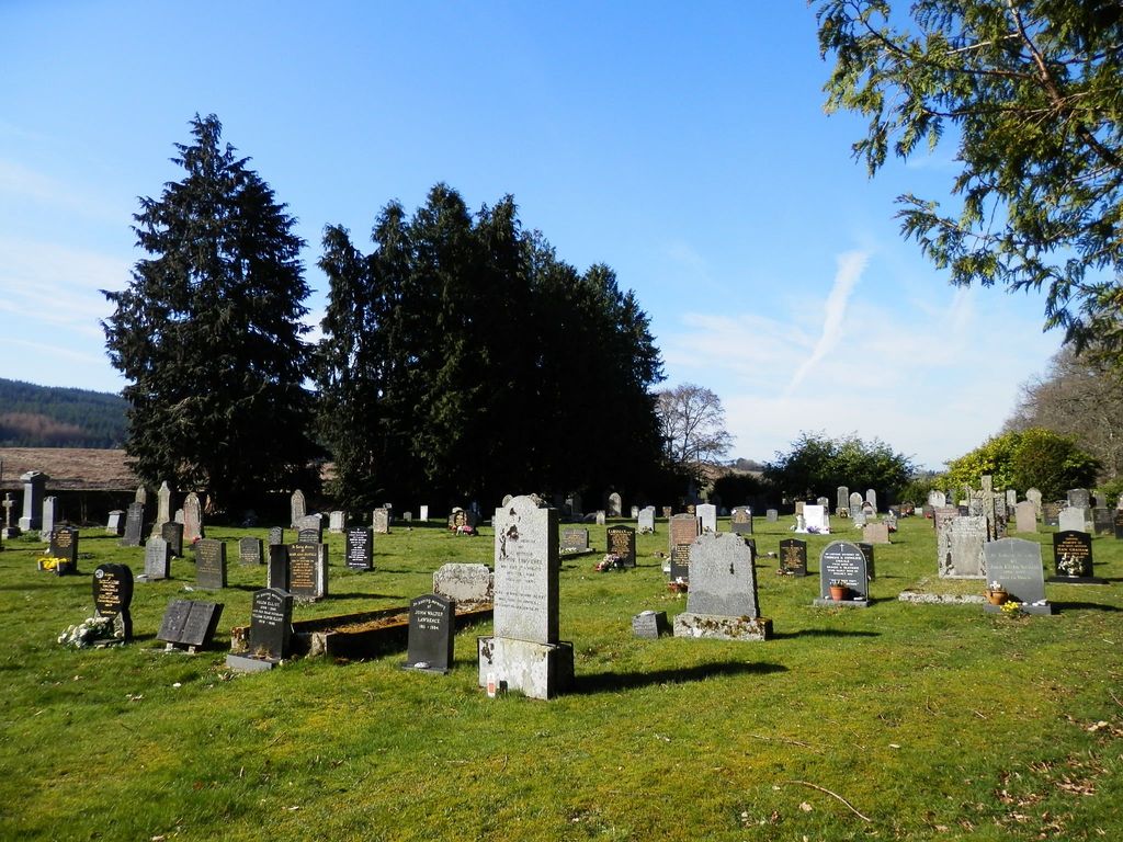
| Description | : | Falstone Cemetery was opened in 1911 and is under the administration of Falstone Parish Council. The cemetery is situated on the approach road to the village. Driving in from Stannersburn, it is on the right hand side of the road, before going over the Tyne Bridge into the village. The entrance is through a set of iron gates flanked by stone pillars. The cemetery contains a memorial to remember the dead from the First and Second World Wars. The memorial was erected by public subscription, and is situated at the entrance to the cemetery. The back... Read More |
frequently asked questions (FAQ):
-
Where is Falstone Cemetery?
Falstone Cemetery is located at Falstone, Northumberland Unitary Authority ,Northumberland ,England.
-
Falstone Cemetery cemetery's updated grave count on graveviews.com?
22 memorials
-
Where are the coordinates of the Falstone Cemetery?
Latitude: 55.1769800
Longitude: -2.4372200
Nearby Cemetories:
1. St Peter's Churchyard
Falstone, Northumberland Unitary Authority, England
Coordinate: 55.1805310, -2.4347650
2. Falstone Presbyterian Churchyard
Falstone, Northumberland Unitary Authority, England
Coordinate: 55.1809920, -2.4364680
3. St Luke's Churchyard
Greystead, Northumberland Unitary Authority, England
Coordinate: 55.1659870, -2.3613570
4. St Oswald Churchyard
Bellingham, Northumberland Unitary Authority, England
Coordinate: 55.1444170, -2.2620390
5. Bellingham Cemetery
Bellingham, Northumberland Unitary Authority, England
Coordinate: 55.1405100, -2.2615430
6. St Cuthbert Churchyard
Bellingham, Northumberland Unitary Authority, England
Coordinate: 55.1433760, -2.2561350
7. Holy Trinity Church
Horsley, Northumberland Unitary Authority, England
Coordinate: 55.2687020, -2.2511820
8. St. Francis Churchyard
Byrness, Northumberland Unitary Authority, England
Coordinate: 55.3189750, -2.3733260
9. St Cuthbert Churchyard
Corsenside, Northumberland Unitary Authority, England
Coordinate: 55.1974870, -2.1737480
10. St Giles Churchyard
Birtley, Northumberland Unitary Authority, England
Coordinate: 55.0959469, -2.1928780
11. Cowburn Primitive Methodist Chapel
Cowburn, Northumberland Unitary Authority, England
Coordinate: 55.0034880, -2.4323380
12. St. Cuthbert's Churchyard
Bewcastle, City of Carlisle, England
Coordinate: 55.0635980, -2.6821690
13. Bewcastle Cemetery
Bewcastle, City of Carlisle, England
Coordinate: 55.0630549, -2.6909662
14. St Mary Magdalene Churchyard
Gilsland, Northumberland Unitary Authority, England
Coordinate: 54.9989150, -2.5743860
15. St. Cuthbert's Churchyard
Elsdon, Northumberland Unitary Authority, England
Coordinate: 55.2336850, -2.1013070
16. St Cuthbert's Churchyard
Greenhead, Northumberland Unitary Authority, England
Coordinate: 54.9813930, -2.5324120
17. Holy Cross Churchyard
Haltwhistle, Northumberland Unitary Authority, England
Coordinate: 54.9699900, -2.4583480
18. All Hallows Churchyard
Henshaw, Northumberland Unitary Authority, England
Coordinate: 54.9731030, -2.3704408
19. Chapel of Hermitage
Scotland
Coordinate: 55.2531046, -2.7803227
20. Haltwhistle Cemetery
Haltwhistle, Northumberland Unitary Authority, England
Coordinate: 54.9652600, -2.4740100
21. St. Cuthbert's Churchyard
Beltingham, Northumberland Unitary Authority, England
Coordinate: 54.9694330, -2.3305080
22. Beltingham Cemetery
Beltingham, Northumberland Unitary Authority, England
Coordinate: 54.9690700, -2.3312200
23. St. Mary's Roman Catholic Churchyard
Great Swinburne, Northumberland Unitary Authority, England
Coordinate: 55.0748020, -2.0998430
24. Haydon Old Churchyard
Haydon Bridge, Northumberland Unitary Authority, England
Coordinate: 54.9818710, -2.2483010