| Memorials | : | 0 |
| Location | : | Hickory Hill, Cole County, USA |
| Coordinate | : | 38.4143500, -92.3889790 |
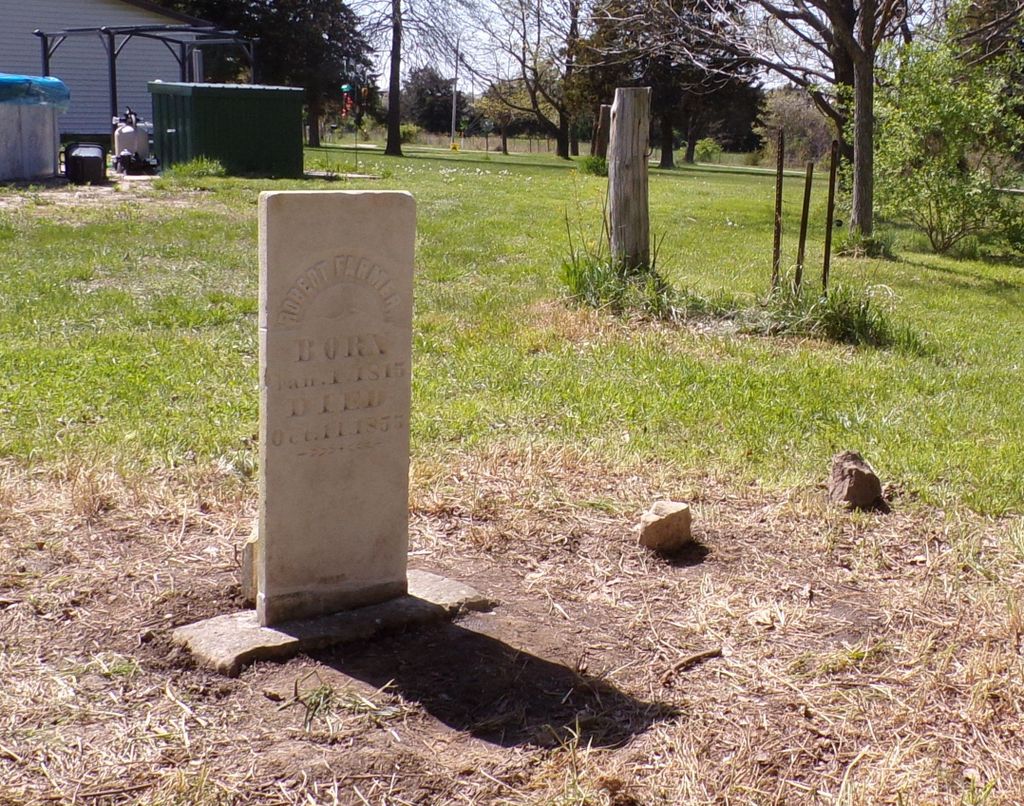
| Description | : | This family cemetery is located on the farm originally purchased in 1834 by William and Martha (Bell) Farmer. In the 1920s, the tombstones were moved aside in order to plant corn on the land. The stone for William's son, Robert Farmer, was found at the back of the property in January 2021. Other family members are known to be buried there, including William who died in 1844, wife Martha, son Stephen and his wife, Jane who died around 1853. |
frequently asked questions (FAQ):
-
Where is Farmer Cemetery?
Farmer Cemetery is located at Hickory Hill, Cole County ,Missouri ,USA.
-
Farmer Cemetery cemetery's updated grave count on graveviews.com?
0 memorials
-
Where are the coordinates of the Farmer Cemetery?
Latitude: 38.4143500
Longitude: -92.3889790
Nearby Cemetories:
1. Duncan-Berry Family Cemetery
Eugene, Cole County, USA
Coordinate: 38.4255555, -92.3761111
2. Hickory Hill Cemetery
Hickory Hill, Cole County, USA
Coordinate: 38.4005900, -92.3596300
3. Spring Garden Cemetery
Spring Garden, Miller County, USA
Coordinate: 38.3922005, -92.4111023
4. Mount Carmel Cemetery
Brazito, Cole County, USA
Coordinate: 38.4398499, -92.3734207
5. Bethel Cemetery
Hickory Hill, Cole County, USA
Coordinate: 38.4122400, -92.3465900
6. Helton Farm Burial Ground
Hickory Hill, Cole County, USA
Coordinate: 38.4288500, -92.3464100
7. Fowler Farm Burial Ground
Bass, Cole County, USA
Coordinate: 38.4193750, -92.3235020
8. Raithel Cemetery
Brazito, Cole County, USA
Coordinate: 38.4420300, -92.3272400
9. Henley Cemetery
Henley, Cole County, USA
Coordinate: 38.3907200, -92.3164800
10. Clibourn Cemetery
Russellville, Cole County, USA
Coordinate: 38.4760500, -92.3973500
11. Roark Cemetery
Russellville, Cole County, USA
Coordinate: 38.4696999, -92.4255981
12. Matheis Cemetery
Russellville, Cole County, USA
Coordinate: 38.4571800, -92.4491600
13. Eugene Cemetery
Eugene, Cole County, USA
Coordinate: 38.3502900, -92.3946100
14. Friedens Cemetery
Brazito, Cole County, USA
Coordinate: 38.4446182, -92.3035660
15. Campbell Cemetery
Cole County, USA
Coordinate: 38.4810982, -92.4297028
16. Arnhold Burial Ground
Brazito, Cole County, USA
Coordinate: 38.4478370, -92.3005870
17. Clarenbach and Wright Cemetery
Brazito, Cole County, USA
Coordinate: 38.4482400, -92.2968000
18. Pleasant Hill Cemetery
Brazito, Cole County, USA
Coordinate: 38.4810300, -92.3224000
19. Allen Cemetery
Olean, Miller County, USA
Coordinate: 38.4150009, -92.5008011
20. Colvin Strong Cemetery
Millbrook, Cole County, USA
Coordinate: 38.5025600, -92.3690400
21. Sommerer Farm Cemetery
Brazito, Cole County, USA
Coordinate: 38.4546500, -92.2801800
22. Trinity Lutheran Cemetery
Russellville, Cole County, USA
Coordinate: 38.5028000, -92.4317017
23. Peace Lutheran Cemetery
Brazito, Cole County, USA
Coordinate: 38.4676600, -92.2889300
24. Enon Cemetery
Russellville, Cole County, USA
Coordinate: 38.4888992, -92.4730988

