
| Memorials | : | 0 |
| Location | : | Hickory Hill, Cole County, USA |
| Coordinate | : | 38.4288500, -92.3464100 |
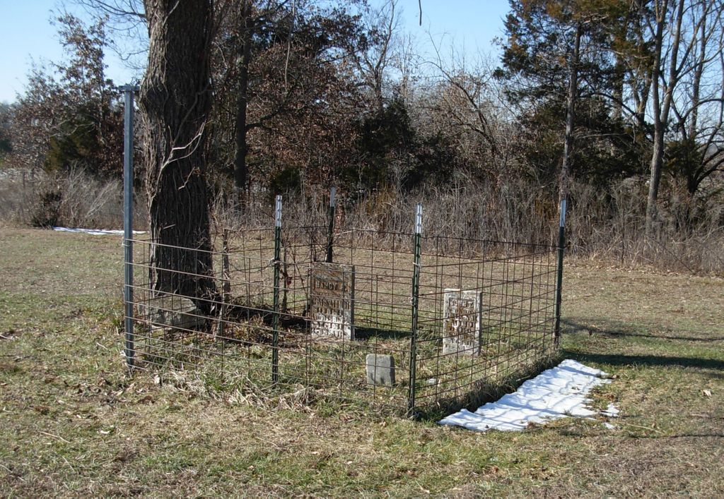
| Description | : | Township 43 N - Range 13 W - Section 34 Information taken from "Cemeteries in Cole County, Missouri as Recorded in the 1930s" by Mrs. Houck McHenry. At that time only two stones were standing. There was also one unmarked burial. This cemetery is also known as the Smith Cemetery. When it was documented in 1986, there was some difference in the information. Based on research done at that time, it was determined at that time that the Smiths were actually Messersmiths. Photos of the tombstones taken at that time supported this. There is an... Read More |
frequently asked questions (FAQ):
-
Where is Helton Farm Burial Ground?
Helton Farm Burial Ground is located at Hickory Hill, Cole County ,Missouri ,USA.
-
Helton Farm Burial Ground cemetery's updated grave count on graveviews.com?
0 memorials
-
Where are the coordinates of the Helton Farm Burial Ground?
Latitude: 38.4288500
Longitude: -92.3464100
Nearby Cemetories:
1. Bethel Cemetery
Hickory Hill, Cole County, USA
Coordinate: 38.4122400, -92.3465900
2. Raithel Cemetery
Brazito, Cole County, USA
Coordinate: 38.4420300, -92.3272400
3. Fowler Farm Burial Ground
Bass, Cole County, USA
Coordinate: 38.4193750, -92.3235020
4. Duncan-Berry Family Cemetery
Eugene, Cole County, USA
Coordinate: 38.4255555, -92.3761111
5. Mount Carmel Cemetery
Brazito, Cole County, USA
Coordinate: 38.4398499, -92.3734207
6. Hickory Hill Cemetery
Hickory Hill, Cole County, USA
Coordinate: 38.4005900, -92.3596300
7. Farmer Cemetery
Hickory Hill, Cole County, USA
Coordinate: 38.4143500, -92.3889790
8. Friedens Cemetery
Brazito, Cole County, USA
Coordinate: 38.4446182, -92.3035660
9. Arnhold Burial Ground
Brazito, Cole County, USA
Coordinate: 38.4478370, -92.3005870
10. Clarenbach and Wright Cemetery
Brazito, Cole County, USA
Coordinate: 38.4482400, -92.2968000
11. Henley Cemetery
Henley, Cole County, USA
Coordinate: 38.3907200, -92.3164800
12. Pleasant Hill Cemetery
Brazito, Cole County, USA
Coordinate: 38.4810300, -92.3224000
13. Sommerer Farm Cemetery
Brazito, Cole County, USA
Coordinate: 38.4546500, -92.2801800
14. Peace Lutheran Cemetery
Brazito, Cole County, USA
Coordinate: 38.4676600, -92.2889300
15. Clibourn Cemetery
Russellville, Cole County, USA
Coordinate: 38.4760500, -92.3973500
16. Spring Garden Cemetery
Spring Garden, Miller County, USA
Coordinate: 38.3922005, -92.4111023
17. Roark Cemetery
Russellville, Cole County, USA
Coordinate: 38.4696999, -92.4255981
18. Colvin Strong Cemetery
Millbrook, Cole County, USA
Coordinate: 38.5025600, -92.3690400
19. Johnston Cemetery
Brazito, Cole County, USA
Coordinate: 38.4928017, -92.2910995
20. Osage Bluff Methodist Cemetery
Osage Bluff, Cole County, USA
Coordinate: 38.4497910, -92.2513809
21. Hedler Cemetery
Jefferson City, Cole County, USA
Coordinate: 38.4814000, -92.2705700
22. Campbell Cemetery
Cole County, USA
Coordinate: 38.4810982, -92.4297028
23. Matheis Cemetery
Russellville, Cole County, USA
Coordinate: 38.4571800, -92.4491600
24. Eugene Cemetery
Eugene, Cole County, USA
Coordinate: 38.3502900, -92.3946100