
| Memorials | : | 0 |
| Location | : | Culberson County, USA |
| Coordinate | : | 31.0596900, -104.5235200 |
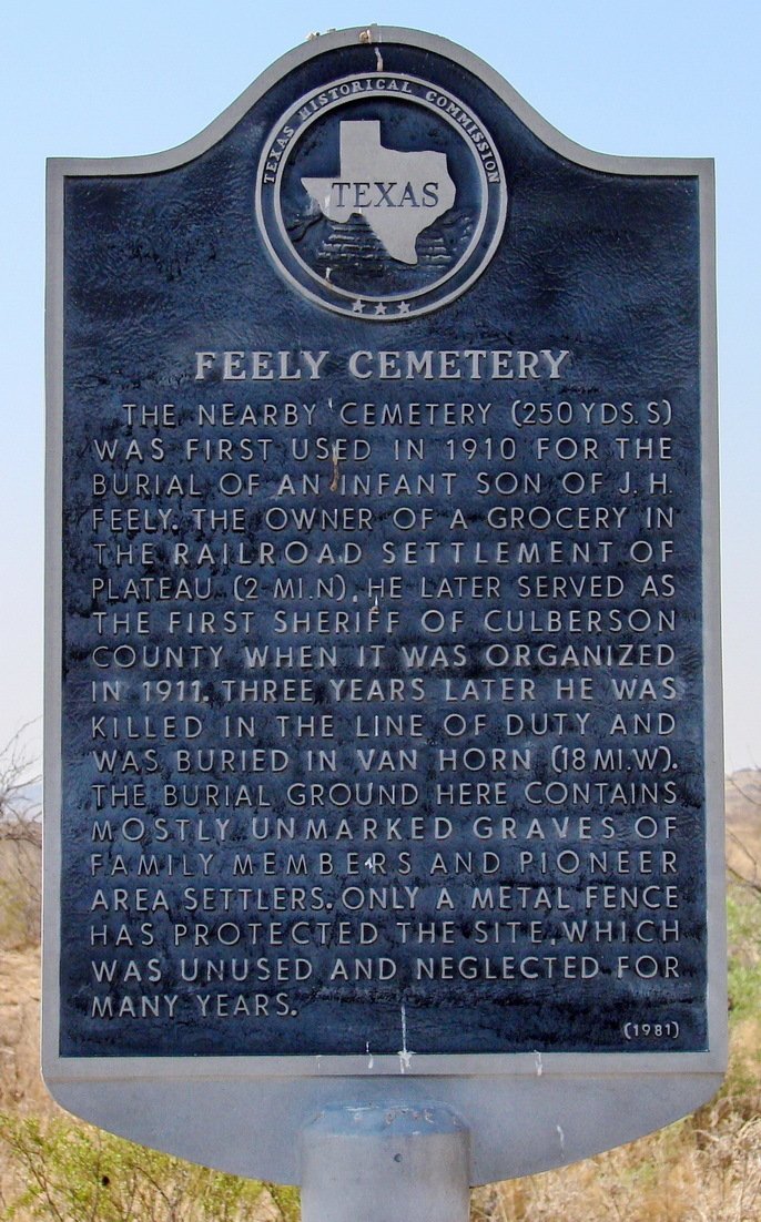
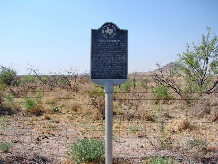
| Description | : | Historical marker text: The nearby cemetery (250 yards south) was first used in 1910 for the burial of an infant son of J.H. Feely. The owner of a grocery in the railroad settlement of Plateau (2 miles north), he later served as the first sheriff of Culberson County when it was organized in 1911. Three years later he was killed in the lin of duty and was buried in Van Horn (18 miles west). The burial ground here contains mostly unmarked graves of family members and pioneer area settlers. Only a metal fence has protected the site, which was unused and... Read More |
frequently asked questions (FAQ):
-
Where is Feely Cemetery?
Feely Cemetery is located at Culberson County ,Texas ,USA.
-
Feely Cemetery cemetery's updated grave count on graveviews.com?
0 memorials
-
Where are the coordinates of the Feely Cemetery?
Latitude: 31.0596900
Longitude: -104.5235200
Nearby Cemetories:
1. Boracho Cemetery
Culberson County, USA
Coordinate: 31.0809510, -104.3856660
2. Kent Cemetery
Kent, Culberson County, USA
Coordinate: 31.0730100, -104.2198900
3. Van Horn Cemetery
Van Horn, Culberson County, USA
Coordinate: 31.0461100, -104.8397000
4. Van Horn Wells Cemetery
Van Horn, Culberson County, USA
Coordinate: 30.8843780, -104.7974260
5. Cowden Family Ranch Cemetery
Kent, Culberson County, USA
Coordinate: 31.7127990, -104.5904250
6. Paisano Baptist Encampment
Alpine, Brewster County, USA
Coordinate: 30.2924230, -103.7973510
7. DeMoss Cemetery
Loving, Eddy County, USA
Coordinate: 32.0497030, -104.8410780
8. Elm Grove Cemetery
Alpine, Brewster County, USA
Coordinate: 30.3585739, -103.6375122
9. Holy Angels Cemetery
Alpine, Brewster County, USA
Coordinate: 30.3600006, -103.6354980
10. Rattlesnake Springs Cemetery
Black River Village, Eddy County, USA
Coordinate: 32.1080560, -104.4597220
11. Miller Family Cemetery
Eddy County, USA
Coordinate: 32.1157639, -104.4556945
12. J O Watkins Gravesite
Eddy County, USA
Coordinate: 32.1013890, -104.7661100
13. Cienega Cemetery
Otero County, USA
Coordinate: 32.0505981, -105.1033020
14. X-Bar Ranch Cemetery
Eddy County, USA
Coordinate: 32.1916670, -104.6188890
15. Queen Cemetery
Queen, Eddy County, USA
Coordinate: 32.2000008, -104.7332993
16. Smith Family Cemetery
Black River Village, Eddy County, USA
Coordinate: 32.2004000, -104.2612000
17. South Cemetery
Eddy County, USA
Coordinate: 32.2002983, -104.2602997
18. Panteón de El Porvenir
Porvenir, Praxedis G. Guerrero Municipality, Mexico
Coordinate: 31.2371690, -105.8757500
19. Bounds Family Cemetery
Black River Village, Eddy County, USA
Coordinate: 32.2079660, -104.2450890
20. Silas Gibson Gravesite
Malaga, Eddy County, USA
Coordinate: 32.1744000, -103.9672000
21. Lookout Cemetery
Malaga, Eddy County, USA
Coordinate: 32.2313995, -104.1089020
22. Panteón Municipal de Colonia Esperanza
Colonia Esperanza, Praxedis G. Guerrero Municipality, Mexico
Coordinate: 31.2981830, -105.9613160
23. Cornudas Mountain Cemetery
Otero County, USA
Coordinate: 32.0495522, -105.4259697
24. Cuba Cemetery
Eddy County, USA
Coordinate: 32.2984250, -104.1575130