
| Memorials | : | 4 |
| Location | : | Cottonwood, Shasta County, USA |
| Coordinate | : | 40.6326828, -121.9151993 |
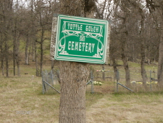
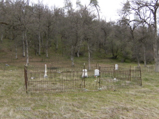
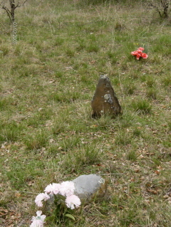
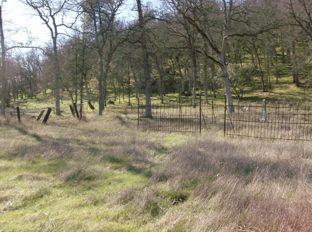
| Description | : | There are many unreadable markers and stones here. And no doubt many graves have disappeared. Location: Very back corner of Shasta County. Go out Gas Point Road, to what looks like the end, about 10 miles. Gas point turns right at Pinckney Cemetery and goes to Igo. Keep going straight.you will cross the bridge then Stay on Foster about another 5 miles. Cemetery is on the right and hard to see. On what appears to be private property, road is bad. |
frequently asked questions (FAQ):
-
Where is Tuttle Gulch Cemetery?
Tuttle Gulch Cemetery is located at Cottonwood, Shasta County ,California ,USA.
-
Tuttle Gulch Cemetery cemetery's updated grave count on graveviews.com?
4 memorials
-
Where are the coordinates of the Tuttle Gulch Cemetery?
Latitude: 40.6326828
Longitude: -121.9151993
Nearby Cemetories:
1. Josephine Cemetery
Whitmore, Shasta County, USA
Coordinate: 40.6326828, -121.9151993
2. Fern Cemetery
Shasta County, USA
Coordinate: 40.6473600, -121.8861500
3. Whitmore Evangelical Cemetery
Shasta County, USA
Coordinate: 40.6235580, -121.8566580
4. Oak Run Cemetery
Oak Run, Shasta County, USA
Coordinate: 40.6882324, -122.0308685
5. Fender Cemetery
Redding, Shasta County, USA
Coordinate: 40.7167320, -122.0352859
6. Ogburn Inwood Cemetery
Shingletown, Shasta County, USA
Coordinate: 40.5092100, -121.9622000
7. Original Plateau Cemetery
Shasta County, USA
Coordinate: 40.5020100, -121.8248200
8. Hunt Cemetery
Shasta County, USA
Coordinate: 40.6236200, -122.1116300
9. Klotz Family Cemetery
Shingletown, Shasta County, USA
Coordinate: 40.4784760, -121.8553840
10. Plateau Cemetery
Shasta County, USA
Coordinate: 40.4840460, -121.8254480
11. Mountain Home Cemetery
Shasta County, USA
Coordinate: 40.5342700, -121.7218200
12. Halcumb Cemetery
Montgomery Creek, Shasta County, USA
Coordinate: 40.8213997, -121.9308014
13. Herrick Family Cemetery
Shasta County, USA
Coordinate: 40.4450200, -121.8679300
14. Manton Cemetery
Manton, Tehama County, USA
Coordinate: 40.4342310, -121.8638310
15. Millville IOOF Cemetery
Millville, Shasta County, USA
Coordinate: 40.5539017, -122.1663971
16. Beck Cemetery
Shasta County, USA
Coordinate: 40.5487400, -122.1720900
17. Millville Masonic Cemetery
Millville, Shasta County, USA
Coordinate: 40.5555000, -122.1842804
18. Fuller Cemetery
Shasta County, USA
Coordinate: 40.4536700, -121.7208300
19. Junior Family Cemetery
Tehama County, USA
Coordinate: 40.3990010, -121.8673330
20. Lanes Valley Cemetery
Paynes Creek, Tehama County, USA
Coordinate: 40.3998400, -121.9762400
21. Haggard Family Ranch Cemetery
Palo Cedro, Shasta County, USA
Coordinate: 40.5105600, -122.2227800
22. Parkville Cemetery
Anderson, Shasta County, USA
Coordinate: 40.4640200, -122.1897500
23. Cove Cemetery
Shasta County, USA
Coordinate: 40.9034100, -121.9386200
24. Houston Cemetery
Redding, Shasta County, USA
Coordinate: 40.6533012, -122.2940979