
| Memorials | : | 0 |
| Location | : | Paynes Creek, Tehama County, USA |
| Coordinate | : | 40.3998400, -121.9762400 |
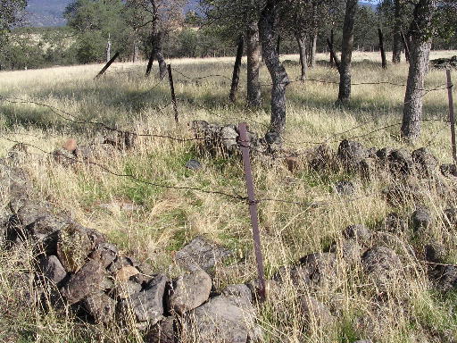
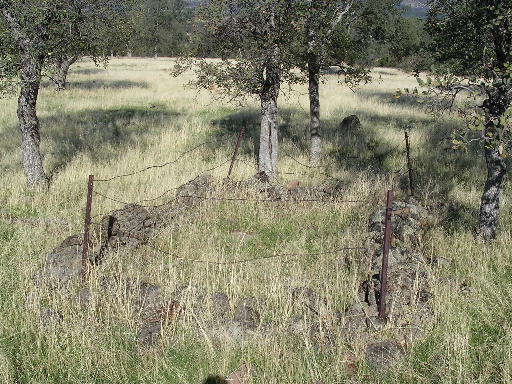
| Description | : | This cemetery is not actually in Paynes Creek, but some miles away on private property. Contributor has more pictures of the cemetery and graves to share, and may be able to arrange access if desired. |
frequently asked questions (FAQ):
-
Where is Lanes Valley Cemetery?
Lanes Valley Cemetery is located at Paynes Creek, Tehama County ,California ,USA.
-
Lanes Valley Cemetery cemetery's updated grave count on graveviews.com?
0 memorials
-
Where are the coordinates of the Lanes Valley Cemetery?
Latitude: 40.3998400
Longitude: -121.9762400

Nearby Cemetories:
1. Junior Family Cemetery
Tehama County, USA
Coordinate: 40.3990010, -121.8673330
2. Manton Cemetery
Manton, Tehama County, USA
Coordinate: 40.4342310, -121.8638310
3. Herrick Family Cemetery
Shasta County, USA
Coordinate: 40.4450200, -121.8679300
4. Ogburn Inwood Cemetery
Shingletown, Shasta County, USA
Coordinate: 40.5092100, -121.9622000
5. Klotz Family Cemetery
Shingletown, Shasta County, USA
Coordinate: 40.4784760, -121.8553840
6. Inks Creek Cemetery
Tehama County, USA
Coordinate: 40.3419800, -122.1297100
7. Plateau Cemetery
Shasta County, USA
Coordinate: 40.4840460, -121.8254480
8. Cameron-Davis Cemetery
Tehama County, USA
Coordinate: 40.2709800, -121.8778500
9. Original Plateau Cemetery
Shasta County, USA
Coordinate: 40.5020100, -121.8248200
10. Parkville Cemetery
Anderson, Shasta County, USA
Coordinate: 40.4640200, -122.1897500
11. Major Pierson B Reading Family Cemetery
Cottonwood, Shasta County, USA
Coordinate: 40.3924300, -122.2126900
12. Belle Mill Cemetery
Lyonsville, Tehama County, USA
Coordinate: 40.3037710, -121.7445660
13. Fuller Cemetery
Shasta County, USA
Coordinate: 40.4536700, -121.7208300
14. Beck Cemetery
Shasta County, USA
Coordinate: 40.5487400, -122.1720900
15. Millville IOOF Cemetery
Millville, Shasta County, USA
Coordinate: 40.5539017, -122.1663971
16. Haggard Family Ranch Cemetery
Palo Cedro, Shasta County, USA
Coordinate: 40.5105600, -122.2227800
17. Cottonwood Creek Ranch Cemetery
Cottonwood, Shasta County, USA
Coordinate: 40.3663100, -122.2598800
18. Millville Masonic Cemetery
Millville, Shasta County, USA
Coordinate: 40.5555000, -122.1842804
19. Mountain Home Cemetery
Shasta County, USA
Coordinate: 40.5342700, -121.7218200
20. Sleepy Hollow Pet Cemetery
Anderson, Shasta County, USA
Coordinate: 40.4199430, -122.2858410
21. Josephine Cemetery
Whitmore, Shasta County, USA
Coordinate: 40.6326828, -121.9151993
22. Tuttle Gulch Cemetery
Cottonwood, Shasta County, USA
Coordinate: 40.6326828, -121.9151993
23. Whitmore Evangelical Cemetery
Shasta County, USA
Coordinate: 40.6235580, -121.8566580
24. Cottonwood Cemetery
Cottonwood, Shasta County, USA
Coordinate: 40.3856100, -122.2936500