
| Memorials | : | 94 |
| Location | : | Fiat, Tuscarawas County, USA |
| Coordinate | : | 40.4175072, -81.6648102 |
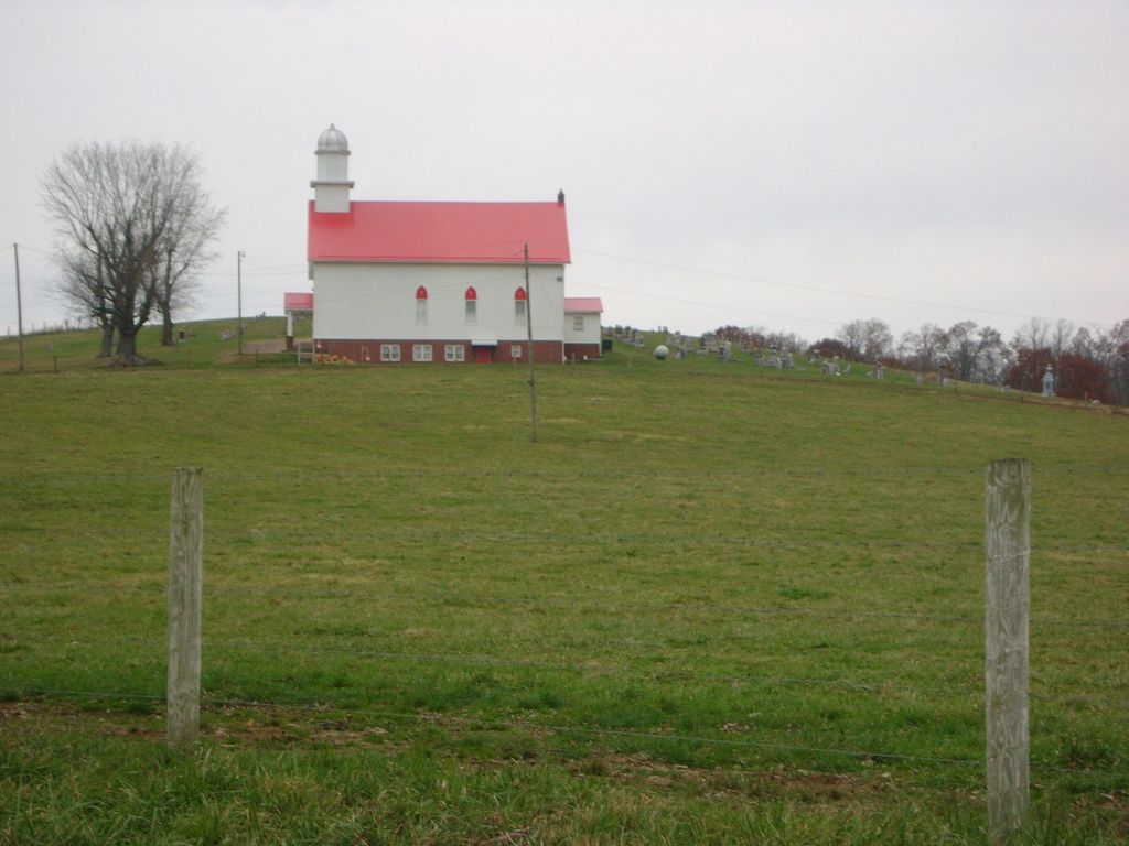
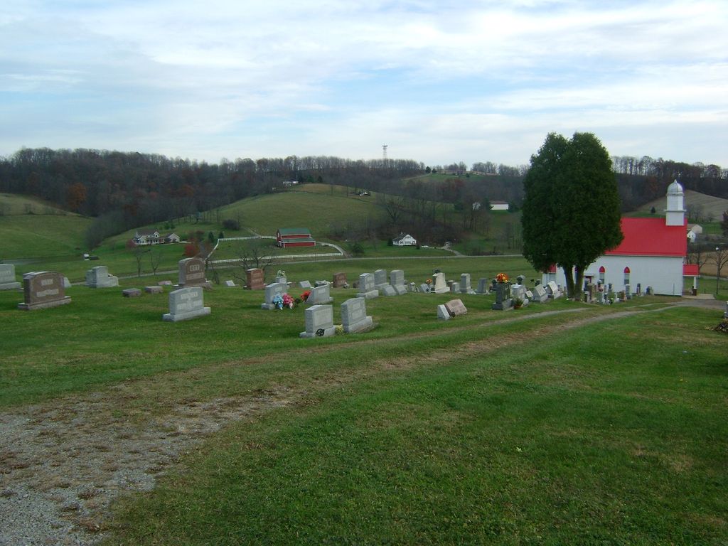
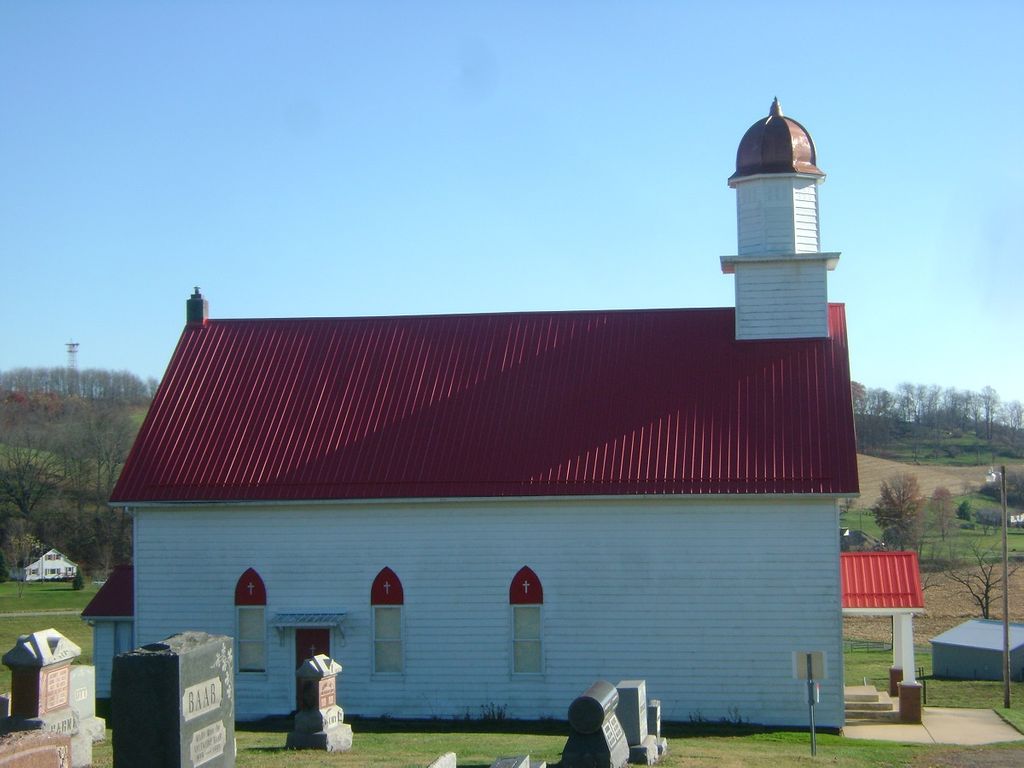
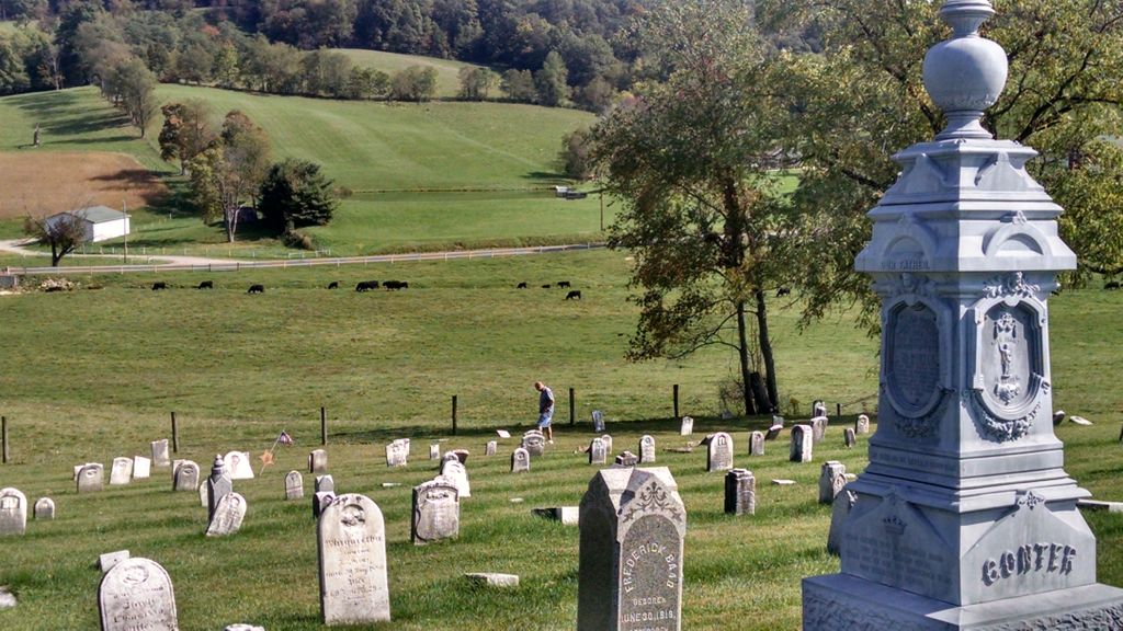
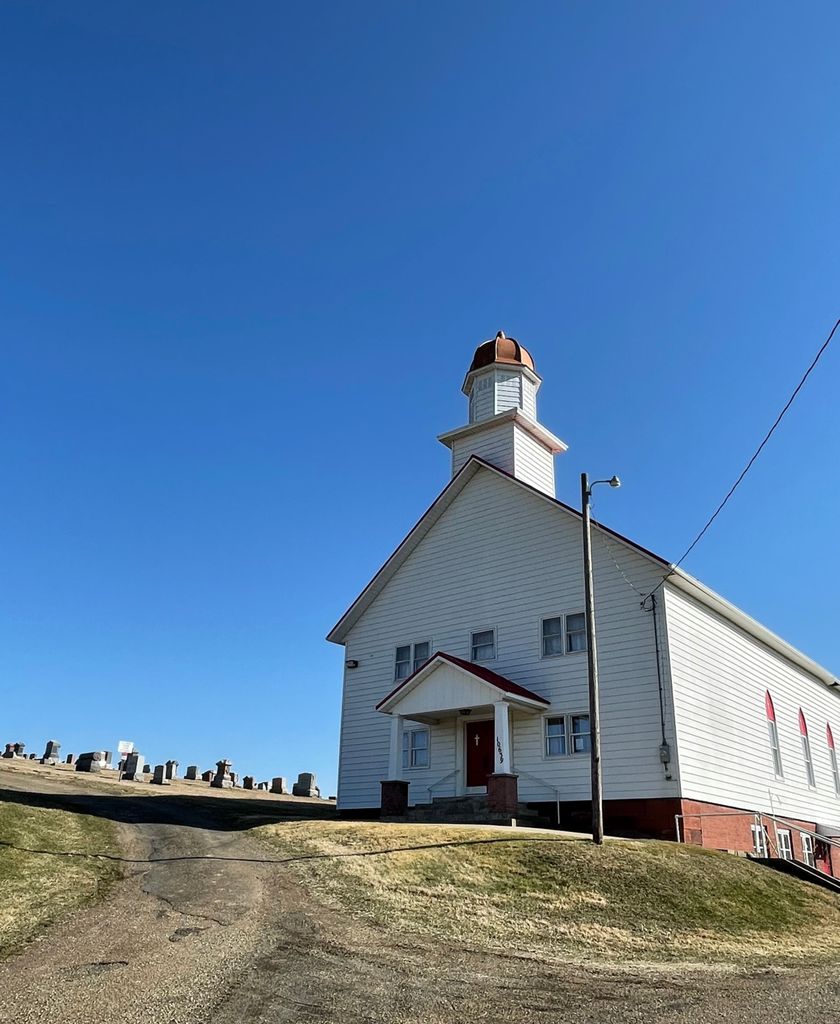
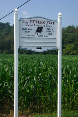
| Description | : | The cemetery is located on northeast side of Indian Spring Road (County Road 96) about 0.25 miles west of its intersection with Troendly Road SW (County Road 42). The cemetery is located in Bucks Township, Tuscarawas County, Ohio, and is # 11708 (Lint Cemetery / Fiat Cemetery / Gonters German Lutheran Cemetery) in “Ohio Cemeteries 1803-2003”, compiled by the Ohio Genealogical Society. The U.S. Geological Survey (USGS) Geographic Names Information System (GNIS) feature ID for the cemetery is 1963826 (Fiat Cemetery / Gonter’s German Lutheran Cemetery / Lint Cemetery / Saint Peter’s United Church of Christ Cemetery). St. Peter's United Church of... Read More |
frequently asked questions (FAQ):
-
Where is Fiat Cemetery?
Fiat Cemetery is located at Indian Spring Road (County Road 96) Fiat, Tuscarawas County ,Ohio , 43804USA.
-
Fiat Cemetery cemetery's updated grave count on graveviews.com?
94 memorials
-
Where are the coordinates of the Fiat Cemetery?
Latitude: 40.4175072
Longitude: -81.6648102
Nearby Cemetories:
1. Penrod Cemetery
Tuscarawas County, USA
Coordinate: 40.4366350, -81.6268450
2. Baltic Cemetery
Baltic, Tuscarawas County, USA
Coordinate: 40.4370500, -81.7063400
3. McCollum Family Cemetery
Baltic, Tuscarawas County, USA
Coordinate: 40.3848000, -81.6904000
4. McCollum Cemetery
Baltic, Tuscarawas County, USA
Coordinate: 40.3847530, -81.6904810
5. Neff Burial Ground
Ragersville, Tuscarawas County, USA
Coordinate: 40.4501200, -81.6332130
6. West Lawn Cemetery
Baltic, Tuscarawas County, USA
Coordinate: 40.4428437, -81.7079054
7. Saint Jacobs Reformed Cemetery
Tuscarawas County, USA
Coordinate: 40.4047891, -81.6098445
8. Ragersville Historical Society Museum
Ragersville, Tuscarawas County, USA
Coordinate: 40.4529500, -81.6299970
9. Fisher Cemetery
Holmes County, USA
Coordinate: 40.4589070, -81.6887460
10. Ragersville Cemetery
Sugarcreek, Tuscarawas County, USA
Coordinate: 40.4542300, -81.6295700
11. Berger Cemetery
Holmes County, USA
Coordinate: 40.4491030, -81.7089270
12. Renners Church Cemetery
Tuscarawas County, USA
Coordinate: 40.3738290, -81.6848690
13. Evans Creek Lutheran Cemetery
Tuscarawas County, USA
Coordinate: 40.3756200, -81.6370700
14. Brush Run East Cemetery
Clark Township, Holmes County, USA
Coordinate: 40.4664400, -81.6751300
15. Halifax Cemetery
Coshocton, Coshocton County, USA
Coordinate: 40.4087030, -81.7294830
16. John N Troyer Farm Cemetery
Farmerstown, Holmes County, USA
Coordinate: 40.4632920, -81.6961860
17. Seltonright Cemetery
Baltic, Tuscarawas County, USA
Coordinate: 40.4701004, -81.6586990
18. Raymond Miller & Albert Hershberger Farms Cemetery
Farmerstown, Holmes County, USA
Coordinate: 40.4706060, -81.6688120
19. Halifax United Brethren Cemetery
Coshocton, Coshocton County, USA
Coordinate: 40.4081150, -81.7342910
20. Ebenezer Cemetery
Stone Creek, Tuscarawas County, USA
Coordinate: 40.3716170, -81.6188260
21. Noah A Troyer Farm Cemetery
Farmerstown, Holmes County, USA
Coordinate: 40.4729580, -81.6877870
22. Albert Schlabach Farm Cemetery
Charm, Holmes County, USA
Coordinate: 40.4771400, -81.6746270
23. Bakersville Cemetery
Coshocton County, USA
Coordinate: 40.3564571, -81.6520681
24. Jacobson Mausoleum
Auburn Township, Tuscarawas County, USA
Coordinate: 40.4803341, -81.6644602