
| Memorials | : | 0 |
| Location | : | Menomonie, Dunn County, USA |
| Coordinate | : | 44.8752100, -91.9249900 |
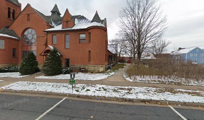
| Description | : | There is NO columbarium located at that church at present. There is a small 'plot' dirt garden that they have records in their office for, with grids identified to help track who is 'buried' where. Cremains must be in a biodegradable container or box so they will return to the earth, and eventually the same areas can be 'reused'. |
frequently asked questions (FAQ):
-
Where is First Congregational UCC Columbarium?
First Congregational UCC Columbarium is located at Menomonie, Dunn County ,Wisconsin ,USA.
-
First Congregational UCC Columbarium cemetery's updated grave count on graveviews.com?
0 memorials
-
Where are the coordinates of the First Congregational UCC Columbarium?
Latitude: 44.8752100
Longitude: -91.9249900
Nearby Cemetories:
1. Saint Josephs Cemetery
Menomonie, Dunn County, USA
Coordinate: 44.8835983, -91.9150009
2. Evergreen Cemetery
Menomonie, Dunn County, USA
Coordinate: 44.8888000, -91.9122000
3. Saint Pauls Cemetery
Menomonie, Dunn County, USA
Coordinate: 44.8532982, -91.9199982
4. Peace Lutheran Cemetery
Menomonie, Dunn County, USA
Coordinate: 44.8502998, -91.9152985
5. Ford Cemetery
Menomonie, Dunn County, USA
Coordinate: 44.8718987, -91.9753036
6. Christ Lutheran Halvorson Cemetery
Menomonie, Dunn County, USA
Coordinate: 44.9127998, -91.9297028
7. Potters Field Cemetery
Menomonie, Dunn County, USA
Coordinate: 44.8898900, -91.8701000
8. Ridgeroad Cemetery
Menomonie, Dunn County, USA
Coordinate: 44.8638992, -91.9863968
9. Faith Church Cemetery
Menomonie, Dunn County, USA
Coordinate: 44.9196050, -91.8974710
10. Highland Cemetery
Menomonie, Dunn County, USA
Coordinate: 44.9235992, -91.9347000
11. Mamre Cemetery
Menomonie, Dunn County, USA
Coordinate: 44.8796997, -92.0049973
12. Froens Cemetery
Menomonie, Dunn County, USA
Coordinate: 44.8288994, -91.8728027
13. Irvine Creek Cemetery
Irvington, Dunn County, USA
Coordinate: 44.8513985, -92.0061035
14. Cedar Falls Cemetery
Cedar Falls, Dunn County, USA
Coordinate: 44.9247017, -91.8656006
15. Saint Johns Cemetery
Irvington, Dunn County, USA
Coordinate: 44.8182983, -91.9832993
16. Little Elk Creek Cemetery
Downsville, Dunn County, USA
Coordinate: 44.8101000, -91.8726000
17. Tramway Cemetery
Menomonie, Dunn County, USA
Coordinate: 44.9296989, -92.0006027
18. Grandview Cemetery
Menomonie, Dunn County, USA
Coordinate: 44.8036003, -91.9677963
19. Saint Johns Lutheran Cemetery
Menomonie, Dunn County, USA
Coordinate: 44.8568993, -91.8022003
20. Teegarden Cemetery
Knapp, Dunn County, USA
Coordinate: 44.9406013, -92.0242004
21. Riverview Cemetery
Downsville, Dunn County, USA
Coordinate: 44.7742004, -91.9216995
22. Beyer Settlement Cemetery
Red Cedar, Dunn County, USA
Coordinate: 44.9161110, -91.7925520
23. Iron Creek Cemetery
Spring Brook, Dunn County, USA
Coordinate: 44.8527985, -91.7786026
24. Lower Weston Cemetery
Weston, Dunn County, USA
Coordinate: 44.7886009, -92.0149994