
| Memorials | : | 3 |
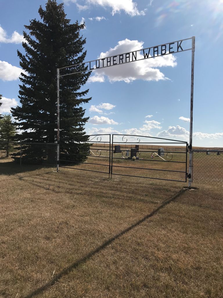
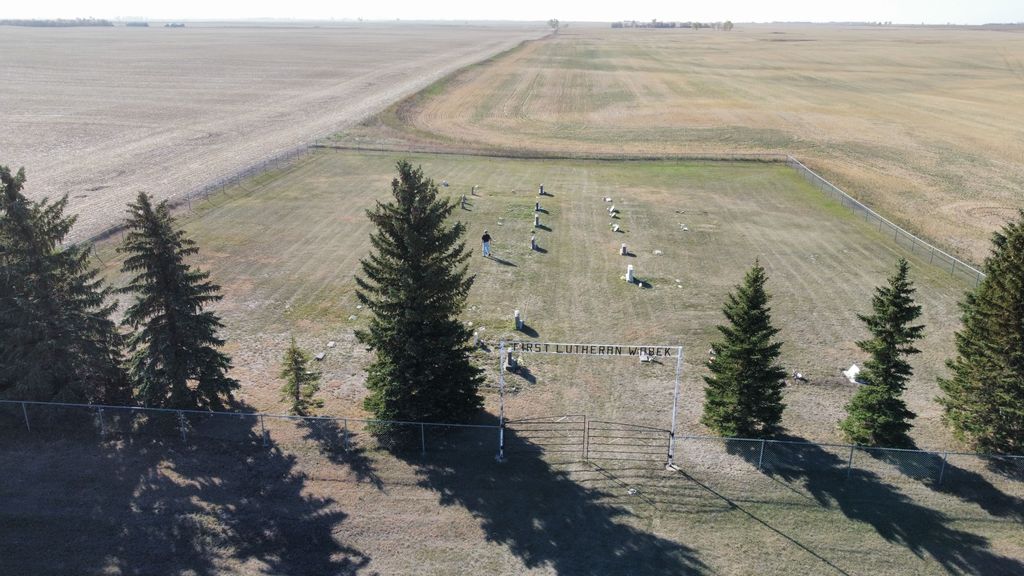
| Location | : | Wabek, Mountrail County, USA |
| Coordinate | : | 47.9633300, -101.9691000 |
| Description | : | Wabek, ND is now a ghost town; however, it has a nice little cemetery of 52 people. It is still maintained.The church still stands a mile away. |
frequently asked questions (FAQ):
-
Where is First Lutheran Wabek Cemetery?
First Lutheran Wabek Cemetery is located at Wabek, Mountrail County ,North Dakota ,USA.
-
First Lutheran Wabek Cemetery cemetery's updated grave count on graveviews.com?
3 memorials
-
Where are the coordinates of the First Lutheran Wabek Cemetery?
Latitude: 47.9633300
Longitude: -101.9691000
Nearby Cemetories:
1. Sacred Heart Cemetery
Plaza, Mountrail County, USA
Coordinate: 48.0139008, -101.9618988
2. East Community Cemetery
Plaza, Mountrail County, USA
Coordinate: 48.0243988, -101.9383011
3. First Lutheran Cemetery
Plaza, Mountrail County, USA
Coordinate: 48.0374985, -101.9542007
4. Saint Elizabeth Catholic Cemetery
Makoti, Ward County, USA
Coordinate: 47.9773600, -101.8074600
5. Saint Bridgets Cemetery
Parshall, Mountrail County, USA
Coordinate: 47.9622700, -102.1328910
6. Parshall Cemetery
Parshall, Mountrail County, USA
Coordinate: 47.9357200, -102.1282000
7. Saint Pauls Lutheran Cemetery
Makoti, Ward County, USA
Coordinate: 47.9057560, -101.8191380
8. Hope Lutheran Cemetery
Makoti, Ward County, USA
Coordinate: 47.9637070, -101.7867420
9. Lucky Mound Lutheran Cemetery
McLean County, USA
Coordinate: 47.8338990, -102.0010640
10. Spring Valley Lutheran Cemetery
Ward County, USA
Coordinate: 48.0813000, -101.8785400
11. Bethlehem Lutheran Cemetery
Belden, Mountrail County, USA
Coordinate: 48.0307007, -102.1838989
12. Church of God Cemetery
Raub, McLean County, USA
Coordinate: 47.8041344, -102.0656662
13. Trinity Lutheran Cemetery
Plaza, Mountrail County, USA
Coordinate: 48.1385307, -102.0082397
14. Hiddenwood Cemetery
McLean County, USA
Coordinate: 47.8330994, -101.7743988
15. Johns Cemetery
Mountrail County, USA
Coordinate: 48.1055984, -102.1461029
16. Roseglen Baptist Cemetery
Roseglen, McLean County, USA
Coordinate: 47.7738991, -101.9246979
17. Emrich Cemetery
Roseglen, McLean County, USA
Coordinate: 47.7947180, -101.8082670
18. Rosehill Cemetery
Ryder, Ward County, USA
Coordinate: 47.9266600, -101.6706500
19. Bethlehem Lutheran Cemetery
Roseglen, McLean County, USA
Coordinate: 47.7602882, -101.9143037
20. Bethesda Lutheran Church Cemetery
Raub, McLean County, USA
Coordinate: 47.7461800, -102.0486800
21. Queen of Peace Cemetery
Raub, McLean County, USA
Coordinate: 47.7458000, -102.0532990
22. Epworth Cemetery
Mountrail County, USA
Coordinate: 48.1258011, -102.2174988
23. Hiland Cemetery
Ryder, Ward County, USA
Coordinate: 48.0729103, -101.6588669
24. Anna Township Cemetery
Makoti, Ward County, USA
Coordinate: 48.0199410, -101.6152740