
| Memorials | : | 11 |
| Location | : | Fort Smith, Sebastian County, USA |
| Coordinate | : | 35.3849900, -94.4182700 |
frequently asked questions (FAQ):
-
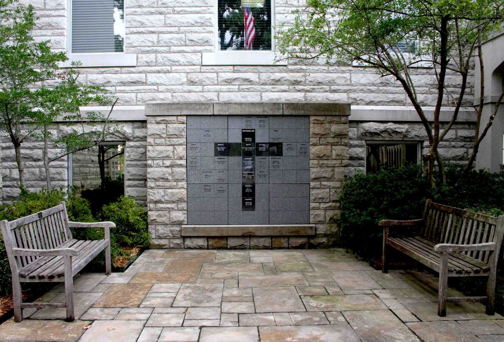
Where is First Presbyterian Church Columbarium?
First Presbyterian Church Columbarium is located at 116 North 12th Street Fort Smith, Sebastian County ,Arkansas ,USA.
-
First Presbyterian Church Columbarium cemetery's updated grave count on graveviews.com?
11 memorials
-
Where are the coordinates of the First Presbyterian Church Columbarium?
Latitude: 35.3849900
Longitude: -94.4182700
Nearby Cemetories:
1. Immaculate Conception Catholic Columbarium
Fort Smith, Sebastian County, USA
Coordinate: 35.3828960, -94.4184930
2. First United Methodist Church Columbarium
Fort Smith, Sebastian County, USA
Coordinate: 35.3834560, -94.4150440
3. Saint John Episcopal Church Columbarium
Fort Smith, Sebastian County, USA
Coordinate: 35.3895490, -94.4234350
4. Calvary Cemetery
Fort Smith, Sebastian County, USA
Coordinate: 35.3764000, -94.4167023
5. Fort Smith National Cemetery
Fort Smith, Sebastian County, USA
Coordinate: 35.3838997, -94.4291992
6. Jewish Cemetery
Fort Smith, Sebastian County, USA
Coordinate: 35.3757000, -94.4176000
7. Goddard United Methodistb Church Columbarium
Fort Smith, Sebastian County, USA
Coordinate: 35.3720830, -94.4129730
8. Oak Cemetery
Fort Smith, Sebastian County, USA
Coordinate: 35.3694000, -94.4017029
9. Christ the King Catholic Church Columbarium
Fort Smith, Sebastian County, USA
Coordinate: 35.3641970, -94.4045960
10. Saint Scholastica Cemetery
Fort Smith, Sebastian County, USA
Coordinate: 35.3700890, -94.3842790
11. Saint Bartholomew Episcopal Church Garden
Fort Smith, Sebastian County, USA
Coordinate: 35.3571380, -94.3945150
12. Rose Lawn Park Cemetery
Fort Smith, Sebastian County, USA
Coordinate: 35.3917007, -94.3700027
13. RoseLawn Park Columbarium
Fort Smith, Sebastian County, USA
Coordinate: 35.3917000, -94.3700000
14. Woodlawn Memorial Park
Fort Smith, Sebastian County, USA
Coordinate: 35.3443300, -94.4329000
15. Holy Cross Cemetery
Fort Smith, Sebastian County, USA
Coordinate: 35.3978004, -94.3685989
16. Washington Cemetery
Fort Smith, Sebastian County, USA
Coordinate: 35.4095980, -94.3713360
17. Stromberg Family Cemetery
Fort Smith, Sebastian County, USA
Coordinate: 35.3392160, -94.4309880
18. Falconer Cemetery
Fort Smith, Sebastian County, USA
Coordinate: 35.3374810, -94.3939300
19. Nolon Springs Cemetery
Fort Smith, Sebastian County, USA
Coordinate: 35.4291992, -94.3843994
20. Forest Park Cemetery
Fort Smith, Sebastian County, USA
Coordinate: 35.4261017, -94.3719025
21. Elmwood Cemetery
Fort Smith, Sebastian County, USA
Coordinate: 35.3276430, -94.4112720
22. Dora Cemetery
Van Buren, Crawford County, USA
Coordinate: 35.4493350, -94.4394630
23. Shady Grove Baptist Church Cemetery
Muldrow, Sequoyah County, USA
Coordinate: 35.3947100, -94.5135400
24. Fairview Cemetery
Van Buren, Crawford County, USA
Coordinate: 35.4411011, -94.3503036