
| Memorials | : | 52 |
| Location | : | Fort Smith, Sebastian County, USA |
| Coordinate | : | 35.3276430, -94.4112720 |
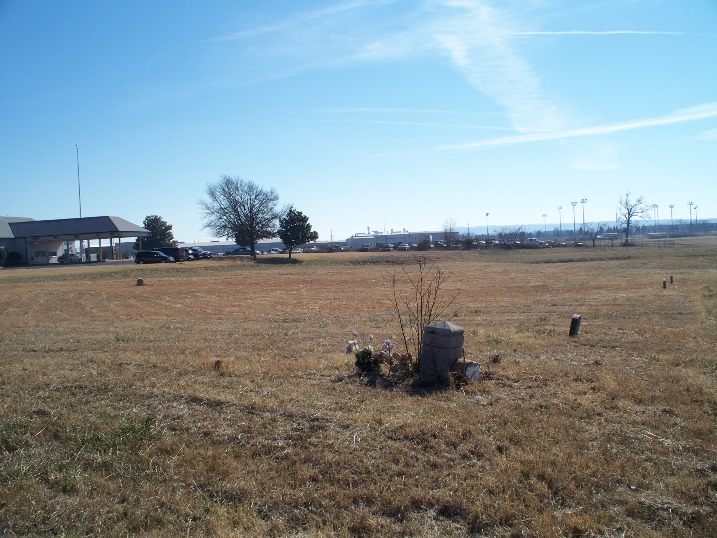
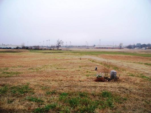
| Description | : | Elmwood Cemetery, located in Fort Smith, Arkansas, was a pauper cemetery, according to historian Sue Clark. Ms. Clark did extensive research on this cemetery and has a wonderful history/description in her book, "Steep Hill and Jewish Cemeteries: Sebastian County, Arkansas: With Some Abandoned Cemeteries." 1998. The county at one time removed some of the graves to make a drainage ditch. Those that had relatives who could be reached were placed in Oak Cemetery, Fort Smith, There are still over at least 800 graves in this cemetery. Others interred there was removed to other cemeteries throughout Fort Smith. |
frequently asked questions (FAQ):
-
Where is Elmwood Cemetery?
Elmwood Cemetery is located at Fort Smith, Sebastian County ,Arkansas ,USA.
-
Elmwood Cemetery cemetery's updated grave count on graveviews.com?
52 memorials
-
Where are the coordinates of the Elmwood Cemetery?
Latitude: 35.3276430
Longitude: -94.4112720
Nearby Cemetories:
1. Falconer Cemetery
Fort Smith, Sebastian County, USA
Coordinate: 35.3374810, -94.3939300
2. Stromberg Family Cemetery
Fort Smith, Sebastian County, USA
Coordinate: 35.3392160, -94.4309880
3. Woodlawn Memorial Park
Fort Smith, Sebastian County, USA
Coordinate: 35.3443300, -94.4329000
4. Saint Bartholomew Episcopal Church Garden
Fort Smith, Sebastian County, USA
Coordinate: 35.3571380, -94.3945150
5. Leard Cemetery
Le Flore County, USA
Coordinate: 35.2971500, -94.4353900
6. Christ the King Catholic Church Columbarium
Fort Smith, Sebastian County, USA
Coordinate: 35.3641970, -94.4045960
7. Oak Cemetery
Fort Smith, Sebastian County, USA
Coordinate: 35.3694000, -94.4017029
8. Goddard United Methodistb Church Columbarium
Fort Smith, Sebastian County, USA
Coordinate: 35.3720830, -94.4129730
9. Saint Scholastica Cemetery
Fort Smith, Sebastian County, USA
Coordinate: 35.3700890, -94.3842790
10. Jewish Cemetery
Fort Smith, Sebastian County, USA
Coordinate: 35.3757000, -94.4176000
11. Calvary Cemetery
Fort Smith, Sebastian County, USA
Coordinate: 35.3764000, -94.4167023
12. Immaculate Conception Catholic Columbarium
Fort Smith, Sebastian County, USA
Coordinate: 35.3828960, -94.4184930
13. First United Methodist Church Columbarium
Fort Smith, Sebastian County, USA
Coordinate: 35.3834560, -94.4150440
14. First Presbyterian Church Columbarium
Fort Smith, Sebastian County, USA
Coordinate: 35.3849900, -94.4182700
15. Fort Smith National Cemetery
Fort Smith, Sebastian County, USA
Coordinate: 35.3838997, -94.4291992
16. Saint John Episcopal Church Columbarium
Fort Smith, Sebastian County, USA
Coordinate: 35.3895490, -94.4234350
17. Steep Hill Cemetery
Fort Smith, Sebastian County, USA
Coordinate: 35.2863998, -94.3480988
18. Booth Cemetery
Sebastian County, USA
Coordinate: 35.2601663, -94.4098570
19. Rose Lawn Park Cemetery
Fort Smith, Sebastian County, USA
Coordinate: 35.3917007, -94.3700027
20. RoseLawn Park Columbarium
Fort Smith, Sebastian County, USA
Coordinate: 35.3917000, -94.3700000
21. Lowrey-Rye Family Cemetery
Sebastian County, USA
Coordinate: 35.2622080, -94.3725250
22. Pleasant Hill Cemetery
Sebastian County, USA
Coordinate: 35.3402140, -94.3226910
23. White Bluff Cemetery
White Bluff, Sebastian County, USA
Coordinate: 35.2532997, -94.4242020
24. Holy Cross Cemetery
Fort Smith, Sebastian County, USA
Coordinate: 35.3978004, -94.3685989