
| Memorials | : | 1 |
| Location | : | Birmingham, Oakland County, USA |
| Coordinate | : | 42.5454370, -83.2330870 |
frequently asked questions (FAQ):
-
Where is First United Methodist Church Memorial Garden?
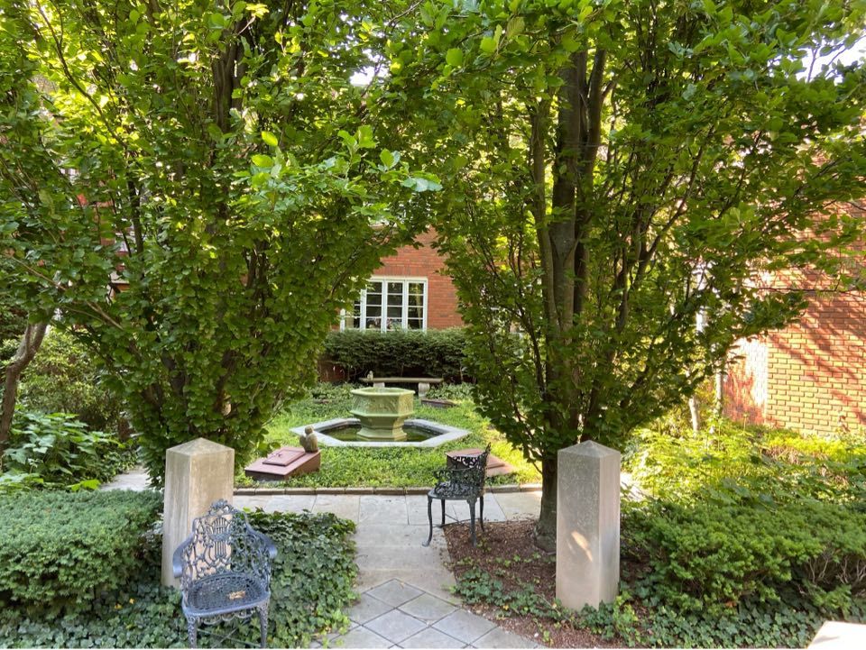
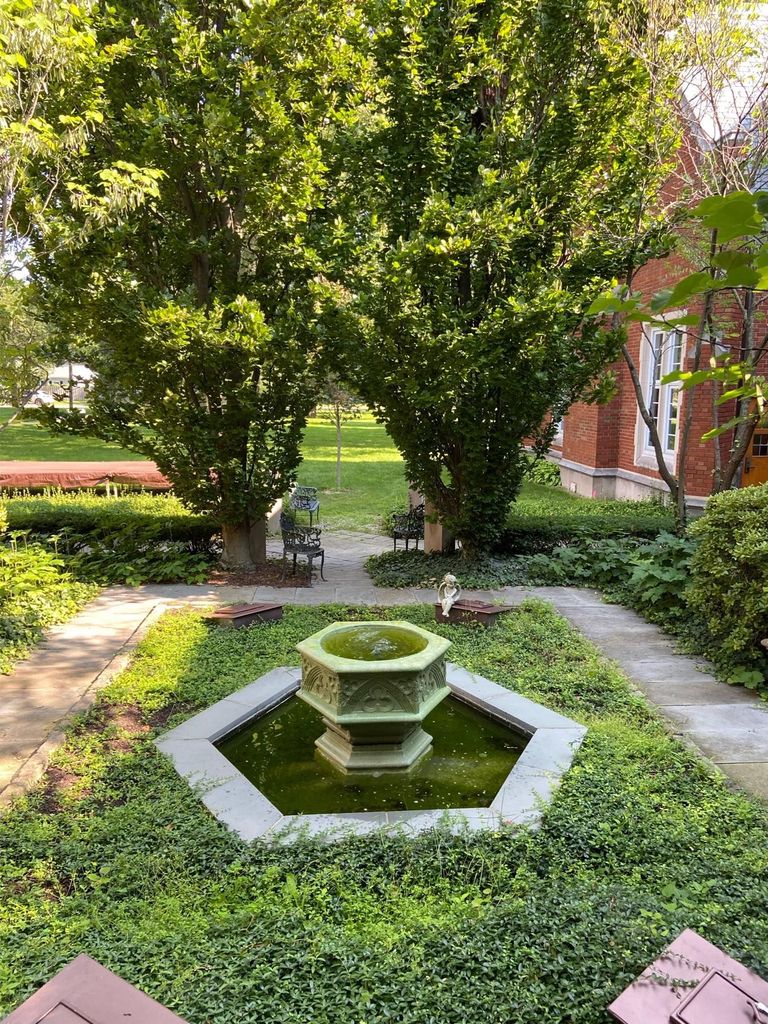
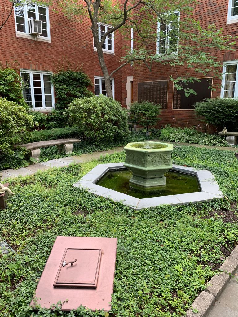
First United Methodist Church Memorial Garden is located at 1589 W. Maple Road Birmingham, Oakland County ,Michigan , 48009USA.
-
First United Methodist Church Memorial Garden cemetery's updated grave count on graveviews.com?
1 memorials
-
Where are the coordinates of the First United Methodist Church Memorial Garden?
Latitude: 42.5454370
Longitude: -83.2330870
Nearby Cemetories:
1. First Presbyterian Church Columbarium
Birmingham, Oakland County, USA
Coordinate: 42.5463380, -83.2351040
2. Lutheran Church of the Redeemer Columbarium
Birmingham, Oakland County, USA
Coordinate: 42.5463540, -83.2373950
3. Greenwood Cemetery
Birmingham, Oakland County, USA
Coordinate: 42.5539017, -83.2238998
4. Saint James Episcopal Church Columbarium
Birmingham, Oakland County, USA
Coordinate: 42.5465088, -83.2179642
5. Christ Church Cranbrook Columbarium
Bloomfield Hills, Oakland County, USA
Coordinate: 42.5672188, -83.2440186
6. Acacia Park Cemetery
Beverly Hills, Oakland County, USA
Coordinate: 42.5217018, -83.2197037
7. Northbrook Presbyterian Church Columbarium
Beverly Hills, Oakland County, USA
Coordinate: 42.5297550, -83.2657280
8. Clover Hill Park Cemetery
Birmingham, Oakland County, USA
Coordinate: 42.5349998, -83.1885986
9. Perrin Cemetery
Troy, Oakland County, USA
Coordinate: 42.5398254, -83.1857605
10. Gilbert Lake Cemetery (Defunct)
Bloomfield, Oakland County, USA
Coordinate: 42.5568800, -83.2799500
11. Beekman Cemetery
Southfield, Oakland County, USA
Coordinate: 42.5098076, -83.2176285
12. Bloomfield Hills Cemetery (Defunct)
Bloomfield Hills, Oakland County, USA
Coordinate: 42.5811111, -83.2563889
13. Saint David Episcopal Church Columbarium
Southfield, Oakland County, USA
Coordinate: 42.5030990, -83.2096400
14. Saint Hugo of the Hills Columbarium
Bloomfield Hills, Oakland County, USA
Coordinate: 42.5927391, -83.2477036
15. Beach Cemetery
Troy, Oakland County, USA
Coordinate: 42.5936012, -83.1980972
16. Crooks Road Cemetery
Troy, Oakland County, USA
Coordinate: 42.5727997, -83.1680984
17. Roseland Park Cemetery
Berkley, Oakland County, USA
Coordinate: 42.5060997, -83.1797028
18. Beautiful Savior Lutheran Church Columbarium
Bloomfield Hills, Oakland County, USA
Coordinate: 42.5984290, -83.2092050
19. Kirk in the Hills Columbarium
Bloomfield Hills, Oakland County, USA
Coordinate: 42.5810394, -83.2942886
20. Franklin Cemetery
Franklin, Oakland County, USA
Coordinate: 42.5224991, -83.3059921
21. Payne-Waugh Cemetery
Bloomfield Township, Oakland County, USA
Coordinate: 42.6044640, -83.2385790
22. Franklin Community Church Columbarium
Franklin, Oakland County, USA
Coordinate: 42.5258470, -83.3100450
23. Southfield Reformed Cemetery
Southfield, Oakland County, USA
Coordinate: 42.4848420, -83.2405580
24. Saint Andrews Memorial Garden
Clawson, Oakland County, USA
Coordinate: 42.5359612, -83.1460571