
| Memorials | : | 5 |
| Location | : | Elk Park, Avery County, USA |
| Coordinate | : | 36.2539960, -81.9337660 |
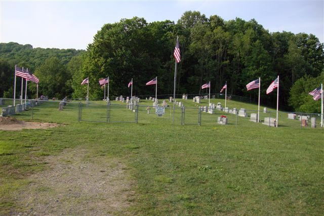
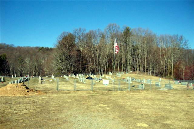
| Description | : | Located on the old Beech Mountain. Go on US Hwy. 321 toward Tennessee, just before the Tenn. state line turn left on to the Flat springs Road go past the Mt. Gilead Baptist Church, continue on up the mountain and you will come to the Flat Spring Baptist Church and Cemetery. |
frequently asked questions (FAQ):
-
Where is Flat Springs Baptist Church Cemetery?
Flat Springs Baptist Church Cemetery is located at Elk Park, Avery County ,North Carolina ,USA.
-
Flat Springs Baptist Church Cemetery cemetery's updated grave count on graveviews.com?
5 memorials
-
Where are the coordinates of the Flat Springs Baptist Church Cemetery?
Latitude: 36.2539960
Longitude: -81.9337660
Nearby Cemetories:
1. 1485 Poga Road Cemetery
Carter County, USA
Coordinate: 36.2562300, -81.9419000
2. John Harmon Cemetery
Elk Park, Avery County, USA
Coordinate: 36.2475600, -81.9223100
3. Old Beech Mountain Cemetery
Flat Springs, Avery County, USA
Coordinate: 36.2426120, -81.9327740
4. Hicks Family Cemetery
Beech Mountain, Avery County, USA
Coordinate: 36.2397300, -81.9247160
5. Estep Cemetery
Whaley, Avery County, USA
Coordinate: 36.2372550, -81.9321410
6. Mitchell Cemetery
Whaley, Avery County, USA
Coordinate: 36.2372120, -81.9329670
7. Stines Family Cemetery
Whaley, Avery County, USA
Coordinate: 36.2426400, -81.9173400
8. Thompson Family Cemetery
Beech Mountain, Avery County, USA
Coordinate: 36.2358450, -81.9268510
9. McGuire Cemetery
Elk Park, Avery County, USA
Coordinate: 36.2332993, -81.9319000
10. Stanberry Cemetery
Johnson County, USA
Coordinate: 36.2771200, -81.9306400
11. Burton Cemetery
Johnson County, USA
Coordinate: 36.2771988, -81.9308014
12. Mount Gilead Baptist Church Cemetery
Mount Gilead, Avery County, USA
Coordinate: 36.2676800, -81.9101300
13. Clawson Cemetery #1
Carter County, USA
Coordinate: 36.2382900, -81.9555800
14. Ward Cemetery
Avery County, USA
Coordinate: 36.2496986, -81.9047012
15. Trivett Cemetery North Hill Gap
Elk Park, Avery County, USA
Coordinate: 36.2302890, -81.9441460
16. Harrison Stanberry Cemetery
Butler, Johnson County, USA
Coordinate: 36.2805600, -81.9321000
17. Stanbery Cemetery
Buntontown, Johnson County, USA
Coordinate: 36.2805600, -81.9320700
18. Joel Trivett Cemetery
Avery County, USA
Coordinate: 36.2328510, -81.9561200
19. Clawson Cemetery
Carter County, USA
Coordinate: 36.2358600, -81.9604500
20. James William Trivett Family Cemetery
Elk Park, Avery County, USA
Coordinate: 36.2253384, -81.9354243
21. Beech Creek Cemetery
Avery County, USA
Coordinate: 36.2577400, -81.8984909
22. Cook Cemetery
Avery County, USA
Coordinate: 36.2250000, -81.9278000
23. Farthing Cemetery
Butler, Johnson County, USA
Coordinate: 36.2825500, -81.9214500
24. Harmon Cemetery
Carter County, USA
Coordinate: 36.2307740, -81.9602820