
| Memorials | : | 0 |
| Location | : | Butler, Johnson County, USA |
| Coordinate | : | 36.2825500, -81.9214500 |
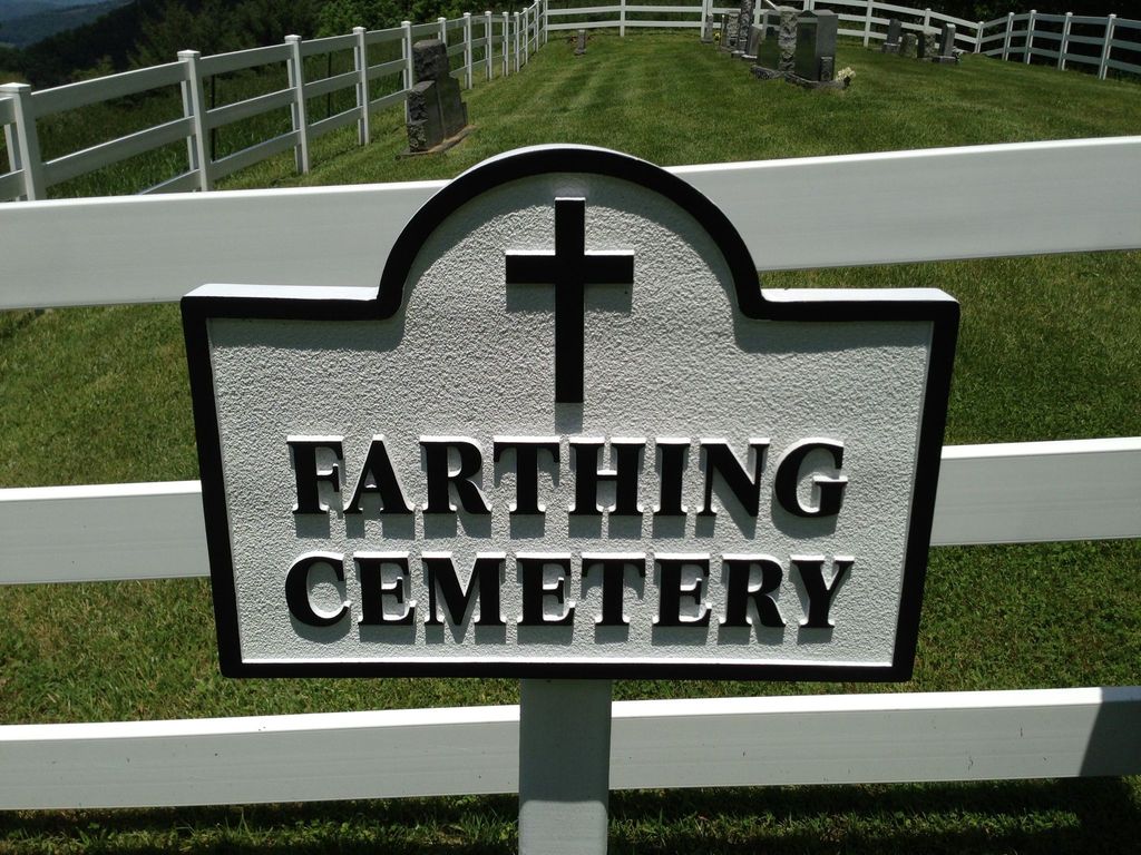
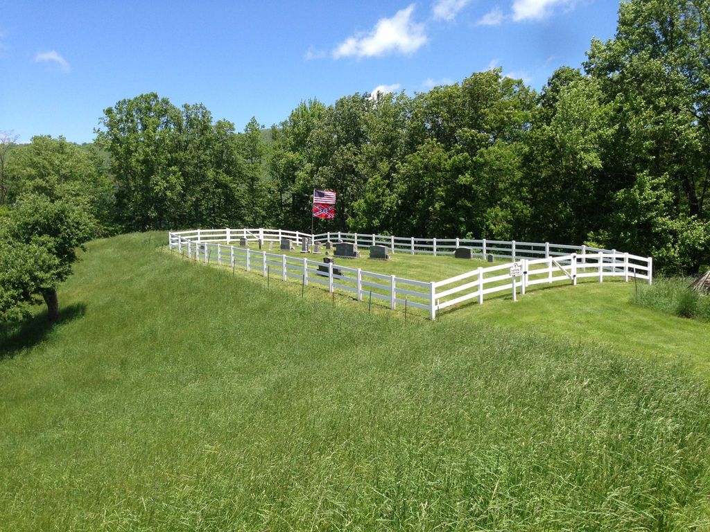
| Description | : | Located off Hwy 321 on a grassy hill, Johnson County, Tennessee on the left about 1/4 mile inside the state line from NC. Nine unmarked graves: My father, Calvin Shaw, told me who each one of these graves belonged to. At that time I made a map of the cemetery listing everyone's name. This was done back in the 1980's. I do not have any obituaries or any formal documentation, just what he told me. "Wanda Farthing" |
frequently asked questions (FAQ):
-
Where is Farthing Cemetery?
Farthing Cemetery is located at 10214 Highway 321 Butler, Johnson County ,Tennessee ,USA.
-
Farthing Cemetery cemetery's updated grave count on graveviews.com?
0 memorials
-
Where are the coordinates of the Farthing Cemetery?
Latitude: 36.2825500
Longitude: -81.9214500
Nearby Cemetories:
1. Guy Cemetery
Butler, Johnson County, USA
Coordinate: 36.2854780, -81.9269960
2. Stanbery Cemetery
Buntontown, Johnson County, USA
Coordinate: 36.2805600, -81.9320700
3. Harrison Stanberry Cemetery
Butler, Johnson County, USA
Coordinate: 36.2805600, -81.9321000
4. Stanberry Cemetery
Johnson County, USA
Coordinate: 36.2771200, -81.9306400
5. Burton Cemetery
Johnson County, USA
Coordinate: 36.2771988, -81.9308014
6. Mount Gilead Baptist Church Cemetery
Mount Gilead, Avery County, USA
Coordinate: 36.2676800, -81.9101300
7. Payne Cemetery
Butler, Johnson County, USA
Coordinate: 36.2961000, -81.9439000
8. Green Valley Baptist Church Cemetery
Watauga County, USA
Coordinate: 36.2919600, -81.8953200
9. Michael Dugger Cemetery
Johnson County, USA
Coordinate: 36.3018990, -81.9464035
10. Cowan Cemetery
Butler, Johnson County, USA
Coordinate: 36.3074300, -81.9387100
11. Flat Springs Baptist Church Cemetery
Elk Park, Avery County, USA
Coordinate: 36.2539960, -81.9337660
12. Beech Creek Cemetery
Avery County, USA
Coordinate: 36.2577400, -81.8984909
13. 1485 Poga Road Cemetery
Carter County, USA
Coordinate: 36.2562300, -81.9419000
14. Dugger Cemetery
Buntontown, Johnson County, USA
Coordinate: 36.3106003, -81.9421997
15. John Harmon Cemetery
Elk Park, Avery County, USA
Coordinate: 36.2475600, -81.9223100
16. Combs Cemetery
Watauga County, USA
Coordinate: 36.2991982, -81.8831024
17. Evans Potter Cemetery
Buntontown, Johnson County, USA
Coordinate: 36.2808800, -81.9650200
18. Ward Cemetery
Avery County, USA
Coordinate: 36.2496986, -81.9047012
19. Crosswhite Cemetery
Johnson County, USA
Coordinate: 36.2947006, -81.9649963
20. Stines Family Cemetery
Whaley, Avery County, USA
Coordinate: 36.2426400, -81.9173400
21. Old Beech Mountain Cemetery
Flat Springs, Avery County, USA
Coordinate: 36.2426120, -81.9327740
22. Julius Dugger Cemetery
Dry Hill, Johnson County, USA
Coordinate: 36.3130989, -81.9580994
23. Hicks Family Cemetery
Beech Mountain, Avery County, USA
Coordinate: 36.2397300, -81.9247160
24. Andrews-Tester Cemetery
Buntontown, Johnson County, USA
Coordinate: 36.2937430, -81.9735220