
| Memorials | : | 0 |
| Location | : | Billings, Noble County, USA |
| Coordinate | : | 36.5139900, -97.3190600 |
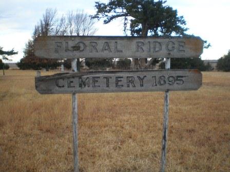
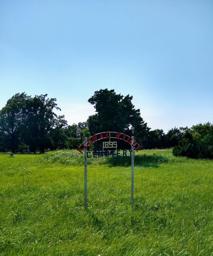
| Description | : | This cemetery is located 7 Miles east and 1 1/2 miles south of Billings in Noble County, Oklahoma. Floral Ridge Church and Cemetery Association was organized in 1895. John Richard Owens and A.J. Reed donated two acres of land from their homesteads for the cemetery. The cemetery is located in the corner of the southeast of the northeast quarter and the northeast corner of the southeast quarter of Section 32, township 24 north, range 1 west of the Indian Merdian. Unmarked graves include J.D. Adams, Joseph Carifell, Josiah Maltby, Eliza Jane Maltby, Earl Maltby, Ethel Grace... Read More |
frequently asked questions (FAQ):
-
Where is Floral Ridge Cemetery?
Floral Ridge Cemetery is located at Billings, Noble County ,Oklahoma ,USA.
-
Floral Ridge Cemetery cemetery's updated grave count on graveviews.com?
0 memorials
-
Where are the coordinates of the Floral Ridge Cemetery?
Latitude: 36.5139900
Longitude: -97.3190600
Nearby Cemetories:
1. Ceres Cemetery
Ceres, Noble County, USA
Coordinate: 36.4773610, -97.2877550
2. Grandview Cemetery
Marland, Noble County, USA
Coordinate: 36.5649400, -97.2792200
3. Billings Union Cemetery
Billings, Noble County, USA
Coordinate: 36.5056000, -97.4163971
4. Prairie View Cemetery
Tonkawa, Kay County, USA
Coordinate: 36.6002998, -97.3003006
5. Billings Catholic Cemetery
Billings, Noble County, USA
Coordinate: 36.5347700, -97.4348400
6. Mount Carmel Cemetery
Perry, Noble County, USA
Coordinate: 36.3907500, -97.3362100
7. Bohemian Cemetery
Red Rock, Noble County, USA
Coordinate: 36.3917007, -97.2850037
8. Red Rock Cemetery
Red Rock, Noble County, USA
Coordinate: 36.4482994, -97.1735992
9. River View Cemetery
Alcorn, Kay County, USA
Coordinate: 36.6300621, -97.4076996
10. White Eagle Monument
Marland, Noble County, USA
Coordinate: 36.5695300, -97.1448000
11. Polo Cemetery
Noble County, USA
Coordinate: 36.3755989, -97.4163971
12. Heitholt Memorial Cemetery
Garfield County, USA
Coordinate: 36.5353012, -97.5156021
13. Tonkawa Indian Cemetery
Tonkawa, Kay County, USA
Coordinate: 36.6726100, -97.2643800
14. Cowboy Hill Cemetery
Ponca City, Kay County, USA
Coordinate: 36.6068993, -97.1380997
15. Tonkawa IOOF Cemetery
Tonkawa, Kay County, USA
Coordinate: 36.6955800, -97.3242300
16. Mount Vernon Cemetery
Lamont, Grant County, USA
Coordinate: 36.6082993, -97.5167007
17. Otoe-Missouria Cemetery
Red Rock, Noble County, USA
Coordinate: 36.4844017, -97.0717010
18. Otoe-Missouria War Mothers Memorial
Red Rock, Noble County, USA
Coordinate: 36.4831170, -97.0717500
19. Black Bear Cemetery
Garfield County, USA
Coordinate: 36.3763885, -97.5058365
20. Ponca Tribal Cemetery
Ponca City, Kay County, USA
Coordinate: 36.6432991, -97.1132965
21. Garber Cemetery
Garber, Garfield County, USA
Coordinate: 36.4419200, -97.5686700
22. Round Grove Cemetery
Tonkawa, Kay County, USA
Coordinate: 36.7094002, -97.1967010
23. Cleghorn Cemetery
Red Rock, Noble County, USA
Coordinate: 36.4907990, -97.0357971
24. Sample Cemetery
Covington, Garfield County, USA
Coordinate: 36.3181000, -97.4788971