
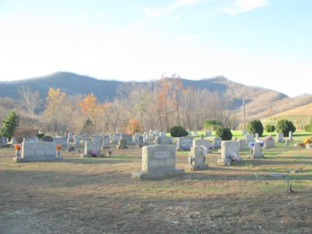
| Memorials | : | 74 |
| Location | : | Cana, Carroll County, USA |
| Coordinate | : | 36.5900510, -80.7286500 |
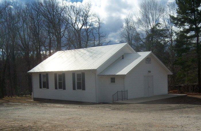
| Description | : | From the intersection of Flower Gap Road (VA Route 691) and Old Pipers Gap Road (VA Route 620), travel approximately 0.87 miles on Flower Gap Road; the church will be on the right; the cemetery is located on both sides of Flower Gap Road. |
frequently asked questions (FAQ):
-
Where is Flower Gap Primitive Baptist Church Cemetery?
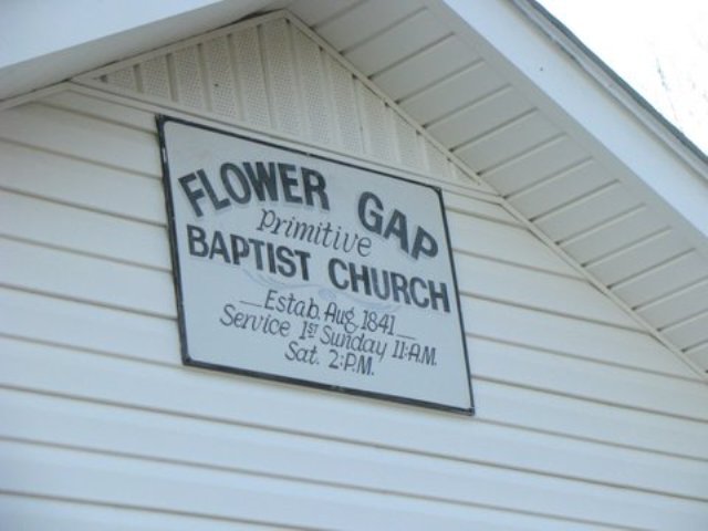
Flower Gap Primitive Baptist Church Cemetery is located at 3409 Flower Gap Road Cana, Carroll County ,Virginia , 24317USA.
-
Flower Gap Primitive Baptist Church Cemetery cemetery's updated grave count on graveviews.com?
74 memorials
-
Where are the coordinates of the Flower Gap Primitive Baptist Church Cemetery?
Latitude: 36.5900510
Longitude: -80.7286500

Nearby Cemetories:
1. Easter Family Cemetery
Carroll County, USA
Coordinate: 36.5900270, -80.7354860
2. Cedar Lane-Easter Cemetery
Cana, Carroll County, USA
Coordinate: 36.5898610, -80.7356070
3. George Jeremiah Edwards Family Cemetery
Cana, Carroll County, USA
Coordinate: 36.5937600, -80.7370100
4. Vernon-Leonard Cemetery
Cana, Carroll County, USA
Coordinate: 36.5841200, -80.7217600
5. McCraw Family Cemetery
Lambsburg, Carroll County, USA
Coordinate: 36.5814200, -80.7235270
6. Surratt Cemetery
Lambsburg, Carroll County, USA
Coordinate: 36.5790920, -80.7396730
7. Marion Cemetery
Cana, Carroll County, USA
Coordinate: 36.6055090, -80.7284550
8. Nathaniel Samuel Jones Family Cemetery
Cana, Carroll County, USA
Coordinate: 36.6047060, -80.7186010
9. Jones-Fleming Cemetery
Carroll County, USA
Coordinate: 36.6012360, -80.7114230
10. Frances Caroline Edwards Family Cemetery
Cana, Carroll County, USA
Coordinate: 36.6089000, -80.7193140
11. Gray Cemetery
Cana, Carroll County, USA
Coordinate: 36.5943420, -80.7034040
12. Sandy Ridge Primitive Baptist Church Cemetery
Cana, Carroll County, USA
Coordinate: 36.6089030, -80.7131890
13. Christopher W Jones Cemetery
Cana, Carroll County, USA
Coordinate: 36.5819178, -80.7000292
14. Hawks Family Cemetery
Lambsburg, Carroll County, USA
Coordinate: 36.5960780, -80.7620250
15. Pauls Creek Baptist Church Cemetery
Cana, Carroll County, USA
Coordinate: 36.6072870, -80.6976360
16. King Cemetery
Cana, Carroll County, USA
Coordinate: 36.6170430, -80.7070900
17. Chestnut Grove Primitive Baptist Church Cemetery
Lambsburg, Carroll County, USA
Coordinate: 36.5800740, -80.7686640
18. Fancy Gap Pentecostal Holiness Church Cemetery
Cana, Carroll County, USA
Coordinate: 36.6227090, -80.7150880
19. Claucy William Hawks Family Cemetery
Cana, Carroll County, USA
Coordinate: 36.6236190, -80.7151980
20. Fellowship Tabernacle Cemetery
Lambsburg, Carroll County, USA
Coordinate: 36.5769680, -80.7723510
21. King Family Cemetery
Cana, Carroll County, USA
Coordinate: 36.6211420, -80.7020900
22. King-Jones Cemetery
Cana, Carroll County, USA
Coordinate: 36.6224890, -80.7033540
23. Imogene Baptist Church Cemetery
Pine Ridge, Surry County, USA
Coordinate: 36.5521393, -80.7203598
24. Rocky Ford Christian Church Cemetery
Cana, Carroll County, USA
Coordinate: 36.6080580, -80.6857110