
| Memorials | : | 11 |
| Location | : | Lambsburg, Carroll County, USA |
| Coordinate | : | 36.5960780, -80.7620250 |
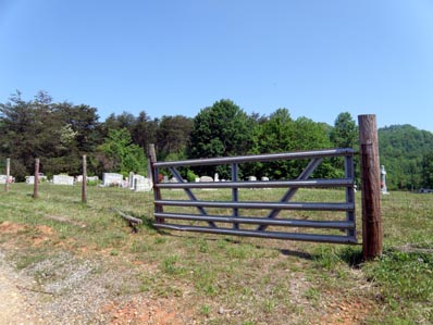
| Description | : | The cemetery is located at the corner of Inez Drive and Bobbitt Hollow Road (VA Route 944). |
frequently asked questions (FAQ):
-
Where is Hawks Family Cemetery?
Hawks Family Cemetery is located at Inez Drive Lambsburg, Carroll County ,Virginia , 24351USA.
-
Hawks Family Cemetery cemetery's updated grave count on graveviews.com?
11 memorials
-
Where are the coordinates of the Hawks Family Cemetery?
Latitude: 36.5960780
Longitude: -80.7620250
Nearby Cemetories:
1. Chestnut Grove Primitive Baptist Church Cemetery
Lambsburg, Carroll County, USA
Coordinate: 36.5800740, -80.7686640
2. George Jeremiah Edwards Family Cemetery
Cana, Carroll County, USA
Coordinate: 36.5937600, -80.7370100
3. W H Stantliff Cemetery
Lambsburg, Carroll County, USA
Coordinate: 36.5807290, -80.7794670
4. Fellowship Tabernacle Cemetery
Lambsburg, Carroll County, USA
Coordinate: 36.5769680, -80.7723510
5. Cedar Lane-Easter Cemetery
Cana, Carroll County, USA
Coordinate: 36.5898610, -80.7356070
6. Easter Family Cemetery
Carroll County, USA
Coordinate: 36.5900270, -80.7354860
7. Surratt Cemetery
Lambsburg, Carroll County, USA
Coordinate: 36.5790920, -80.7396730
8. Edwards-Upchurch Cemetery
Lambsburg, Carroll County, USA
Coordinate: 36.5750140, -80.7788060
9. Flower Gap Primitive Baptist Church Cemetery
Cana, Carroll County, USA
Coordinate: 36.5900510, -80.7286500
10. Marion Cemetery
Cana, Carroll County, USA
Coordinate: 36.6055090, -80.7284550
11. Holly Grove Baptist Church Cemetery
Lambsburg, Carroll County, USA
Coordinate: 36.5712840, -80.7810790
12. Stewart Cemetery
Lambsburg, Carroll County, USA
Coordinate: 36.5681860, -80.7855490
13. McCraw Family Cemetery
Lambsburg, Carroll County, USA
Coordinate: 36.5814200, -80.7235270
14. Vernon-Leonard Cemetery
Cana, Carroll County, USA
Coordinate: 36.5841200, -80.7217600
15. Nathaniel Samuel Jones Family Cemetery
Cana, Carroll County, USA
Coordinate: 36.6047060, -80.7186010
16. Phillip Haywood McBride Family Cemetery
Lowgap, Surry County, USA
Coordinate: 36.5602950, -80.7678630
17. Frances Caroline Edwards Family Cemetery
Cana, Carroll County, USA
Coordinate: 36.6089000, -80.7193140
18. Blue Ridge Chapel Baptist Church Cemetery
Carroll County, USA
Coordinate: 36.6073517, -80.8056282
19. Jones-Fleming Cemetery
Carroll County, USA
Coordinate: 36.6012360, -80.7114230
20. Sandy Ridge Primitive Baptist Church Cemetery
Cana, Carroll County, USA
Coordinate: 36.6089030, -80.7131890
21. Johnson-Leftwich Cemetery
Fancy Gap, Carroll County, USA
Coordinate: 36.6331620, -80.7381820
22. Fancy Gap Pentecostal Holiness Church Cemetery
Cana, Carroll County, USA
Coordinate: 36.6227090, -80.7150880
23. Claucy William Hawks Family Cemetery
Cana, Carroll County, USA
Coordinate: 36.6236190, -80.7151980
24. Gray Cemetery
Cana, Carroll County, USA
Coordinate: 36.5943420, -80.7034040