
| Memorials | : | 0 |
| Location | : | Socorro County, USA |
| Coordinate | : | 33.6306000, -107.0111008 |
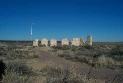
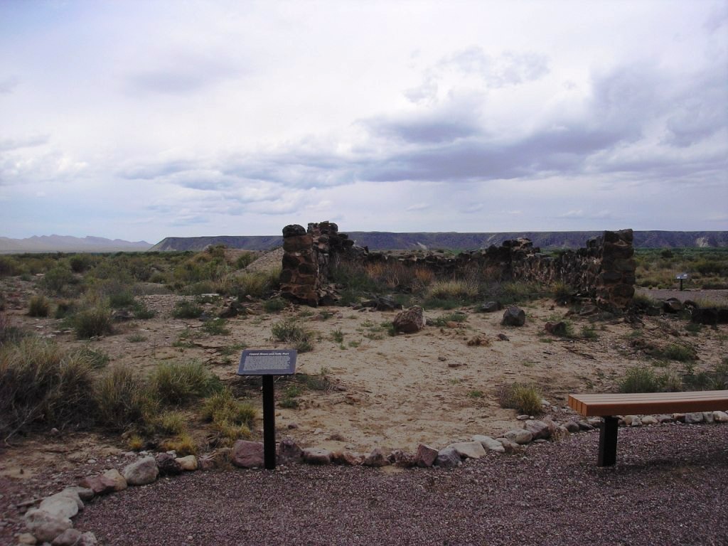
| Description | : | In 2007 all of the cemetery was surveyed and all remaining burials were removed to the Santa Fe National Cemetery Many burials were unmarked and original reinterment burial documents were not found. This means that many reinterments were not identified. A complete excavation of this cemetery was done in 2007 and each item found was documented by the United States Bureau of Reclamation The final report for the Fort Craig Post Cemetery can be found on the United States Bureau of Reclamation website. |
frequently asked questions (FAQ):
-
Where is Fort Craig Cemetery (Defunct)?
Fort Craig Cemetery (Defunct) is located at Socorro County ,New Mexico ,USA.
-
Fort Craig Cemetery (Defunct) cemetery's updated grave count on graveviews.com?
0 memorials
-
Where are the coordinates of the Fort Craig Cemetery (Defunct)?
Latitude: 33.6306000
Longitude: -107.0111008
Nearby Cemetories:
1. Contadero Cemetery
San Marcial, Socorro County, USA
Coordinate: 33.6503868, -106.9876938
2. Gonzales Cemetery
San Marcial, Socorro County, USA
Coordinate: 33.6934662, -106.9982834
3. San Marcial Cemetery
San Marcial, Socorro County, USA
Coordinate: 33.7005110, -106.9888050
4. Val Verde Cemetery
Val Verde, Socorro County, USA
Coordinate: 33.7014500, -106.9279200
5. San Antonito Cemetery
San Antonio, Socorro County, USA
Coordinate: 33.8894800, -106.8785900
6. San Antonio Roman Catholic Cemetery
San Antonio, Socorro County, USA
Coordinate: 33.9187500, -106.8662600
7. San Pedro Cemetery
San Antonio, Socorro County, USA
Coordinate: 33.9155400, -106.8406400
8. Carthage Cemetery
Socorro County, USA
Coordinate: 33.8842010, -106.7253036
9. Rosedale Cemetery
Magdalena, Socorro County, USA
Coordinate: 33.8082200, -107.3862300
10. Bosquecito Cemetery
Bosquecito, Socorro County, USA
Coordinate: 33.9733000, -106.8415000
11. Luis Lopez Cemetery
Luis Lopez, Socorro County, USA
Coordinate: 33.9924000, -106.8885800
12. Confederate Soldier Burial Site
Socorro County, USA
Coordinate: 34.0563060, -106.9029170
13. Socorro Cemetery
Socorro, Socorro County, USA
Coordinate: 34.0589790, -106.9072037
14. San Miguel Cemetery
Socorro, Socorro County, USA
Coordinate: 34.0583000, -106.9011002
15. Monticello Cemetery
Monticello, Sierra County, USA
Coordinate: 33.3922005, -107.4522018
16. Old San Miguel Mission
Socorro, Socorro County, USA
Coordinate: 34.0604600, -106.8937400
17. San Miguel de Socorro Churchyard
Socorro County, USA
Coordinate: 34.0605000, -106.8935000
18. Engle Cemetery
Sierra County, USA
Coordinate: 33.1789017, -107.0503006
19. Escondida Cemetery
Escondida, Socorro County, USA
Coordinate: 34.1008900, -106.8990100
20. Kelly Cemetery
Kelly, Socorro County, USA
Coordinate: 34.0847000, -107.2056000
21. Cuchillo Cemetery
Cuchillo, Sierra County, USA
Coordinate: 33.2329570, -107.3501980
22. Elephant Butte Cemetery
Sierra County, USA
Coordinate: 33.1444016, -107.1727982
23. Vista Memory Gardens
Truth or Consequences, Sierra County, USA
Coordinate: 33.1577900, -107.2618700
24. Graham Cemetery
Sierra County, USA
Coordinate: 33.1067009, -107.0674973