
| Memorials | : | 0 |
| Location | : | Socorro County, USA |
| Coordinate | : | 33.8842010, -106.7253036 |
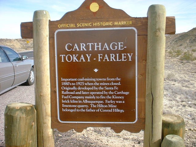
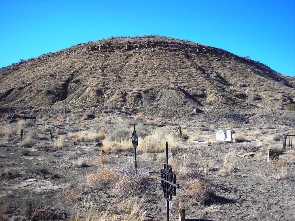
| Description | : | Carthage Cemetery is on the south side of HWY 380 approximately 12 1/2 miles east of I25 at Socorro, NM. The cemetery has no sign and is on the same side of HWY 380 as the Carthage Historical Marker Sign. If you look closely, you can see the cemetery when standing by the sign. You can enter the cemetery by going to the bottom of the hill just west of the sign and through the gate. |
frequently asked questions (FAQ):
-
Where is Carthage Cemetery?
Carthage Cemetery is located at Socorro County ,New Mexico ,USA.
-
Carthage Cemetery cemetery's updated grave count on graveviews.com?
0 memorials
-
Where are the coordinates of the Carthage Cemetery?
Latitude: 33.8842010
Longitude: -106.7253036
Nearby Cemetories:
1. San Pedro Cemetery
San Antonio, Socorro County, USA
Coordinate: 33.9155400, -106.8406400
2. San Antonio Roman Catholic Cemetery
San Antonio, Socorro County, USA
Coordinate: 33.9187500, -106.8662600
3. San Antonito Cemetery
San Antonio, Socorro County, USA
Coordinate: 33.8894800, -106.8785900
4. Bosquecito Cemetery
Bosquecito, Socorro County, USA
Coordinate: 33.9733000, -106.8415000
5. Luis Lopez Cemetery
Luis Lopez, Socorro County, USA
Coordinate: 33.9924000, -106.8885800
6. San Miguel de Socorro Churchyard
Socorro County, USA
Coordinate: 34.0605000, -106.8935000
7. Old San Miguel Mission
Socorro, Socorro County, USA
Coordinate: 34.0604600, -106.8937400
8. Confederate Soldier Burial Site
Socorro County, USA
Coordinate: 34.0563060, -106.9029170
9. San Miguel Cemetery
Socorro, Socorro County, USA
Coordinate: 34.0583000, -106.9011002
10. Socorro Cemetery
Socorro, Socorro County, USA
Coordinate: 34.0589790, -106.9072037
11. Val Verde Cemetery
Val Verde, Socorro County, USA
Coordinate: 33.7014500, -106.9279200
12. Escondida Cemetery
Escondida, Socorro County, USA
Coordinate: 34.1008900, -106.8990100
13. San Marcial Cemetery
San Marcial, Socorro County, USA
Coordinate: 33.7005110, -106.9888050
14. Gonzales Cemetery
San Marcial, Socorro County, USA
Coordinate: 33.6934662, -106.9982834
15. Composanto Viejo Cemetery
Lemitar, Socorro County, USA
Coordinate: 34.1593900, -106.9123100
16. La Sagrada Familia Catholic Cemetery
Lemitar, Socorro County, USA
Coordinate: 34.1583470, -106.9167910
17. Contadero Cemetery
San Marcial, Socorro County, USA
Coordinate: 33.6503868, -106.9876938
18. Fort Craig Cemetery (Defunct)
Socorro County, USA
Coordinate: 33.6306000, -107.0111008
19. San Lorenzo Cemetery
Polvadera, Socorro County, USA
Coordinate: 34.2047005, -106.9210968
20. Shelton Family Cemetery
Polvadera, Socorro County, USA
Coordinate: 34.2090200, -106.9270100
21. San Acacia Cemetery
San Acacia, Socorro County, USA
Coordinate: 34.2578700, -106.8905400
22. Kelly Cemetery
Kelly, Socorro County, USA
Coordinate: 34.0847000, -107.2056000
23. La Joya Cemetery
Socorro County, USA
Coordinate: 34.3424988, -106.8399963
24. Magdalena Community Cemetery
Magdalena, Socorro County, USA
Coordinate: 34.1241690, -107.2389220