
| Memorials | : | 4 |
| Location | : | Brandonville, Preston County, USA |
| Coordinate | : | 39.6545000, -79.5753000 |
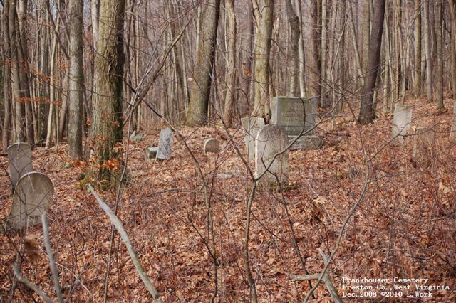
| Description | : | The cemetery is located 1.5 miles southeast of Brandonville, WV off of county route 5/20 (or old CR-26/12). It is located off of a path in the woods. It's on private property with no discernible path or maintenance. Cemetery Photograph |
frequently asked questions (FAQ):
-
Where is Frankhouser Cemetery?
Frankhouser Cemetery is located at Brandonville, Preston County ,West Virginia ,USA.
-
Frankhouser Cemetery cemetery's updated grave count on graveviews.com?
4 memorials
-
Where are the coordinates of the Frankhouser Cemetery?
Latitude: 39.6545000
Longitude: -79.5753000
Nearby Cemetories:
1. Reverend John Boger Cemetery
Brandonville, Preston County, USA
Coordinate: 39.6623310, -79.5577120
2. Shady Grove Union Cemetery
Brandonville, Preston County, USA
Coordinate: 39.6739006, -79.5960999
3. Jeffreys Cemetery
Hazelton, Preston County, USA
Coordinate: 39.6446160, -79.5351210
4. Brandonville Cemetery
Brandonville, Preston County, USA
Coordinate: 39.6667400, -79.6193100
5. Pleasant Grove Cemetery
Brandonville, Preston County, USA
Coordinate: 39.6941986, -79.5614014
6. Glover Cemetery
Glade Farms, Preston County, USA
Coordinate: 39.6943390, -79.5606420
7. Salem-Thomas Cemetery
Clifton Mills, Preston County, USA
Coordinate: 39.6972970, -79.5787720
8. Danks Cemetery
Bruceton Mills, Preston County, USA
Coordinate: 39.6256110, -79.5290560
9. Ringer Cemetery
Bruceton Mills, Preston County, USA
Coordinate: 39.6175680, -79.6206020
10. Bruceton Mills Cemetery
Bruceton Mills, Preston County, USA
Coordinate: 39.6666100, -79.6402150
11. Sugar Valley Cemetery
Bruceton Mills, Preston County, USA
Coordinate: 39.6665993, -79.6404037
12. Mitchell Cemetery
Glade Farms, Preston County, USA
Coordinate: 39.6925470, -79.5294020
13. Parnell Cemetery
Cuzzart, Preston County, USA
Coordinate: 39.5991900, -79.5687000
14. Centenary Cemetery
Cuzzart, Preston County, USA
Coordinate: 39.6000920, -79.6036560
15. Savage Cemetery
Hazelton, Preston County, USA
Coordinate: 39.6323470, -79.5003360
16. Webb Chapel Cemetery
Hazelton, Preston County, USA
Coordinate: 39.6648210, -79.4915600
17. Cuppett-Falkner Cemetery
Hazelton, Preston County, USA
Coordinate: 39.6493900, -79.4879280
18. Cuppett - Teets Cemetery
Glade Farms, Preston County, USA
Coordinate: 39.7101700, -79.5225000
19. VanSickle Cemetery
Hazelton, Preston County, USA
Coordinate: 39.6800840, -79.4850690
20. Sisler Cemetery
Mountain Dale, Preston County, USA
Coordinate: 39.6081009, -79.4938965
21. Keeler Glade Cemetery
Garrett County, USA
Coordinate: 39.6308000, -79.4768000
22. Saint Peters Lutheran Cemetery
Clifton Mills, Preston County, USA
Coordinate: 39.7035860, -79.6691010
23. Carroll Family Cemetery
Fayette County, USA
Coordinate: 39.7398300, -79.5435100
24. Sand Spring Cemetery
Friendsville, Garrett County, USA
Coordinate: 39.6711006, -79.4597015