
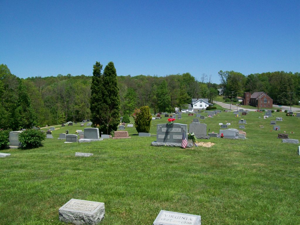
| Memorials | : | 91 |
| Location | : | Brandonville, Preston County, USA |
| Coordinate | : | 39.6739006, -79.5960999 |
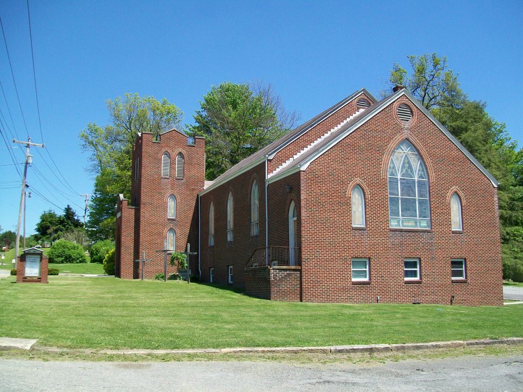
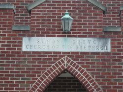
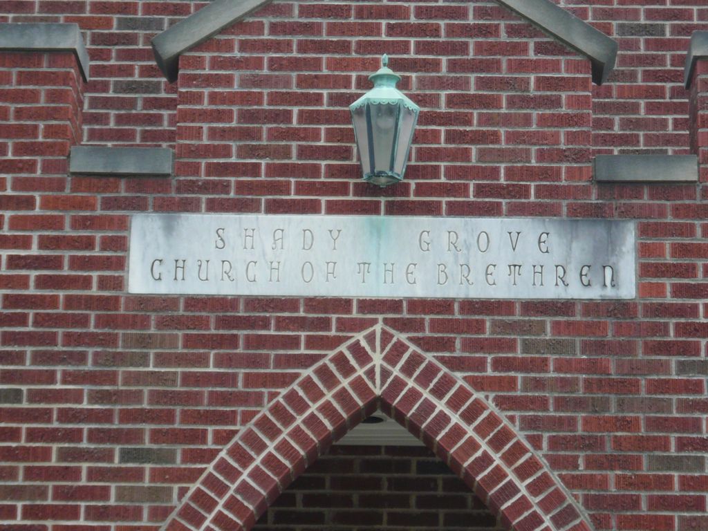
| Description | : | Located along Rt. 26 - North Preston Highway, approximately 1.5 miles north of the community of Brandonville. |
frequently asked questions (FAQ):
-
Where is Shady Grove Union Cemetery?
Shady Grove Union Cemetery is located at CR26 - North Preston Highway Brandonville, Preston County ,West Virginia ,USA.
-
Shady Grove Union Cemetery cemetery's updated grave count on graveviews.com?
90 memorials
-
Where are the coordinates of the Shady Grove Union Cemetery?
Latitude: 39.6739006
Longitude: -79.5960999
Nearby Cemetories:
1. Brandonville Cemetery
Brandonville, Preston County, USA
Coordinate: 39.6667400, -79.6193100
2. Frankhouser Cemetery
Brandonville, Preston County, USA
Coordinate: 39.6545000, -79.5753000
3. Salem-Thomas Cemetery
Clifton Mills, Preston County, USA
Coordinate: 39.6972970, -79.5787720
4. Reverend John Boger Cemetery
Brandonville, Preston County, USA
Coordinate: 39.6623310, -79.5577120
5. Pleasant Grove Cemetery
Brandonville, Preston County, USA
Coordinate: 39.6941986, -79.5614014
6. Glover Cemetery
Glade Farms, Preston County, USA
Coordinate: 39.6943390, -79.5606420
7. Bruceton Mills Cemetery
Bruceton Mills, Preston County, USA
Coordinate: 39.6666100, -79.6402150
8. Sugar Valley Cemetery
Bruceton Mills, Preston County, USA
Coordinate: 39.6665993, -79.6404037
9. Mitchell Cemetery
Glade Farms, Preston County, USA
Coordinate: 39.6925470, -79.5294020
10. Jeffreys Cemetery
Hazelton, Preston County, USA
Coordinate: 39.6446160, -79.5351210
11. Ringer Cemetery
Bruceton Mills, Preston County, USA
Coordinate: 39.6175680, -79.6206020
12. Saint Peters Lutheran Cemetery
Clifton Mills, Preston County, USA
Coordinate: 39.7035860, -79.6691010
13. Cuppett - Teets Cemetery
Glade Farms, Preston County, USA
Coordinate: 39.7101700, -79.5225000
14. Danks Cemetery
Bruceton Mills, Preston County, USA
Coordinate: 39.6256110, -79.5290560
15. Centenary Cemetery
Cuzzart, Preston County, USA
Coordinate: 39.6000920, -79.6036560
16. Carroll Family Cemetery
Fayette County, USA
Coordinate: 39.7398300, -79.5435100
17. Maust Cemetery
Clifton Mills, Preston County, USA
Coordinate: 39.7202600, -79.6769710
18. Parnell Cemetery
Cuzzart, Preston County, USA
Coordinate: 39.5991900, -79.5687000
19. Webb Chapel Cemetery
Hazelton, Preston County, USA
Coordinate: 39.6648210, -79.4915600
20. Mountain Grove Church of the Brethren Cemetery
Laurel Run, Preston County, USA
Coordinate: 39.7003564, -79.6989387
21. Everly Cemetery
Laurel Run, Preston County, USA
Coordinate: 39.6725722, -79.7048876
22. Savage Cemetery
Hazelton, Preston County, USA
Coordinate: 39.6323470, -79.5003360
23. VanSickle Cemetery
Hazelton, Preston County, USA
Coordinate: 39.6800840, -79.4850690
24. Cuppett-Falkner Cemetery
Hazelton, Preston County, USA
Coordinate: 39.6493900, -79.4879280