
| Memorials | : | 0 |
| Location | : | McDowell County, USA |
| Coordinate | : | 35.5883900, -81.8445700 |
frequently asked questions (FAQ):
-
Where is Freedom Baptist Church Cemetery?
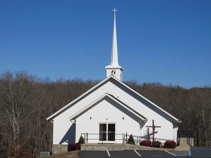
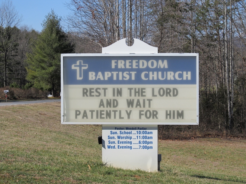
Freedom Baptist Church Cemetery is located at Fortune Road McDowell County ,North Carolina ,USA.
-
Freedom Baptist Church Cemetery cemetery's updated grave count on graveviews.com?
0 memorials
-
Where are the coordinates of the Freedom Baptist Church Cemetery?
Latitude: 35.5883900
Longitude: -81.8445700
Nearby Cemetories:
1. Kirksey Family Cemetery
McDowell County, USA
Coordinate: 35.5810600, -81.8431900
2. Trinity United Methodist Church Cemetery
Dysartsville, McDowell County, USA
Coordinate: 35.5995270, -81.8644050
3. Dysartsville Baptist Church Cemetery
Dysartsville, McDowell County, USA
Coordinate: 35.6011400, -81.8697800
4. Silver Creek Knob
Burke County, USA
Coordinate: 35.5835000, -81.7970000
5. Ernie Mack Reed Memorial Cemetery
Silver Creek Township, Burke County, USA
Coordinate: 35.6197840, -81.8084640
6. Epps Family Cemetery
McDowell County, USA
Coordinate: 35.5778020, -81.9016850
7. Drucilla Independent Fundamental Cemetery
Dysartsville, McDowell County, USA
Coordinate: 35.6285700, -81.8821900
8. Laurel Hill Baptist Church Cemetery
Nebo, McDowell County, USA
Coordinate: 35.6143120, -81.8984140
9. Poteet Family Cemetery
McDowell County, USA
Coordinate: 35.5774040, -81.9125020
10. Sunny Grove Baptist Church Cemetery
McDowell County, USA
Coordinate: 35.6271870, -81.8957620
11. Fairview Church Cemetery
Forest City, Rutherford County, USA
Coordinate: 35.5409640, -81.8010940
12. Dysartsville Church of Christ Cemetery
Marion, McDowell County, USA
Coordinate: 35.6354600, -81.8890800
13. Weast Cemetery
Sunshine, Rutherford County, USA
Coordinate: 35.5341320, -81.8145960
14. Golden Valley Church of the Brethren Cemetery
Sunshine, Rutherford County, USA
Coordinate: 35.5368800, -81.7974200
15. Pinnacle Methodist Church Cemetery
Nebo, McDowell County, USA
Coordinate: 35.6492200, -81.8747900
16. Cane Creek Baptist Church Cemetery
Union Mills, Rutherford County, USA
Coordinate: 35.5222250, -81.8530630
17. Mooney-Van Zandt Cemetery
Rutherford County, USA
Coordinate: 35.5335800, -81.7932500
18. Fork Creek Baptist Church Cemetery
Rutherford County, USA
Coordinate: 35.5249710, -81.8802872
19. Dixon Cemetery
McDowell County, USA
Coordinate: 35.6507988, -81.8861008
20. Sprouse Cemetery
Dysartsville, McDowell County, USA
Coordinate: 35.5723570, -81.9297430
21. Brackettown Cemetery
McDowell County, USA
Coordinate: 35.5532990, -81.9207993
22. Living Waters Cemetery
McDowell County, USA
Coordinate: 35.6480160, -81.8956420
23. Rainhill Wesleyan Methodist Church Cemetery
Morganton, Burke County, USA
Coordinate: 35.6480570, -81.7922930
24. Bradley Family Cemetery - Nebo
McDowell County, USA
Coordinate: 35.6475900, -81.8999100