
| Memorials | : | 0 |
| Location | : | Sunshine, Rutherford County, USA |
| Coordinate | : | 35.5368800, -81.7974200 |
| Description | : | Just before Camp McCall road on 226 there is a "heavy equipment" yard on the left. Just past it turn left onto a dirt road. Cemetery is located a few miles out this dirt road on the left |
frequently asked questions (FAQ):
-
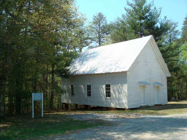
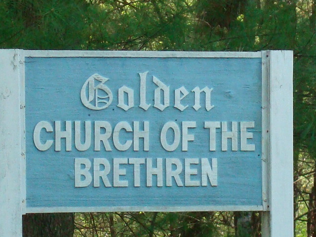
Where is Golden Valley Church of the Brethren Cemetery?
Golden Valley Church of the Brethren Cemetery is located at Sunshine, Rutherford County ,North Carolina ,USA.
-
Golden Valley Church of the Brethren Cemetery cemetery's updated grave count on graveviews.com?
0 memorials
-
Where are the coordinates of the Golden Valley Church of the Brethren Cemetery?
Latitude: 35.5368800
Longitude: -81.7974200
Nearby Cemetories:
1. Mooney-Van Zandt Cemetery
Rutherford County, USA
Coordinate: 35.5335800, -81.7932500
2. Fairview Church Cemetery
Forest City, Rutherford County, USA
Coordinate: 35.5409640, -81.8010940
3. Weast Cemetery
Sunshine, Rutherford County, USA
Coordinate: 35.5341320, -81.8145960
4. Golden Valley United Methodist Church Cemetery
Bostic, Rutherford County, USA
Coordinate: 35.5203018, -81.7900009
5. Fortune Cemetery
Rutherford County, USA
Coordinate: 35.5092010, -81.7647018
6. First Broad Baptist Church Cemetery
Bostic, Rutherford County, USA
Coordinate: 35.5176770, -81.7543960
7. Silver Creek Knob
Burke County, USA
Coordinate: 35.5835000, -81.7970000
8. Golden Valley Missionary Methodist Church Cemetery
Bostic, Rutherford County, USA
Coordinate: 35.4961700, -81.7678800
9. Cane Creek Baptist Church Cemetery
Union Mills, Rutherford County, USA
Coordinate: 35.5222250, -81.8530630
10. Kirksey Family Cemetery
McDowell County, USA
Coordinate: 35.5810600, -81.8431900
11. Cooper Springs Congregational Holiness Church Ceme
Rutherford County, USA
Coordinate: 35.4755700, -81.7844540
12. Freedom Baptist Church Cemetery
McDowell County, USA
Coordinate: 35.5883900, -81.8445700
13. Fellowship Baptist Church Cemetery
Bostic, Rutherford County, USA
Coordinate: 35.5650630, -81.7235360
14. Fork Creek Baptist Church Cemetery
Rutherford County, USA
Coordinate: 35.5249710, -81.8802872
15. Mount Harmony Baptist Church Cemetery
Bostic, Rutherford County, USA
Coordinate: 35.4588380, -81.7996940
16. Diviney Cemetery
Duncans Creek, Rutherford County, USA
Coordinate: 35.5143920, -81.7042200
17. Ross Hill Baptist Church Cemetery
Bostic, Rutherford County, USA
Coordinate: 35.4575280, -81.7922220
18. Mount Pleasant Baptist Church Cemetery
Rutherford County, USA
Coordinate: 35.5509280, -81.6976340
19. Trinity United Methodist Church Cemetery
Dysartsville, McDowell County, USA
Coordinate: 35.5995270, -81.8644050
20. Ernie Mack Reed Memorial Cemetery
Silver Creek Township, Burke County, USA
Coordinate: 35.6197840, -81.8084640
21. Duncans Creek Presbyterian Church Cemetery
Hollis, Rutherford County, USA
Coordinate: 35.4742680, -81.7276620
22. Cedar Grove United Methodist Church Cemetery
Rutherford County, USA
Coordinate: 35.4506110, -81.8097540
23. Dysartsville Baptist Church Cemetery
Dysartsville, McDowell County, USA
Coordinate: 35.6011400, -81.8697800
24. Sandy Level Baptist Cemetery
Bostic, Rutherford County, USA
Coordinate: 35.4591400, -81.8520440