
| Memorials | : | 0 |
| Location | : | Rutherford County, USA |
| Coordinate | : | 35.5335800, -81.7932500 |
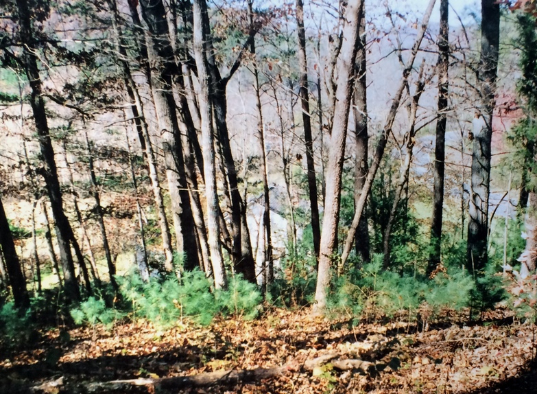
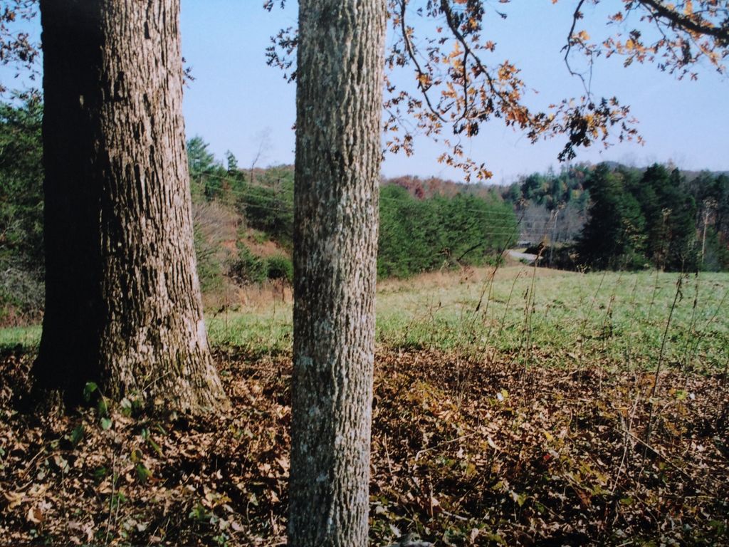
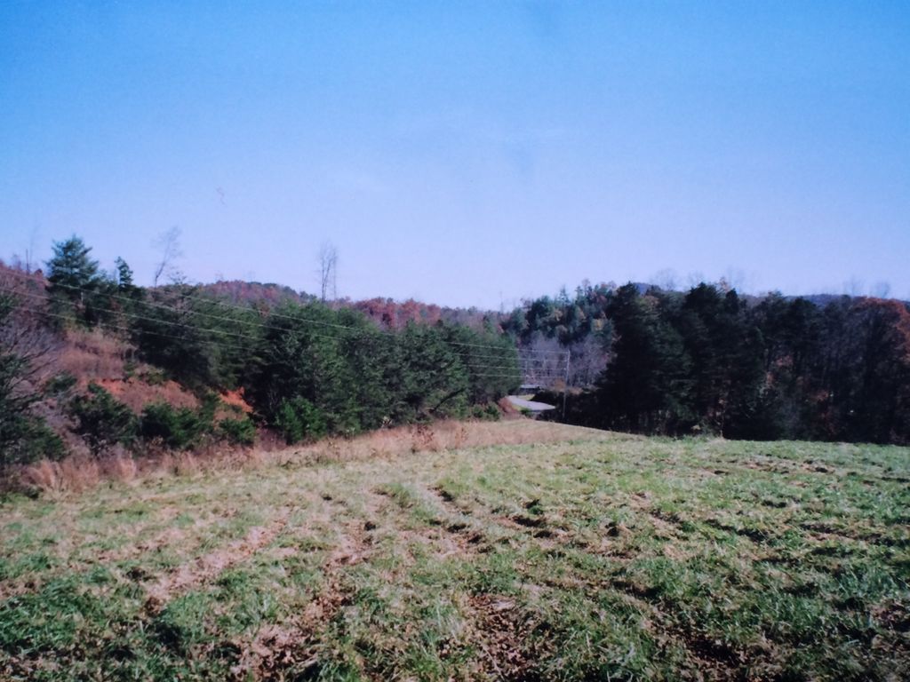
| Description | : | Located on steep slope near top. It's in a stand of trees near the western edge of a large pasture. The closest residence is the preacher's house with the driveway in the middle between the house, and the hillside. On the south side of 226 looking from the roadway - the cemetery hill is left, cattle gate in middle, and Preacher's driveway toward the right. A local land owner and historian served as a guide as we entered through the cattle gate. More markers are likely under the leaves, and soil. Cattle have grazed in this area over the centuries... Read More |
frequently asked questions (FAQ):
-
Where is Mooney-Van Zandt Cemetery?
Mooney-Van Zandt Cemetery is located at Near 4000 Block of NC-226 Rutherford County ,North Carolina , 28018USA.
-
Mooney-Van Zandt Cemetery cemetery's updated grave count on graveviews.com?
0 memorials
-
Where are the coordinates of the Mooney-Van Zandt Cemetery?
Latitude: 35.5335800
Longitude: -81.7932500

Nearby Cemetories:
1. Golden Valley Church of the Brethren Cemetery
Sunshine, Rutherford County, USA
Coordinate: 35.5368800, -81.7974200
2. Fairview Church Cemetery
Forest City, Rutherford County, USA
Coordinate: 35.5409640, -81.8010940
3. Golden Valley United Methodist Church Cemetery
Bostic, Rutherford County, USA
Coordinate: 35.5203018, -81.7900009
4. Weast Cemetery
Sunshine, Rutherford County, USA
Coordinate: 35.5341320, -81.8145960
5. Fortune Cemetery
Rutherford County, USA
Coordinate: 35.5092010, -81.7647018
6. First Broad Baptist Church Cemetery
Bostic, Rutherford County, USA
Coordinate: 35.5176770, -81.7543960
7. Golden Valley Missionary Methodist Church Cemetery
Bostic, Rutherford County, USA
Coordinate: 35.4961700, -81.7678800
8. Cane Creek Baptist Church Cemetery
Union Mills, Rutherford County, USA
Coordinate: 35.5222250, -81.8530630
9. Silver Creek Knob
Burke County, USA
Coordinate: 35.5835000, -81.7970000
10. Cooper Springs Congregational Holiness Church Ceme
Rutherford County, USA
Coordinate: 35.4755700, -81.7844540
11. Kirksey Family Cemetery
McDowell County, USA
Coordinate: 35.5810600, -81.8431900
12. Fellowship Baptist Church Cemetery
Bostic, Rutherford County, USA
Coordinate: 35.5650630, -81.7235360
13. Freedom Baptist Church Cemetery
McDowell County, USA
Coordinate: 35.5883900, -81.8445700
14. Fork Creek Baptist Church Cemetery
Rutherford County, USA
Coordinate: 35.5249710, -81.8802872
15. Mount Harmony Baptist Church Cemetery
Bostic, Rutherford County, USA
Coordinate: 35.4588380, -81.7996940
16. Diviney Cemetery
Duncans Creek, Rutherford County, USA
Coordinate: 35.5143920, -81.7042200
17. Ross Hill Baptist Church Cemetery
Bostic, Rutherford County, USA
Coordinate: 35.4575280, -81.7922220
18. Mount Pleasant Baptist Church Cemetery
Rutherford County, USA
Coordinate: 35.5509280, -81.6976340
19. Duncans Creek Presbyterian Church Cemetery
Hollis, Rutherford County, USA
Coordinate: 35.4742680, -81.7276620
20. Cedar Grove United Methodist Church Cemetery
Rutherford County, USA
Coordinate: 35.4506110, -81.8097540
21. Ernie Mack Reed Memorial Cemetery
Silver Creek Township, Burke County, USA
Coordinate: 35.6197840, -81.8084640
22. Trinity United Methodist Church Cemetery
Dysartsville, McDowell County, USA
Coordinate: 35.5995270, -81.8644050
23. Sandy Level Baptist Cemetery
Bostic, Rutherford County, USA
Coordinate: 35.4591400, -81.8520440
24. Pisgah United Methodist Church Cemetery
Rutherfordton, Rutherford County, USA
Coordinate: 35.4770130, -81.8799750