| Memorials | : | 3 |
| Location | : | McPherson County, USA |
| Coordinate | : | 38.2027400, -97.4362500 |
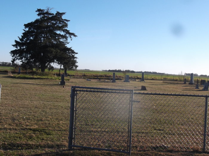
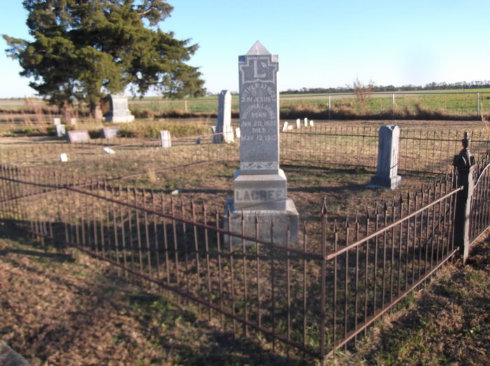
| Description | : | South side of Arrowhead Road (McPherson County Road 451) between 26th and 27th Avenue. Northeast corner of the northwest quarter of section 28. The first burials here in the early 1870's were members of the French-speaking Freedom Baptist Church, many of whom had come down from Quebec, Canada. The first minister of the church was Anaclet Chartrand who, with his wife Marguerite, is buried here. |
frequently asked questions (FAQ):
-
Where is Freedom Baptist Church Cemetery?
Freedom Baptist Church Cemetery is located at McPherson County ,Kansas ,USA.
-
Freedom Baptist Church Cemetery cemetery's updated grave count on graveviews.com?
3 memorials
-
Where are the coordinates of the Freedom Baptist Church Cemetery?
Latitude: 38.2027400
Longitude: -97.4362500
Nearby Cemetories:
1. Anna Schmidt Cemetery
Meridian Township, McPherson County, USA
Coordinate: 38.2283911, -97.3893937
2. Meridian Cemetery
McPherson County, USA
Coordinate: 38.1741028, -97.3904722
3. German Evangelical Lutheran Cemetery
Meridian Township, McPherson County, USA
Coordinate: 38.2567150, -97.4267420
4. Whitestone Mennonite Church Columbarium
Hesston, Harvey County, USA
Coordinate: 38.1458950, -97.4297920
5. Hesston Cemetery
Hesston, Harvey County, USA
Coordinate: 38.1448900, -97.4402400
6. First Mennonite Cemetery
Moundridge, McPherson County, USA
Coordinate: 38.1885090, -97.5094070
7. Knopp Cemetery
West Branch Township, Marion County, USA
Coordinate: 38.2003140, -97.3540140
8. Immanuel Lutheran Church Cemetery
Canton, McPherson County, USA
Coordinate: 38.2755330, -97.4473030
9. West Zion Cemetery
Moundridge, McPherson County, USA
Coordinate: 38.2028008, -97.5372009
10. Mound Township Cemetery
Moundridge, McPherson County, USA
Coordinate: 38.2028008, -97.5378036
11. Schmidt Homestead Cemetery
Meridian Township, McPherson County, USA
Coordinate: 38.2654300, -97.3717700
12. Blumenfeld Cemetery
Goessel, Marion County, USA
Coordinate: 38.2644900, -97.3697400
13. Goessel Mennonite Brethren Cemetery
Goessel, Marion County, USA
Coordinate: 38.2456780, -97.3459880
14. Goessel Mennonite Church Cemetery
Goessel, Marion County, USA
Coordinate: 38.2544000, -97.3531000
15. Heinrich J. Schmidt Family Cemetery
Spring Valley Township, McPherson County, USA
Coordinate: 38.2754900, -97.3763700
16. Groenfeld Cemetery
Goessel, Marion County, USA
Coordinate: 38.2253600, -97.3290500
17. Schlender Cemetery
Harvey County, USA
Coordinate: 38.1669006, -97.5374985
18. Highland Cemetery
Newton, Harvey County, USA
Coordinate: 38.1440540, -97.3531320
19. Tabor Mennonite Church Cemetery
Goessel, Marion County, USA
Coordinate: 38.2037582, -97.3233719
20. Farnsworth-Cook Cemetery
Halstead, Harvey County, USA
Coordinate: 38.1233600, -97.4992200
21. Garden Valley Cemetery
Harvey County, USA
Coordinate: 38.1232147, -97.4998856
22. Eastlawn Cemetery
Zimmerdale, Harvey County, USA
Coordinate: 38.1151100, -97.3902900
23. Lone Tree Cemetery
Moundridge, McPherson County, USA
Coordinate: 38.2846985, -97.5002975
24. Alexanderwohl Friedhof Cemetery
Goessel, Marion County, USA
Coordinate: 38.2611008, -97.3317032


