
| Memorials | : | 0 |
| Location | : | Newcastle, Weston County, USA |
| Coordinate | : | 43.8359000, -104.2280600 |
| Description | : | Traveling West on the bypass on Highway No 16, turn left a the Weston County Fairgrounds.Travel one mile on the gravel road. When you come to a dead end on the road going NOrth and south, turn west and travel a quarter of a mile. |
frequently asked questions (FAQ):
-
Where is Old Ridge Cemetery?
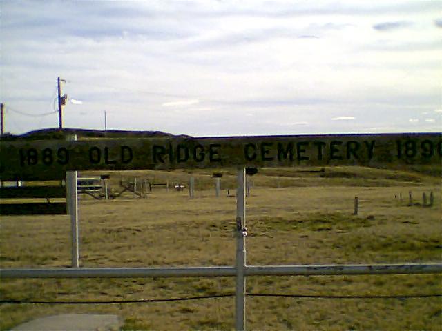
Old Ridge Cemetery is located at Sec 45N Range 61W Newcastle, Weston County ,Wyoming ,USA.
-
Old Ridge Cemetery cemetery's updated grave count on graveviews.com?
0 memorials
-
Where are the coordinates of the Old Ridge Cemetery?
Latitude: 43.8359000
Longitude: -104.2280600
Nearby Cemetories:
1. Greenwood Cemetery
Newcastle, Weston County, USA
Coordinate: 43.8518982, -104.1943970
2. Cambria Cemetery
Weston County, USA
Coordinate: 43.9543991, -104.2133026
3. Freel Gravesite
Weston County, USA
Coordinate: 43.9779000, -104.2996000
4. Garhart Cemetery
Osage, Weston County, USA
Coordinate: 43.9793600, -104.4265200
5. Boyd Cemetery
Weston County, USA
Coordinate: 44.0774994, -104.1192017
6. Saint Alberts Catholic Cemetery
Weston County, USA
Coordinate: 44.1082340, -104.1581150
7. Pollat Ranch Cemetery
Newcastle, Weston County, USA
Coordinate: 43.7563900, -104.6588300
8. Green Mountain Cemetery
Horton, Weston County, USA
Coordinate: 44.1646996, -104.2397003
9. Greenwood Cemetery
Upton, Weston County, USA
Coordinate: 44.0894012, -104.6132965
10. Soldiers Gravesite
Crook County, USA
Coordinate: 44.2185000, -104.2674000
11. Reynolds Ranch Cemetery
Rochford, Pennington County, USA
Coordinate: 44.0875667, -103.8027265
12. Hanson Ranch Cemetery
Niobrara County, USA
Coordinate: 43.4786100, -104.4844800
13. Inyan Kara Cemetery
Sundance, Crook County, USA
Coordinate: 44.2613983, -104.2994003
14. Thunderhead Mountain
Custer, Custer County, USA
Coordinate: 43.8346510, -103.6221890
15. Greenwood Cemetery
Crook County, USA
Coordinate: 44.2355995, -104.4886017
16. Bell Park Cemetery
Rochford, Pennington County, USA
Coordinate: 44.1116982, -103.7466965
17. Custer Cemetery
Custer, Custer County, USA
Coordinate: 43.7781181, -103.6159592
18. Hill City Cemetery
Hill City, Pennington County, USA
Coordinate: 43.9366270, -103.5789730
19. McGillycuddy Monument
Pennington County, USA
Coordinate: 43.8865110, -103.5670850
20. Carr Cemetery
Hanna, Lawrence County, USA
Coordinate: 44.2411003, -103.8606033
21. Dumont Cemetery
Lawrence County, USA
Coordinate: 44.2270000, -103.7860000
22. Pringle Cemetery
Pringle, Custer County, USA
Coordinate: 43.6086006, -103.6042023
23. Holy Cross Cemetery
Englewood, Lawrence County, USA
Coordinate: 44.2818985, -103.8047028
24. Mountain Lawn Cemetery
Englewood, Lawrence County, USA
Coordinate: 44.2818985, -103.8047028