
| Memorials | : | 7 |
| Location | : | Cloud County, USA |
| Coordinate | : | 39.4395200, -97.4148290 |
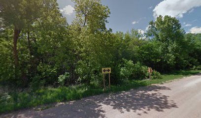
| Description | : | This cemetery has been Abandoned. The following was found in the books titled "Cloud County, Kansas Cemeteries - Volume 1"... and "Early Deaths Cloud County, Kansas - Before 1903" The cemetery was located in the South center of section 34... about 1/4 mile into the field. On the 1885 Atlas of Cloud County, a church is shown in this location. This church later burned to the ground. In 1982, four stones were found there; on a return trip in 1987, only two stones were found. |
frequently asked questions (FAQ):
-
Where is French Presbyterian Church Cemetery?
French Presbyterian Church Cemetery is located at Shirley Township Cloud County ,Kansas ,USA.
-
French Presbyterian Church Cemetery cemetery's updated grave count on graveviews.com?
7 memorials
-
Where are the coordinates of the French Presbyterian Church Cemetery?
Latitude: 39.4395200
Longitude: -97.4148290
Nearby Cemetories:
1. Iwacura Cemetery
Morganville, Clay County, USA
Coordinate: 39.4550000, -97.3510000
2. Saint Joseph Cemetery
Saint Joseph, Cloud County, USA
Coordinate: 39.5074941, -97.4022328
3. Sulphur Springs Cemetery
Aurora, Cloud County, USA
Coordinate: 39.4086610, -97.4986840
4. Princeville Cemetery
Aurora, Cloud County, USA
Coordinate: 39.4672012, -97.5010986
5. Smith Grave
Miltonvale, Cloud County, USA
Coordinate: 39.3645300, -97.4308700
6. Saint Peters Cemetery
Aurora, Cloud County, USA
Coordinate: 39.4763985, -97.5180969
7. Lincoln Cemetery
Clay Center, Clay County, USA
Coordinate: 39.4230995, -97.2930984
8. Pleasant View Cemetery
Ames, Cloud County, USA
Coordinate: 39.5346985, -97.4431000
9. Miltonvale Cemetery
Miltonvale, Cloud County, USA
Coordinate: 39.3358002, -97.4447021
10. Bloom Cemetery
Morganville, Clay County, USA
Coordinate: 39.4519005, -97.2778015
11. Cedar Grove Cemetery
Clyde, Cloud County, USA
Coordinate: 39.5494003, -97.4056015
12. Green Mound Cemetery
Rice, Cloud County, USA
Coordinate: 39.5248450, -97.5081630
13. Riverdale Cemetery
Clay County, USA
Coordinate: 39.5106010, -97.2930984
14. Shields Cemetery
Clay County, USA
Coordinate: 39.3208008, -97.3507996
15. Nelson Cemetery
Rice, Cloud County, USA
Coordinate: 39.5257988, -97.5410995
16. Idana Cemetery
Idana, Clay County, USA
Coordinate: 39.3574500, -97.2693300
17. Walnut Grove Cemetery
Cloud County, USA
Coordinate: 39.5699997, -97.4993973
18. Oakland Union Cemetery
Miltonvale, Cloud County, USA
Coordinate: 39.3647003, -97.5824966
19. Enterprise Cemetery
Cloud County, USA
Coordinate: 39.4230995, -97.6106033
20. Mount Calvary Cemetery
Clyde, Cloud County, USA
Coordinate: 39.5917015, -97.4143982
21. Mount Hope Cemetery
Clyde, Cloud County, USA
Coordinate: 39.5969009, -97.4116974
22. Rice Cemetery
Rice, Cloud County, USA
Coordinate: 39.5614014, -97.5552979
23. Table Mound Cemetery
Idana, Clay County, USA
Coordinate: 39.3141300, -97.2792300
24. Thomas Cemetery
Miltonvale, Cloud County, USA
Coordinate: 39.3300000, -97.5750000