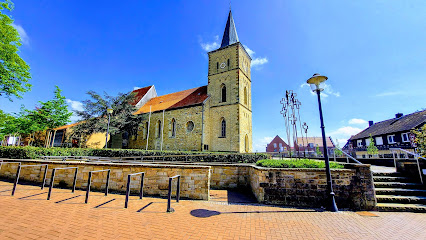
| Memorials | : | 0 |
| Location | : | Heek, Kreis Borken, Germany |
| Phone | : | 0256893000 |
| Coordinate | : | 52.1172280, 7.1081770 |
| Description | : | Cemetery Administration Heek 1.07 km from Heek Address: Bahnhofstr. 60, 48619 Heek Phone: 0256893000 Fax: 02568930038 Email: [email protected] Opening hours: Mon-Fri 8:30 am - 12:30 pm as well as Mon-Wed 2:00 pm - 4:00 pm Thu 2:00 pm - 6:00 pm |
frequently asked questions (FAQ):
-
Where is Friedhof Heek?
Friedhof Heek is located at Bahnhofstr. 60, Heek Heek, Kreis Borken ,Nordrhein-Westfalen , 48619Germany.
-
Friedhof Heek cemetery's updated grave count on graveviews.com?
0 memorials
-
Where are the coordinates of the Friedhof Heek?
Latitude: 52.1172280
Longitude: 7.1081770
Nearby Cemetories:
1. Jüdischer Friedhof
Metelen, Kreis Steinfurt, Germany
Coordinate: 52.1413770, 7.2132690
2. Friedhof Asbeck
Asbeck, Kreis Borken, Germany
Coordinate: 52.0517515, 7.1456952
3. Alter Friedhof
Schoppingen, Kreis Borken, Germany
Coordinate: 52.0957000, 7.2305000
4. Katholischer Friedhof Legden
Legden, Kreis Borken, Germany
Coordinate: 52.0313707, 7.0958980
5. Katholischer Friedhof
Gronau, Kreis Borken, Germany
Coordinate: 52.2009691, 7.0436211
6. Alter evangelischer Friedhof
Gronau, Kreis Borken, Germany
Coordinate: 52.2105474, 7.0290033
7. Ochtrup-Kriegsgräberstätte
Ochtrup, Kreis Steinfurt, Germany
Coordinate: 52.2099778, 7.1916935
8. Evangelischer Friedhof
Gronau, Kreis Borken, Germany
Coordinate: 52.2206190, 7.0396011
9. St. Gertrudis Horstmar - Leer
Horstmar, Kreis Steinfurt, Germany
Coordinate: 52.0830841, 7.2987570
10. Overdinkel Roman Catholic Churchyard
Overdinkel, Losser Municipality, Netherlands
Coordinate: 52.2405100, 7.0319800
11. Doodenzorg Begraafplaats
Glanerbrug, Enschede Municipality, Netherlands
Coordinate: 52.2180600, 6.9695900
12. Waldfrieden Horstmar-Alst
Alst, Kreis Steinfurt, Germany
Coordinate: 52.0983900, 7.3304600
13. Evangelischer Friedhof Burgsteinfurt
Burgsteinfurt, Kreis Steinfurt, Germany
Coordinate: 52.1542548, 7.3329151
14. Katholischer Friedhof Burgsteinfurt
Burgsteinfurt, Kreis Steinfurt, Germany
Coordinate: 52.1456804, 7.3377331
15. Enschede Roman Catholic Cemetery
Enschede, Enschede Municipality, Netherlands
Coordinate: 52.2183100, 6.9307100
16. Friedhof des Fürstenhauses
Burgsteinfurt, Kreis Steinfurt, Germany
Coordinate: 52.1406839, 7.3489196
17. RuheForst Westmünsterland – Coesfeld
Coesfeld, Kreis Coesfeld, Germany
Coordinate: 51.9666640, 7.1358330
18. Joodse begraafplaats Esmarkerrondweg
Enschede, Enschede Municipality, Netherlands
Coordinate: 52.2211480, 6.9282250
19. Enschede Oosterbegraafplaats
Enschede, Enschede Municipality, Netherlands
Coordinate: 52.2221700, 6.9292600
20. Losser General Cemetery
Losser, Losser Municipality, Netherlands
Coordinate: 52.2625100, 7.0105100
21. Joodse begraafplaats Kneedweg
Enschede, Enschede Municipality, Netherlands
Coordinate: 52.2199400, 6.9099900
22. Losser Roman Catholic Churchyard
Losser, Losser Municipality, Netherlands
Coordinate: 52.2628700, 7.0034500
23. Friedhof an der Marienburg
Coesfeld, Kreis Coesfeld, Germany
Coordinate: 51.9468000, 7.1464000
24. Sankt Lamberti Friedhof
Coesfeld, Kreis Coesfeld, Germany
Coordinate: 51.9503000, 7.1797000

