
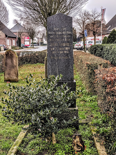
| Memorials | : | 0 |
| Location | : | Metelen, Kreis Steinfurt, Germany |
| Coordinate | : | 52.1413770, 7.2132690 |
frequently asked questions (FAQ):
-
Where is Jüdischer Friedhof?
Jüdischer Friedhof is located at Schöppingener Str. 11 Metelen, Kreis Steinfurt ,Nordrhein-Westfalen , 48629Germany.
-
Jüdischer Friedhof cemetery's updated grave count on graveviews.com?
0 memorials
-
Where are the coordinates of the Jüdischer Friedhof?
Latitude: 52.1413770
Longitude: 7.2132690
Nearby Cemetories:
1. Alter Friedhof
Schoppingen, Kreis Borken, Germany
Coordinate: 52.0957000, 7.2305000
2. Friedhof Heek
Heek, Kreis Borken, Germany
Coordinate: 52.1172280, 7.1081770
3. Ochtrup-Kriegsgräberstätte
Ochtrup, Kreis Steinfurt, Germany
Coordinate: 52.2099778, 7.1916935
4. Evangelischer Friedhof Burgsteinfurt
Burgsteinfurt, Kreis Steinfurt, Germany
Coordinate: 52.1542548, 7.3329151
5. Katholischer Friedhof Burgsteinfurt
Burgsteinfurt, Kreis Steinfurt, Germany
Coordinate: 52.1456804, 7.3377331
6. St. Gertrudis Horstmar - Leer
Horstmar, Kreis Steinfurt, Germany
Coordinate: 52.0830841, 7.2987570
7. Friedhof des Fürstenhauses
Burgsteinfurt, Kreis Steinfurt, Germany
Coordinate: 52.1406839, 7.3489196
8. Waldfrieden Horstmar-Alst
Alst, Kreis Steinfurt, Germany
Coordinate: 52.0983900, 7.3304600
9. Friedhof Asbeck
Asbeck, Kreis Borken, Germany
Coordinate: 52.0517515, 7.1456952
10. Katholischer Friedhof
Gronau, Kreis Borken, Germany
Coordinate: 52.2009691, 7.0436211
11. Friedhof Borghorst (Königsallee)
Borghorst, Kreis Steinfurt, Germany
Coordinate: 52.1204832, 7.4127861
12. Katholischer Friedhof Legden
Legden, Kreis Borken, Germany
Coordinate: 52.0313707, 7.0958980
13. Alter evangelischer Friedhof
Gronau, Kreis Borken, Germany
Coordinate: 52.2105474, 7.0290033
14. Evangelischer Friedhof
Gronau, Kreis Borken, Germany
Coordinate: 52.2206190, 7.0396011
15. Overdinkel Roman Catholic Churchyard
Overdinkel, Losser Municipality, Netherlands
Coordinate: 52.2405100, 7.0319800
16. Bad Bentheim War Memorial
Bad Bentheim, Landkreis Grafschaft Bentheim, Germany
Coordinate: 52.3018100, 7.1567300
17. St. Johannes der Täufer Church Cemetery
Bad Bentheim, Landkreis Grafschaft Bentheim, Germany
Coordinate: 52.3023100, 7.1539000
18. Doodenzorg Begraafplaats
Glanerbrug, Enschede Municipality, Netherlands
Coordinate: 52.2180600, 6.9695900
19. Katholischer Friedhof Nordwalde
Nordwalde, Kreis Steinfurt, Germany
Coordinate: 52.0804644, 7.4765322
20. Losser General Cemetery
Losser, Losser Municipality, Netherlands
Coordinate: 52.2625100, 7.0105100
21. Losser Roman Catholic Churchyard
Losser, Losser Municipality, Netherlands
Coordinate: 52.2628700, 7.0034500
22. RuheForst Westmünsterland – Coesfeld
Coesfeld, Kreis Coesfeld, Germany
Coordinate: 51.9666640, 7.1358330
23. Friedhof Königsesch
Rheine, Kreis Steinfurt, Germany
Coordinate: 52.2868666, 7.4097261
24. Enschede Roman Catholic Cemetery
Enschede, Enschede Municipality, Netherlands
Coordinate: 52.2183100, 6.9307100