
| Memorials | : | 0 |
| Location | : | Schöllbronn, Landkreis Karlsruhe, Germany |
| Coordinate | : | 48.8998000, 8.4240000 |
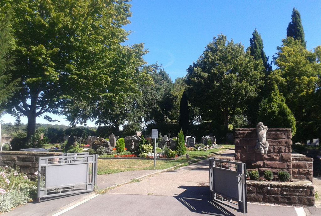
| Description | : | Teilweise mit alten Bäumen bestandener Friedhof oberhalb von Schöllbronn am nordöstlichen Ortsrand. Fläche etwa 1,4 Hektar. A cemetery, partly with old trees, above the village of Schöllbronn on the northeastern outskirts. Area about 1.4 hectares. |
frequently asked questions (FAQ):
-
Where is Friedhof Schöllbronn?
Friedhof Schöllbronn is located at Kreuzstraße Schöllbronn, Landkreis Karlsruhe ,Baden-Württemberg , 76275Germany.
-
Friedhof Schöllbronn cemetery's updated grave count on graveviews.com?
0 memorials
-
Where are the coordinates of the Friedhof Schöllbronn?
Latitude: 48.8998000
Longitude: 8.4240000
Nearby Cemetories:
1. Friedhof Schluttenbach
Schluttenbach, Landkreis Karlsruhe, Germany
Coordinate: 48.9017300, 8.4009700
2. Friedhof Spessart
Spessart, Landkreis Karlsruhe, Germany
Coordinate: 48.9170000, 8.4376000
3. Friedhof Burbach
Burbach, Landkreis Karlsruhe, Germany
Coordinate: 48.8727000, 8.4362000
4. Friedhof Völkersbach
Völkersbach, Landkreis Karlsruhe, Germany
Coordinate: 48.8757000, 8.3938000
5. Friedhof Spielberg
Spielberg, Landkreis Karlsruhe, Germany
Coordinate: 48.8971000, 8.4736000
6. Friedhof Etzenrot
Etzenrot, Landkreis Karlsruhe, Germany
Coordinate: 48.9157600, 8.4674700
7. Friedhof Sulzbach
Sulzbach, Landkreis Karlsruhe, Germany
Coordinate: 48.9000263, 8.3691718
8. Friedhof Ettlingenweier
Ettlingenweier, Landkreis Karlsruhe, Germany
Coordinate: 48.9314000, 8.3909000
9. Alter Friedhof Ettlingen
Ettlingen, Landkreis Karlsruhe, Germany
Coordinate: 48.9437700, 8.4103900
10. Friedhof Busenbach
Busenbach, Landkreis Karlsruhe, Germany
Coordinate: 48.9341000, 8.4687000
11. Friedhof Reichenbach
Reichenbach, Landkreis Karlsruhe, Germany
Coordinate: 48.9254000, 8.4845000
12. Friedhof Ettlingen
Ettlingen, Landkreis Karlsruhe, Germany
Coordinate: 48.9491000, 8.4151000
13. Friedhof Schielberg
Schielberg, Landkreis Karlsruhe, Germany
Coordinate: 48.8485703, 8.4488692
14. Friedhof Langensteinbach
Langensteinbach, Landkreis Karlsruhe, Germany
Coordinate: 48.9128000, 8.5110000
15. Friedhof Palmbach
Palmbach, Stadtkreis Karlsruhe, Germany
Coordinate: 48.9482740, 8.4803376
16. Friedhof Malsch
Malsch, Landkreis Karlsruhe, Germany
Coordinate: 48.8765000, 8.3338000
17. Friedhof Grünwettersbach
Grünwettersbach, Stadtkreis Karlsruhe, Germany
Coordinate: 48.9572302, 8.4719305
18. Friedhof Ittersbach
Ittersbach, Landkreis Karlsruhe, Germany
Coordinate: 48.8639000, 8.5075000
19. Kloster Frauenalb
Frauenalb, Landkreis Karlsruhe, Germany
Coordinate: 48.8340000, 8.4410000
20. Gefallenendenkmal Rüppurr
Rüppurr, Stadtkreis Karlsruhe, Germany
Coordinate: 48.9685350, 8.4022270
21. Kriegsopferdenkmal Auerbach
Auerbach, Landkreis Karlsruhe, Germany
Coordinate: 48.9138351, 8.5313172
22. Friedhof Hohenwettersbach
Hohenwettersbach, Stadtkreis Karlsruhe, Germany
Coordinate: 48.9646000, 8.4726000
23. Friedhof Langenalb
Langenalb, Enzkreis, Germany
Coordinate: 48.8431200, 8.4921100
24. Friedhof Rüppurr
Rüppurr, Stadtkreis Karlsruhe, Germany
Coordinate: 48.9709000, 8.3996200