
| Memorials | : | 0 |
| Location | : | Stedesand, Kreis Nordfriesland, Germany |
| Coordinate | : | 54.7384122, 8.9305541 |
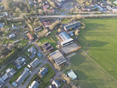
| Description | : | Contact: Kirchenamt Stedesand Kirchensteig 25920 Stedesand Email: [email protected] Stedesand is a municipality in the district (county) of Nordfriesland, in Schleswig-Holstein, Germany. There used to be an older cemetery around the village church (St. Laurentius) which was used until the beginning of the 20th century. This newer cemetery was opened afterwards. Its part of the Lutheran Church congregations of Nordfriesland. There are some historic metal crosses, restored grave markers from the old cemetery. Those folks are not buried here. See Reeder family, dating back to 1826. Please note that the graves in Germany are not perpetual. After a certain period of repose (20-30 years in Stedesand) the... Read More |
frequently asked questions (FAQ):
-
Where is Friedhof Stedesand?
Friedhof Stedesand is located at Dorfstraße / Kirchensteig Stedesand, Kreis Nordfriesland ,Schleswig-Holstein , 25920Germany.
-
Friedhof Stedesand cemetery's updated grave count on graveviews.com?
0 memorials
-
Where are the coordinates of the Friedhof Stedesand?
Latitude: 54.7384122
Longitude: 8.9305541
Nearby Cemetories:
1. Enger Friedhof
Enge, Kreis Nordfriesland, Germany
Coordinate: 54.7283600, 8.9797400
2. Leck Friedhof
Leck, Kreis Nordfriesland, Germany
Coordinate: 54.7747776, 8.9798520
3. Parkfriedhof Niebüll
Niebüll, Kreis Nordfriesland, Germany
Coordinate: 54.7904535, 8.8387020
4. Friedhof Deezbüll
Deezbüll, Kreis Nordfriesland, Germany
Coordinate: 54.7776616, 8.8147038
5. Friedhof Braderup
Braderup, Kreis Nordfriesland, Germany
Coordinate: 54.8342848, 8.8909250
6. St. Nikolai zu Bordelum
Bordelum, Kreis Nordfriesland, Germany
Coordinate: 54.6383240, 8.9411910
7. St.-Petri Kirche Friedhof
Ladelund, Kreis Nordfriesland, Germany
Coordinate: 54.8409180, 9.0245260
8. Friedhof Dagebüll
Dagebull, Kreis Nordfriesland, Germany
Coordinate: 54.7304200, 8.7235300
9. Friedhof Bredstedt
Bredstedt, Kreis Nordfriesland, Germany
Coordinate: 54.6153270, 8.9655360
10. Friedhof Humptrup
Humptrup, Kreis Nordfriesland, Germany
Coordinate: 54.8630646, 8.8652848
11. Friedhof Nordhackstedt
Nordhackstedt, Kreis Schleswig-Flensburg, Germany
Coordinate: 54.7338210, 9.1691548
12. Friedhof Medelby
Medelby, Kreis Schleswig-Flensburg, Germany
Coordinate: 54.8144695, 9.1741529
13. Friedhof Neukirchen
Rodenas, Kreis Nordfriesland, Germany
Coordinate: 54.8660878, 8.7355666
14. Friedhof Aventoft
Aventoft, Kreis Nordfriesland, Germany
Coordinate: 54.9003772, 8.8153899
15. Ubjerg kirkegård
Ubjerg, Tønder Kommune, Denmark
Coordinate: 54.9123677, 8.8548693
16. Friedhof Wallsbüll
Wallsbüll, Kreis Nordfriesland, Germany
Coordinate: 54.7741526, 9.2365888
17. Friedhof Grossenwiehe
Grossenwiehe, Kreis Schleswig-Flensburg, Germany
Coordinate: 54.7077014, 9.2499823
18. Friedhof Rodenäs
Rodenas, Kreis Nordfriesland, Germany
Coordinate: 54.8887661, 8.6998137
19. Møgeltønder Kirkegård
Mogeltonder, Tønder Kommune, Denmark
Coordinate: 54.9406590, 8.8031660
20. St. Marien Kirche Friedhof
Hattstedt, Kreis Nordfriesland, Germany
Coordinate: 54.5251480, 9.0205530
21. Friedhof Wyk auf Föhr
Boldixum, Kreis Nordfriesland, Germany
Coordinate: 54.6954900, 8.5510100
22. Friedhof Handewitt
Handewitt, Kreis Schleswig-Flensburg, Germany
Coordinate: 54.7615424, 9.3232075
23. Daler Cemetery
Tønder Kommune, Denmark
Coordinate: 54.9696400, 8.7461500
24. Friedhof Nieblum auf Föhr
Nieblum, Kreis Nordfriesland, Germany
Coordinate: 54.6934060, 8.4911330