
| Memorials | : | 0 |
| Location | : | Mogeltonder, Tønder Kommune, Denmark |
| Coordinate | : | 54.9406590, 8.8031660 |
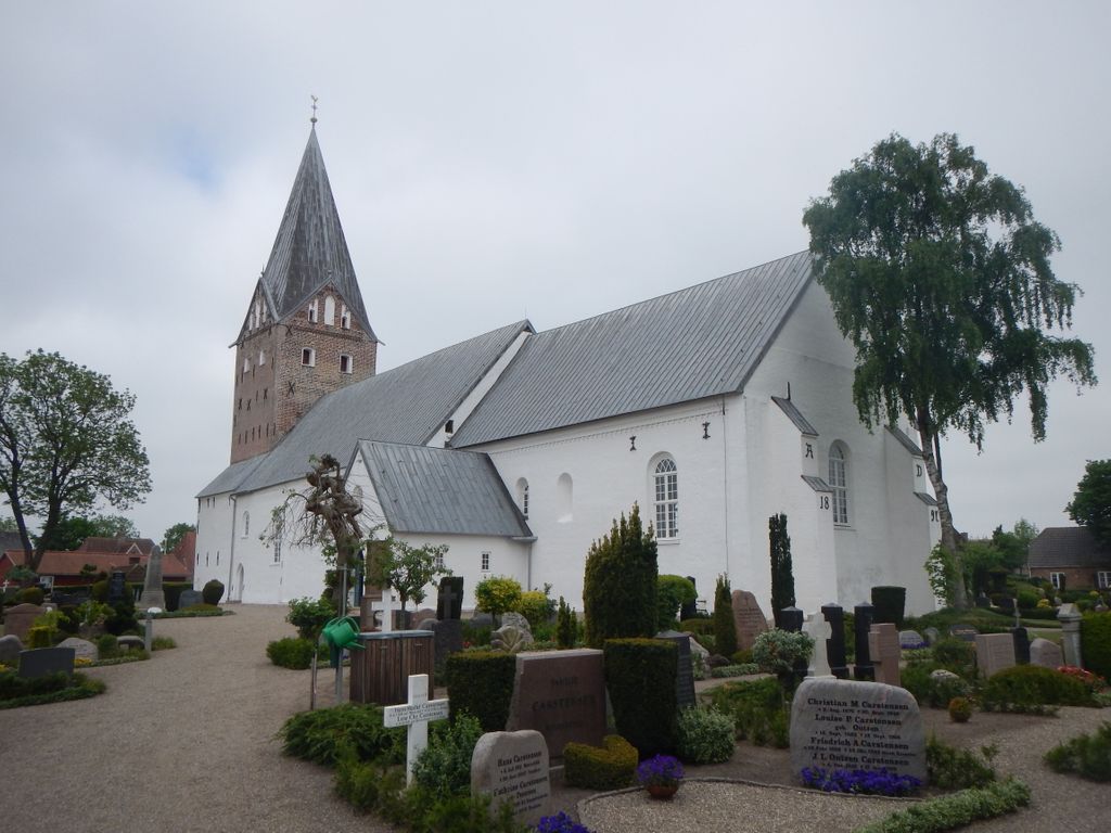
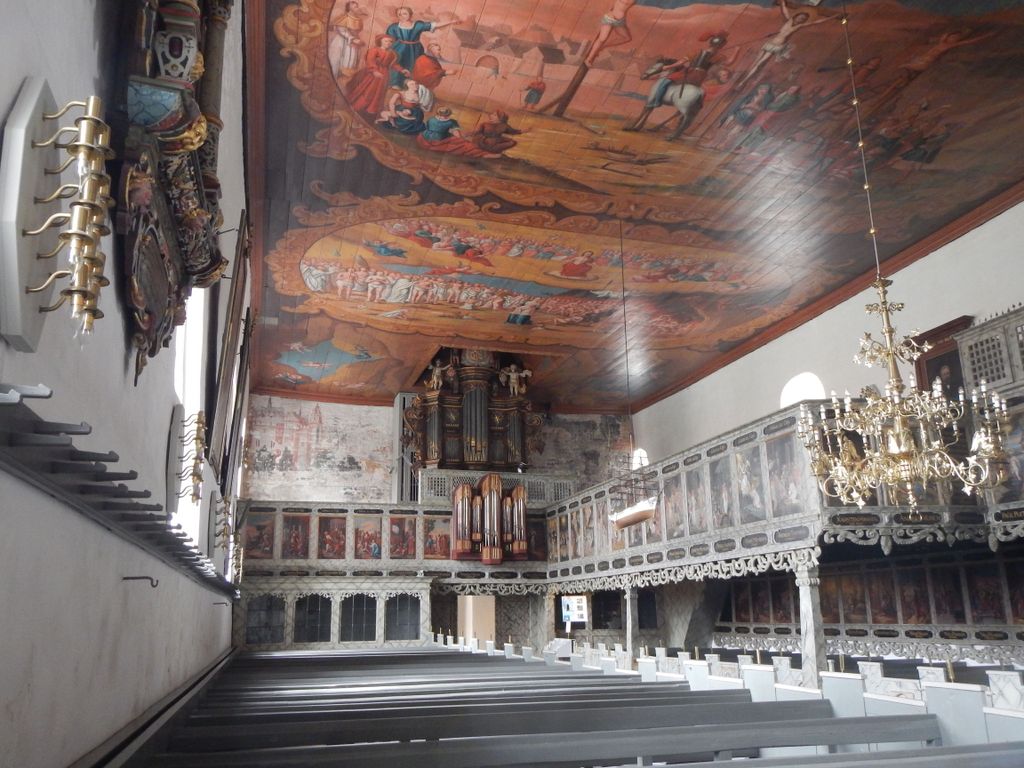
| Description | : | Large Cemetery surrounding the Møgeltønder Kirke. One of Denmark's largest village churches with valuable furnishing and interior decorations. The church belonged to Schackenborg until 1970. Fully restored 1970-1988. Contains Denmark's oldest church organ. One of Southern Jutland's most interesting churches. |
frequently asked questions (FAQ):
-
Where is Møgeltønder Kirkegård?
Møgeltønder Kirkegård is located at Sønderbyvej 2, 6270 Tønder Denmark Mogeltonder, Tønder Kommune ,Syddanmark , 6270 TøndeDenmark.
-
Møgeltønder Kirkegård cemetery's updated grave count on graveviews.com?
0 memorials
-
Where are the coordinates of the Møgeltønder Kirkegård?
Latitude: 54.9406590
Longitude: 8.8031660


Nearby Cemetories:
1. Friedhof Aventoft
Aventoft, Kreis Nordfriesland, Germany
Coordinate: 54.9003772, 8.8153899
2. Ubjerg kirkegård
Ubjerg, Tønder Kommune, Denmark
Coordinate: 54.9123677, 8.8548693
3. Daler Cemetery
Tønder Kommune, Denmark
Coordinate: 54.9696400, 8.7461500
4. Visby Cemetery
Visby, Tønder Kommune, Denmark
Coordinate: 55.0113000, 8.7763200
5. Friedhof Rodenäs
Rodenas, Kreis Nordfriesland, Germany
Coordinate: 54.8887661, 8.6998137
6. Friedhof Neukirchen
Rodenas, Kreis Nordfriesland, Germany
Coordinate: 54.8660878, 8.7355666
7. Friedhof Humptrup
Humptrup, Kreis Nordfriesland, Germany
Coordinate: 54.8630646, 8.8652848
8. Friedhof Braderup
Braderup, Kreis Nordfriesland, Germany
Coordinate: 54.8342848, 8.8909250
9. Brede Cemetery
Brede, Tønder Kommune, Denmark
Coordinate: 55.0582200, 8.8311000
10. Løgumkloster Cemetery
Logumkloster, Tønder Kommune, Denmark
Coordinate: 55.0570006, 8.9508550
11. Parkfriedhof Niebüll
Niebüll, Kreis Nordfriesland, Germany
Coordinate: 54.7904535, 8.8387020
12. St.-Petri Kirche Friedhof
Ladelund, Kreis Nordfriesland, Germany
Coordinate: 54.8409180, 9.0245260
13. Friedhof Deezbüll
Deezbüll, Kreis Nordfriesland, Germany
Coordinate: 54.7776616, 8.8147038
14. Leck Friedhof
Leck, Kreis Nordfriesland, Germany
Coordinate: 54.7747776, 8.9798520
15. Friedhof Stedesand
Stedesand, Kreis Nordfriesland, Germany
Coordinate: 54.7384122, 8.9305541
16. Friedhof Dagebüll
Dagebull, Kreis Nordfriesland, Germany
Coordinate: 54.7304200, 8.7235300
17. Skærbæk Kirkegård
Skærbæk, Tønder Kommune, Denmark
Coordinate: 55.1597726, 8.7653944
18. Friedhof Morsum
Morsum, Kreis Nordfriesland, Germany
Coordinate: 54.8677177, 8.4332085
19. Kirkeby Churchyard
Romo Kirkeby, Tønder Kommune, Denmark
Coordinate: 55.1129800, 8.5426400
20. Enger Friedhof
Enge, Kreis Nordfriesland, Germany
Coordinate: 54.7283600, 8.9797400
21. Friedhof List
List, Kreis Nordfriesland, Germany
Coordinate: 55.0226600, 8.4176300
22. Friedhof Medelby
Medelby, Kreis Schleswig-Flensburg, Germany
Coordinate: 54.8144695, 9.1741529
23. Friedhof Sankt Severin
Keitum, Kreis Nordfriesland, Germany
Coordinate: 54.9026700, 8.3636300
24. Bjolderup kirkegård
Bolderslev, Aabenraa Kommune, Denmark
Coordinate: 54.9954485, 9.2526627