
| Memorials | : | 0 |
| Location | : | Westoverledingen, Landkreis Leer, Germany |
| Coordinate | : | 53.1000300, 7.4504200 |
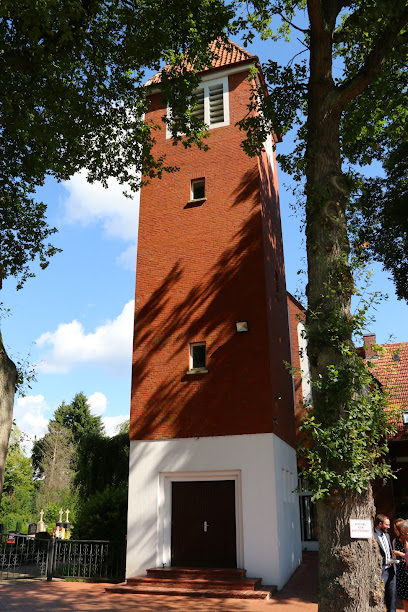
| Description | : | Völlenerkönigsfehn is one of the many hamlets that make up the town of Westoverledingen. The cemetery was opened in 1900, the church was built in 1907. Please note that the graves in Germany are not perpetual. After a certain period of repose (20-30 years) the graves are being leveled and re-used. There is no toxic embalming being done in Germany, so the coffin and the corpse can decompose naturally. If the family of the deceased decides to purchase another period the duration can be extended by another 30 years. Otherwise the grave will be leveled and reused, the marker than used... Read More |
frequently asked questions (FAQ):
-
Where is Friedhof Völlenerkönigsfehn?
Friedhof Völlenerkönigsfehn is located at Papenburger Strasse Westoverledingen, Landkreis Leer ,Lower Saxony (Niedersachsen) , 36810Germany.
-
Friedhof Völlenerkönigsfehn cemetery's updated grave count on graveviews.com?
0 memorials
-
Where are the coordinates of the Friedhof Völlenerkönigsfehn?
Latitude: 53.1000300
Longitude: 7.4504200
Nearby Cemetories:
1. Friedhof Völlenerfehn
Westoverledingen, Landkreis Leer, Germany
Coordinate: 53.1020220, 7.4181880
2. Katholischer Friedhof Flachsmeer
Westoverledingen, Landkreis Leer, Germany
Coordinate: 53.1189533, 7.4608385
3. Evangelisch-lutherischer Friedhof Flachsmeer
Westoverledingen, Landkreis Leer, Germany
Coordinate: 53.1233800, 7.4627760
4. Friedhof Grosswolderfeld
Westoverledingen, Landkreis Leer, Germany
Coordinate: 53.1320270, 7.4678850
5. Friedhof Papenburg
Papenburg, Landkreis Emsland, Germany
Coordinate: 53.0804783, 7.3987984
6. Friedhof Steenfelde
Steenfelde, Landkreis Leer, Germany
Coordinate: 53.1378900, 7.4395380
7. Friedhof Völlen
Westoverledingen, Landkreis Leer, Germany
Coordinate: 53.1089930, 7.3850390
8. Friedhof Grosswolde
Westoverledingen, Landkreis Leer, Germany
Coordinate: 53.1431660, 7.4450360
9. Kirchfriedhof Ihrenerfeld
Westoverledingen, Landkreis Leer, Germany
Coordinate: 53.1423620, 7.4751270
10. Gemeindefriedhof Ihrenerfeld
Westoverledingen, Landkreis Leer, Germany
Coordinate: 53.1441510, 7.4739760
11. Friedhof Mitling-Mark
Westoverledingen, Landkreis Leer, Germany
Coordinate: 53.1325110, 7.3785670
12. Friedhof Ihrhove
Westoverledingen, Landkreis Leer, Germany
Coordinate: 53.1619890, 7.4590140
13. Kirchfriedhof Ihrhove
Westoverledingen, Landkreis Leer, Germany
Coordinate: 53.1678020, 7.4543660
14. Friedhof Vellage
Weener, Landkreis Leer, Germany
Coordinate: 53.1155510, 7.3400310
15. Neuer Friedhof Collinghorst
Rhauderfehn, Landkreis Leer, Germany
Coordinate: 53.1606190, 7.5194020
16. Katholischer Friedhof Langholt
Rhauderfehn, Landkreis Leer, Germany
Coordinate: 53.1070200, 7.5754980
17. Alter Friedhof Collinghorst
Rhauderfehn, Landkreis Leer, Germany
Coordinate: 53.1603290, 7.5282680
18. Friedhof Grotegaste
Westoverledingen, Landkreis Leer, Germany
Coordinate: 53.1731640, 7.3988520
19. Friedhof Rhaudermoor
Rhauderfehn, Landkreis Leer, Germany
Coordinate: 53.1413000, 7.5638220
20. Friedhof Westrhauderfehn
Rhauderfehn, Landkreis Leer, Germany
Coordinate: 53.1336150, 7.5727230
21. Friedhof Burlage
Rhauderfehn, Landkreis Leer, Germany
Coordinate: 53.0746270, 7.5831780
22. Jüdischer Friedhof (Aschendorf)
Papenburg, Landkreis Emsland, Germany
Coordinate: 53.0705809, 7.3192885
23. Friedhof Stapelmoor
Weener, Landkreis Leer, Germany
Coordinate: 53.1348100, 7.3221570
24. Evangelischer Friedhof Langholt
Langholt, Landkreis Leer, Germany
Coordinate: 53.1111970, 7.5904740