
| Memorials | : | 0 |
| Location | : | Bluffton, Clay County, USA |
| Coordinate | : | 31.5218120, -84.8722670 |
frequently asked questions (FAQ):
-
Where is Friendship Baptist Church Cemetery?
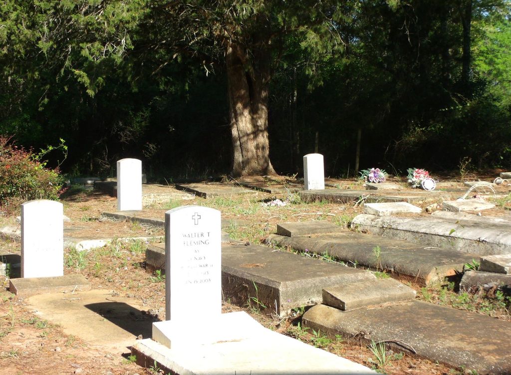
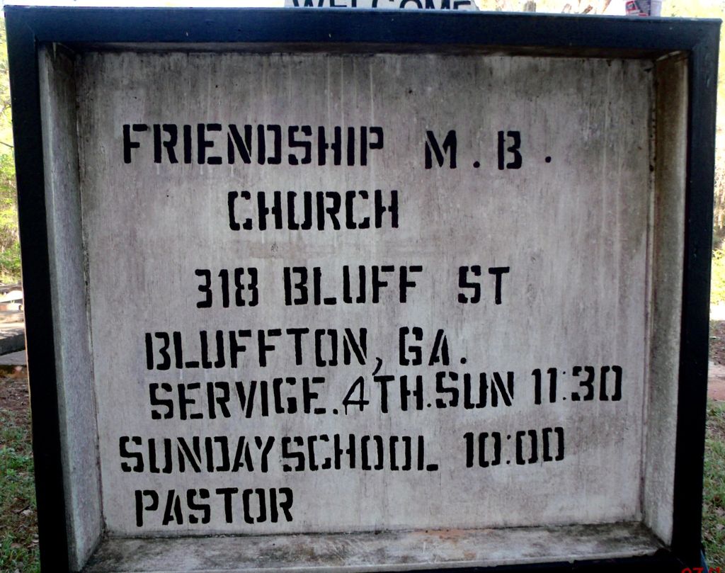
Friendship Baptist Church Cemetery is located at 318 Bluff Street Bluffton, Clay County ,Georgia , 39824USA.
-
Friendship Baptist Church Cemetery cemetery's updated grave count on graveviews.com?
0 memorials
-
Where are the coordinates of the Friendship Baptist Church Cemetery?
Latitude: 31.5218120
Longitude: -84.8722670
Nearby Cemetories:
1. Bluffton Cemetery
Bluffton, Clay County, USA
Coordinate: 31.5256004, -84.8732986
2. Blocker Family Cemetery
Clay County, USA
Coordinate: 31.5192432, -84.8542328
3. Union AME Church Cemetery
Bluffton, Clay County, USA
Coordinate: 31.5468380, -84.8600580
4. Vincent Cemetery
Bluffton, Clay County, USA
Coordinate: 31.5238991, -84.8199997
5. Todd Cemetery
Bluffton, Clay County, USA
Coordinate: 31.5089950, -84.8217240
6. Evergreen Church Cemetery
Blakely, Early County, USA
Coordinate: 31.4735845, -84.8630114
7. Bryant-Neves Cemetery
Clay County, USA
Coordinate: 31.5293999, -84.9308014
8. Saint Luke Missionary Baptist Cemetery
Fort Gaines, Clay County, USA
Coordinate: 31.5579070, -84.9275370
9. Colomokee Baptist Church Cemetery
Blakely, Early County, USA
Coordinate: 31.4613991, -84.8874969
10. Enterprise Baptist Church Cemetery
Clay County, USA
Coordinate: 31.5771999, -84.8330994
11. Rosinvick Baptist Church Cemetery
Blakely, Early County, USA
Coordinate: 31.4556120, -84.8653610
12. Ebenezer AME Church Cemetery
Zetto, Clay County, USA
Coordinate: 31.5218800, -84.9545660
13. Christ Missionary Baptist Church Cemetery
Early County, USA
Coordinate: 31.4842100, -84.7995400
14. Pleasant Grove Cemetery
Calhoun County, USA
Coordinate: 31.5403004, -84.7891998
15. Mills Cemetery
Calhoun County, USA
Coordinate: 31.5396996, -84.7881012
16. Matt Gilbert Cemetery
Early County, USA
Coordinate: 31.4496100, -84.8431300
17. Mount Zion Cemetery
Clay County, USA
Coordinate: 31.5424995, -84.9646988
18. Mount Calvary Church Cemetery
Fort Gaines, Clay County, USA
Coordinate: 31.5233890, -84.9688790
19. Mercier Family Cemetery
Early County, USA
Coordinate: 31.4661007, -84.9452972
20. Harmony Cemetery
Parksville, Calhoun County, USA
Coordinate: 31.5095600, -84.7710900
21. Wesley Cemetery
Clay County, USA
Coordinate: 31.5935993, -84.9313965
22. Hayes Cemetery
Early County, USA
Coordinate: 31.4577999, -84.9458008
23. Bell Family Cemetery
Edison, Calhoun County, USA
Coordinate: 31.5859430, -84.7956500
24. Mars Hill Cemetery
Calhoun County, USA
Coordinate: 31.5730991, -84.7763977