
| Memorials | : | 2 |
| Location | : | Bluffton, Clay County, USA |
| Coordinate | : | 31.5089950, -84.8217240 |
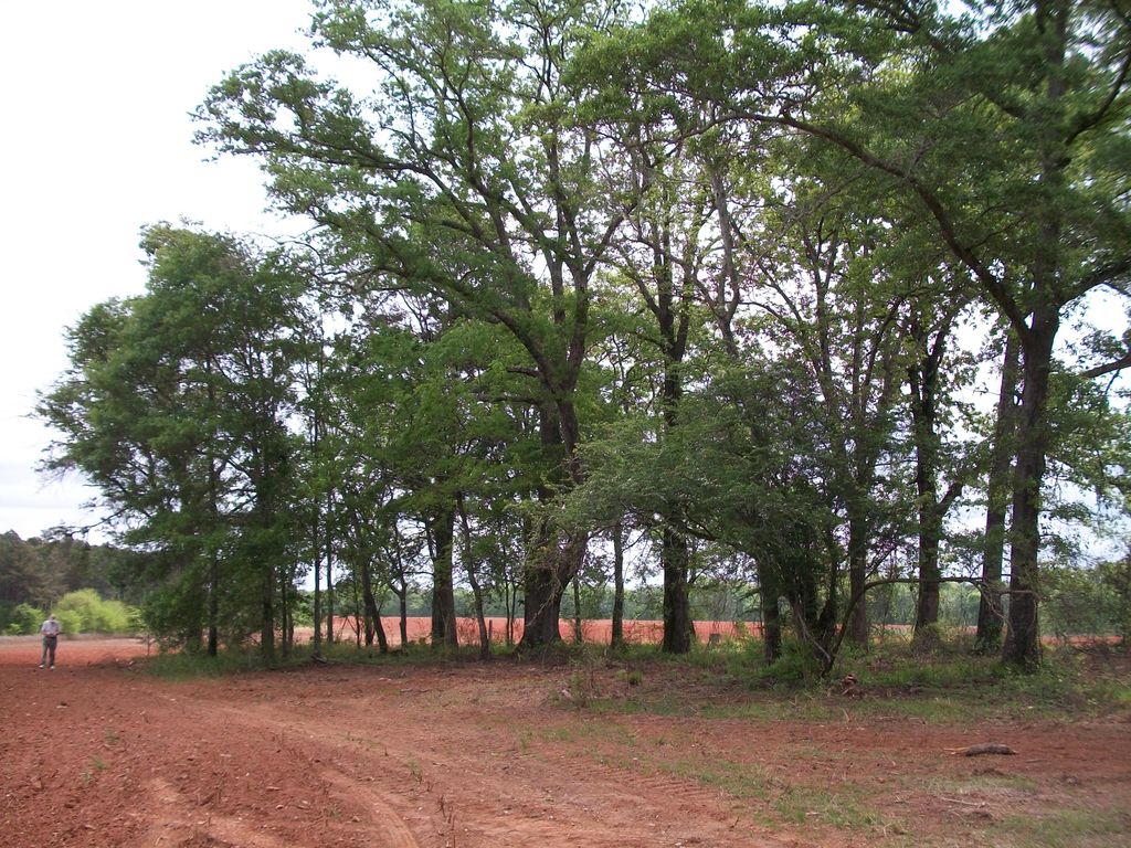
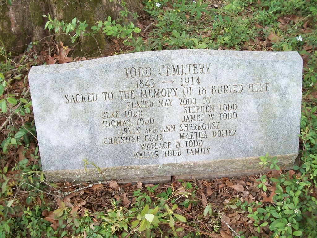
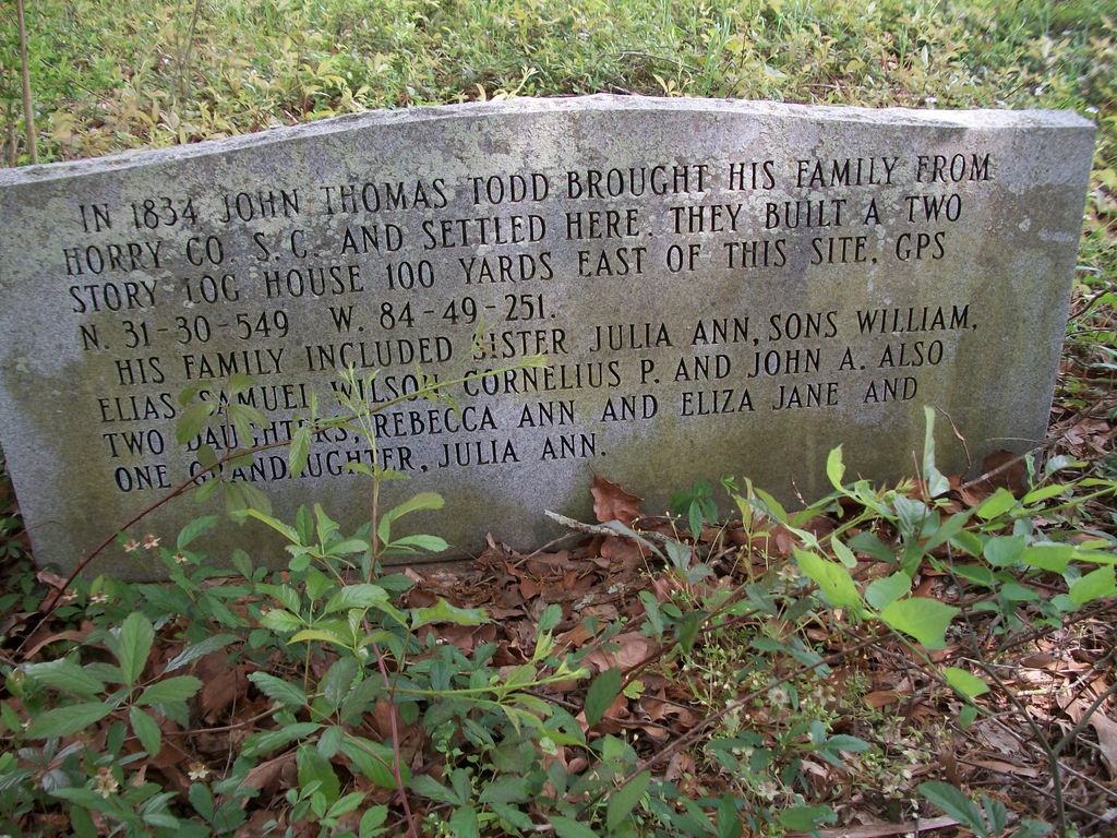
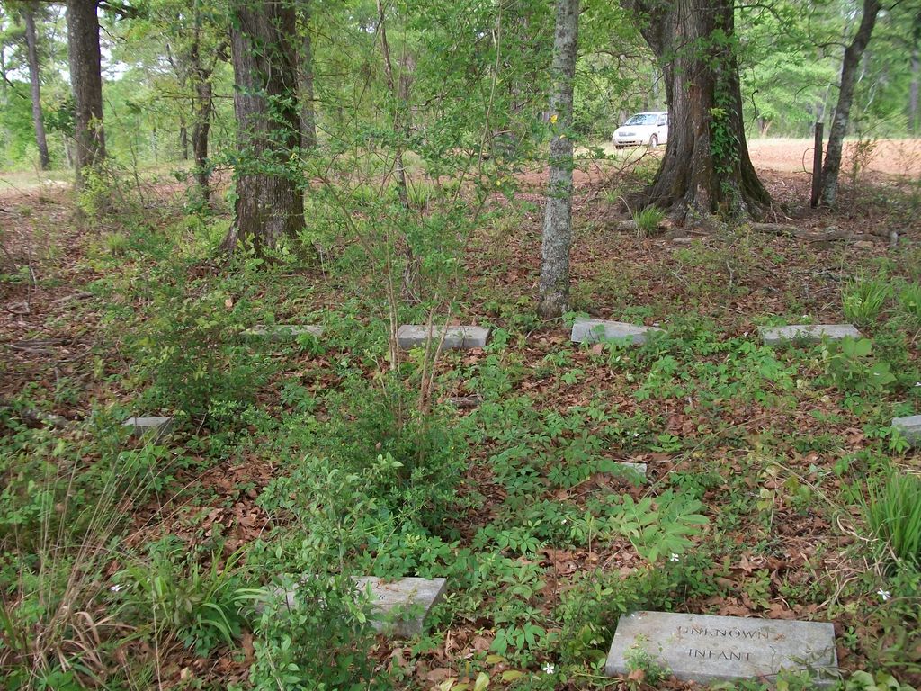
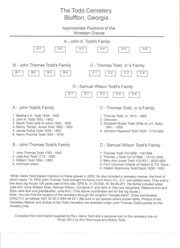
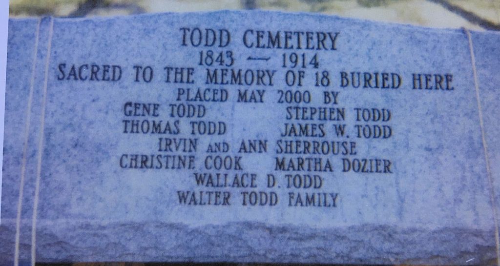
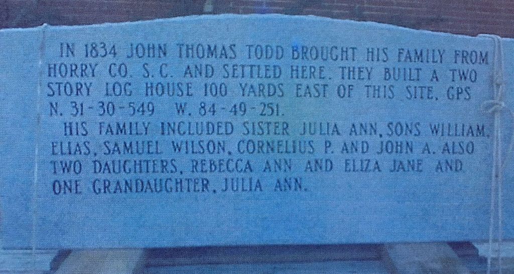
| Description | : | I believe this is where Thomas Todd settled, along Spring Creek. He built a two story log house which stood intact until it was sold then moved to another location (dismantled in 1993). Thomas is buried between a great oak tree and cedar tree. --- The Todd Cemetery is located in a field in a working farm between Bluffton and Edison, Georgia. There is no public access to the site. (Source: Ann Sherrouse) The Todd Cemetery is located in a field on a working farm between Bluffton and Edison, Georgia. It is approximately 1/2 mile off a dirt road. This photo was taken 18... Read More |
frequently asked questions (FAQ):
-
Where is Todd Cemetery?
Todd Cemetery is located at Bluffton, Clay County ,Georgia ,USA.
-
Todd Cemetery cemetery's updated grave count on graveviews.com?
2 memorials
-
Where are the coordinates of the Todd Cemetery?
Latitude: 31.5089950
Longitude: -84.8217240
Nearby Cemetories:
1. Vincent Cemetery
Bluffton, Clay County, USA
Coordinate: 31.5238991, -84.8199997
2. Blocker Family Cemetery
Clay County, USA
Coordinate: 31.5192432, -84.8542328
3. Christ Missionary Baptist Church Cemetery
Early County, USA
Coordinate: 31.4842100, -84.7995400
4. Pleasant Grove Cemetery
Calhoun County, USA
Coordinate: 31.5403004, -84.7891998
5. Mills Cemetery
Calhoun County, USA
Coordinate: 31.5396996, -84.7881012
6. Harmony Cemetery
Parksville, Calhoun County, USA
Coordinate: 31.5095600, -84.7710900
7. Friendship Baptist Church Cemetery
Bluffton, Clay County, USA
Coordinate: 31.5218120, -84.8722670
8. Bluffton Cemetery
Bluffton, Clay County, USA
Coordinate: 31.5256004, -84.8732986
9. Evergreen Church Cemetery
Blakely, Early County, USA
Coordinate: 31.4735845, -84.8630114
10. Union AME Church Cemetery
Bluffton, Clay County, USA
Coordinate: 31.5468380, -84.8600580
11. Matt Gilbert Cemetery
Early County, USA
Coordinate: 31.4496100, -84.8431300
12. Rosinvick Baptist Church Cemetery
Blakely, Early County, USA
Coordinate: 31.4556120, -84.8653610
13. Enterprise Baptist Church Cemetery
Clay County, USA
Coordinate: 31.5771999, -84.8330994
14. Colomokee Baptist Church Cemetery
Blakely, Early County, USA
Coordinate: 31.4613991, -84.8874969
15. Mars Hill Cemetery
Calhoun County, USA
Coordinate: 31.5730991, -84.7763977
16. Bell Family Cemetery
Edison, Calhoun County, USA
Coordinate: 31.5859430, -84.7956500
17. Duke Family Cemetery
Edison, Calhoun County, USA
Coordinate: 31.5876400, -84.7861300
18. Bryant-Neves Cemetery
Clay County, USA
Coordinate: 31.5293999, -84.9308014
19. Arms of Faith Missionary Baptist Church Cemetery
Early County, USA
Coordinate: 31.4136300, -84.8401200
20. Saint Luke Missionary Baptist Cemetery
Fort Gaines, Clay County, USA
Coordinate: 31.5579070, -84.9275370
21. Saint Stephen's Cemetery
Edison, Calhoun County, USA
Coordinate: 31.5688992, -84.7232971
22. Mount Ebel Baptist Church Cemetery
Arlington, Calhoun County, USA
Coordinate: 31.4399400, -84.7313100
23. Oak Grove Cemetery
Arlington, Calhoun County, USA
Coordinate: 31.4444809, -84.7262192
24. Gethsemane F.W.B. Church Cemetery
Arlington, Calhoun County, USA
Coordinate: 31.4402100, -84.7303800