
| Memorials | : | 0 |
| Location | : | Bluffton, Clay County, USA |
| Coordinate | : | 31.5468380, -84.8600580 |
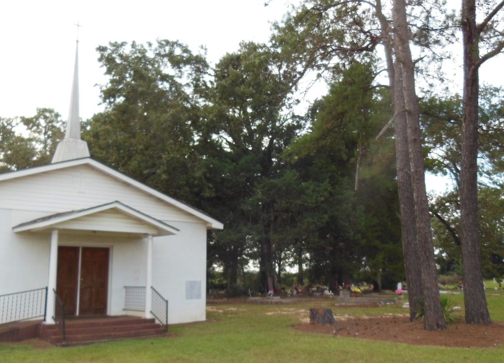
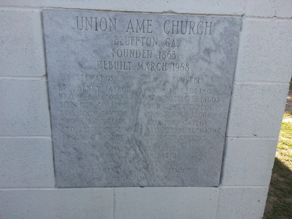
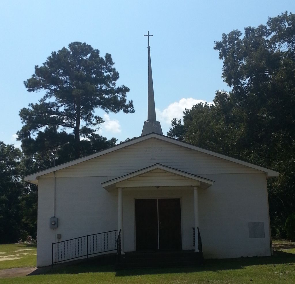
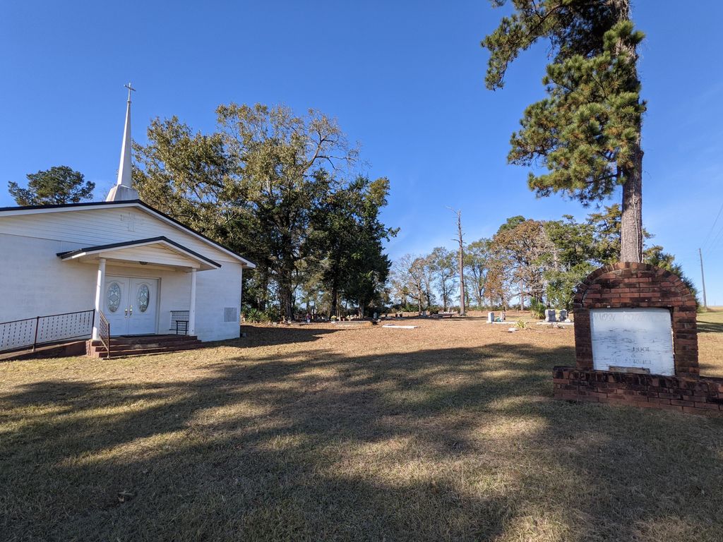
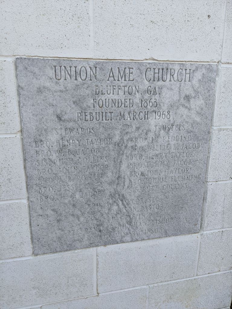
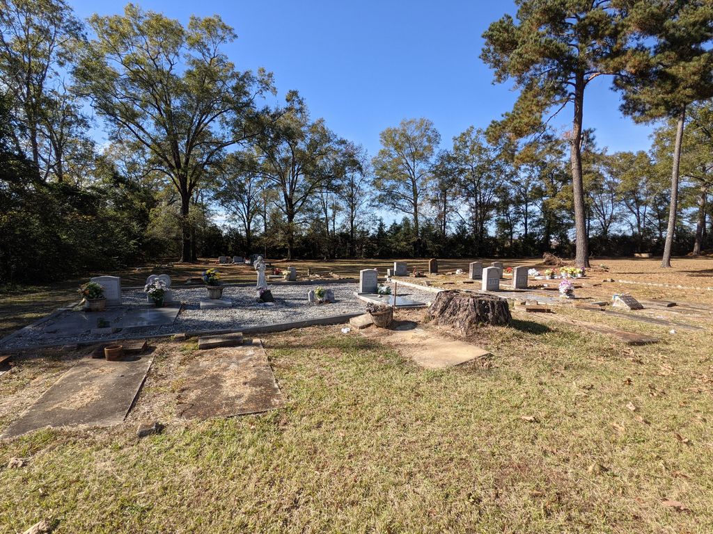
| Description | : | Union AME Church was established following the American Civil War in a land grant from a former white plantation owner to the African Methodist Episcopal Church. It located on U.S. Highway 27 North in Bluffton, GA. The cemetery is located directly beside the church. Graves date back to the late 1800s. |
frequently asked questions (FAQ):
-
Where is Union AME Church Cemetery?
Union AME Church Cemetery is located at Bluffton, Clay County ,Georgia ,USA.
-
Union AME Church Cemetery cemetery's updated grave count on graveviews.com?
0 memorials
-
Where are the coordinates of the Union AME Church Cemetery?
Latitude: 31.5468380
Longitude: -84.8600580
Nearby Cemetories:
1. Bluffton Cemetery
Bluffton, Clay County, USA
Coordinate: 31.5256004, -84.8732986
2. Friendship Baptist Church Cemetery
Bluffton, Clay County, USA
Coordinate: 31.5218120, -84.8722670
3. Blocker Family Cemetery
Clay County, USA
Coordinate: 31.5192432, -84.8542328
4. Enterprise Baptist Church Cemetery
Clay County, USA
Coordinate: 31.5771999, -84.8330994
5. Vincent Cemetery
Bluffton, Clay County, USA
Coordinate: 31.5238991, -84.8199997
6. Todd Cemetery
Bluffton, Clay County, USA
Coordinate: 31.5089950, -84.8217240
7. Saint Luke Missionary Baptist Cemetery
Fort Gaines, Clay County, USA
Coordinate: 31.5579070, -84.9275370
8. Pleasant Grove Cemetery
Calhoun County, USA
Coordinate: 31.5403004, -84.7891998
9. Mills Cemetery
Calhoun County, USA
Coordinate: 31.5396996, -84.7881012
10. Bryant-Neves Cemetery
Clay County, USA
Coordinate: 31.5293999, -84.9308014
11. Bell Family Cemetery
Edison, Calhoun County, USA
Coordinate: 31.5859430, -84.7956500
12. Enon Baptist Church Cemetery
Fort Gaines, Clay County, USA
Coordinate: 31.6132160, -84.8359720
13. Evergreen Church Cemetery
Blakely, Early County, USA
Coordinate: 31.4735845, -84.8630114
14. Duke Family Cemetery
Edison, Calhoun County, USA
Coordinate: 31.5876400, -84.7861300
15. Mars Hill Cemetery
Calhoun County, USA
Coordinate: 31.5730991, -84.7763977
16. Wesley Cemetery
Clay County, USA
Coordinate: 31.5935993, -84.9313965
17. Christ Missionary Baptist Church Cemetery
Early County, USA
Coordinate: 31.4842100, -84.7995400
18. Ebenezer AME Church Cemetery
Zetto, Clay County, USA
Coordinate: 31.5218800, -84.9545660
19. Harmony Cemetery
Parksville, Calhoun County, USA
Coordinate: 31.5095600, -84.7710900
20. Colomokee Baptist Church Cemetery
Blakely, Early County, USA
Coordinate: 31.4613991, -84.8874969
21. Mount Zion Cemetery
Clay County, USA
Coordinate: 31.5424995, -84.9646988
22. Rosinvick Baptist Church Cemetery
Blakely, Early County, USA
Coordinate: 31.4556120, -84.8653610
23. Mount Calvary Church Cemetery
Fort Gaines, Clay County, USA
Coordinate: 31.5233890, -84.9688790
24. Matt Gilbert Cemetery
Early County, USA
Coordinate: 31.4496100, -84.8431300