
| Memorials | : | 0 |
| Location | : | Lancaster, Fairfield County, USA |
| Coordinate | : | 39.7252998, -82.5258026 |
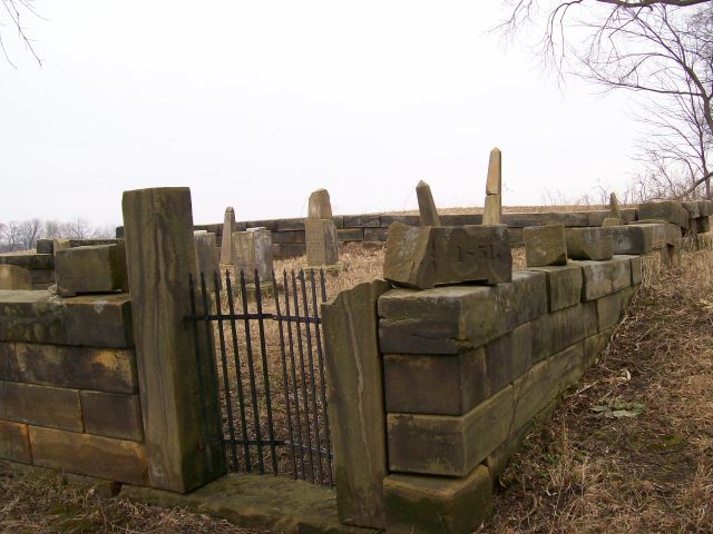
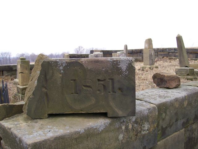
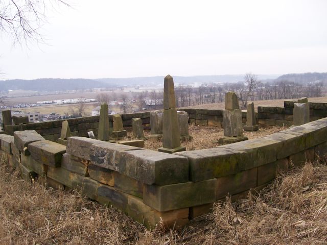
| Description | : | This stone walled cemetery is located on a hill on the north side of State Route 22 about 1/2 mile east of the Route 22 and Route 37 split and just west of Snoke Hill Road. The cemetery has been neglected and is in poor condition. The cemetery has been weeded out and the stones that were toppled over have been reset. Unfortunately many of the stones within the walls are totally blank. There are two Friesner Cemetery locations in Fairfield County. The other Friesner Cemetery resides in the town of Bremen. The cemetery is located in Pleasant Township, Fairfield... Read More |
frequently asked questions (FAQ):
-
Where is Friesner Cemetery?
Friesner Cemetery is located at Cincinnati Zanesville Road (US 22) Lancaster, Fairfield County ,Ohio , 43130USA.
-
Friesner Cemetery cemetery's updated grave count on graveviews.com?
0 memorials
-
Where are the coordinates of the Friesner Cemetery?
Latitude: 39.7252998
Longitude: -82.5258026
Nearby Cemetories:
1. Maple Grove Cemetery
Lancaster, Fairfield County, USA
Coordinate: 39.7266998, -82.5186005
2. Mount Tabor Cemetery
Fairfield County, USA
Coordinate: 39.7205000, -82.5174330
3. Applegate Cemetery
Lancaster, Fairfield County, USA
Coordinate: 39.7202988, -82.5421982
4. Bibler Cemetery
Fairfield County, USA
Coordinate: 39.7214012, -82.5081024
5. Amish Mennonite Cemetery
Lancaster, Fairfield County, USA
Coordinate: 39.7218610, -82.5035470
6. Pleasant Hill United Methodist Cemetery
Pleasant Township, Fairfield County, USA
Coordinate: 39.7454830, -82.5303940
7. Casper Hufford Cemetery
Lancaster, Fairfield County, USA
Coordinate: 39.7196198, -82.4976425
8. Asbury Cemetery
Lancaster, Fairfield County, USA
Coordinate: 39.7221985, -82.5558014
9. Collins Chapel Cemetery
Fairfield County, USA
Coordinate: 39.7097015, -82.4961014
10. Saint Mathews Cemetery
Lancaster, Fairfield County, USA
Coordinate: 39.7461014, -82.5017014
11. Emanuel Lutheran Church Cemetery
Lancaster, Fairfield County, USA
Coordinate: 39.7497128, -82.5490379
12. Huber Cemetery
Lancaster, Fairfield County, USA
Coordinate: 39.7407220, -82.5626840
13. Saint Paul Lutheran Cemetery
North Berne, Fairfield County, USA
Coordinate: 39.6913400, -82.5164000
14. Grace Evangelical Lutheran Church Cemetery
Lancaster, Fairfield County, USA
Coordinate: 39.7491330, -82.4894720
15. Sites-Sitz-Greenfiled-Ewing Cemetery
Lancaster, Fairfield County, USA
Coordinate: 39.7478828, -82.5699997
16. Tent Church Cemetery
Lancaster, Fairfield County, USA
Coordinate: 39.7485929, -82.4819305
17. Driver Cemetery
Bremen, Fairfield County, USA
Coordinate: 39.7144012, -82.4721985
18. Keller Cemetery
Fairfield County, USA
Coordinate: 39.7728060, -82.5377860
19. Mount Zion Cemetery
Bremen, Fairfield County, USA
Coordinate: 39.7075005, -82.4666977
20. Lamott Cemetery
Fairfield County, USA
Coordinate: 39.6931590, -82.5743200
21. Baptist Corners Cemetery
Lancaster, Fairfield County, USA
Coordinate: 39.7732520, -82.5059350
22. Fairfield County Infirmary Cemetery
Lancaster, Fairfield County, USA
Coordinate: 39.7388992, -82.5892029
23. Elmwood Cemetery
Lancaster, Fairfield County, USA
Coordinate: 39.7103004, -82.5899963
24. Crawfis-Emery Cemetery
Lancaster, Fairfield County, USA
Coordinate: 39.6787000, -82.5580000