
| Memorials | : | 0 |
| Location | : | Frisby on the Wreake, Melton Borough, England |
| Coordinate | : | 52.7480480, -0.9801370 |
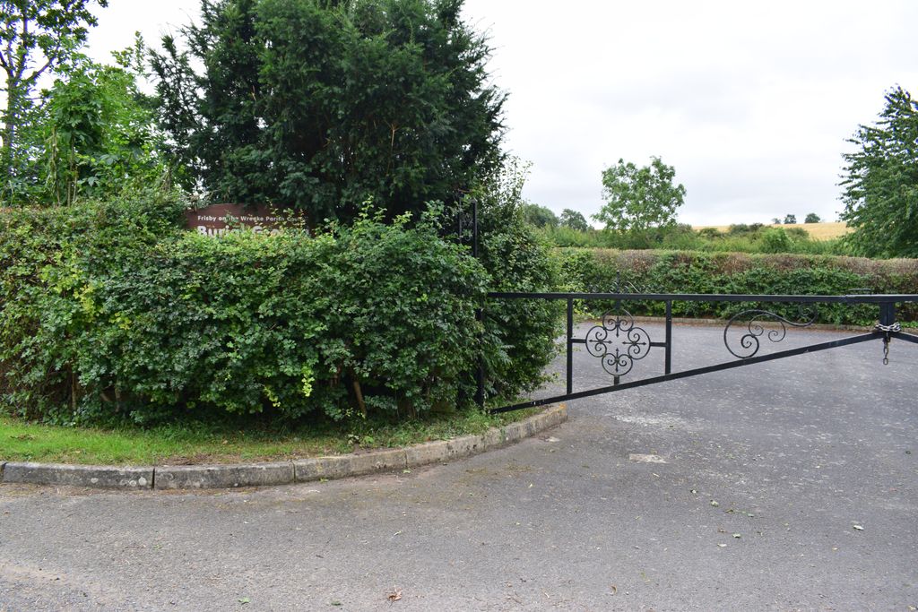
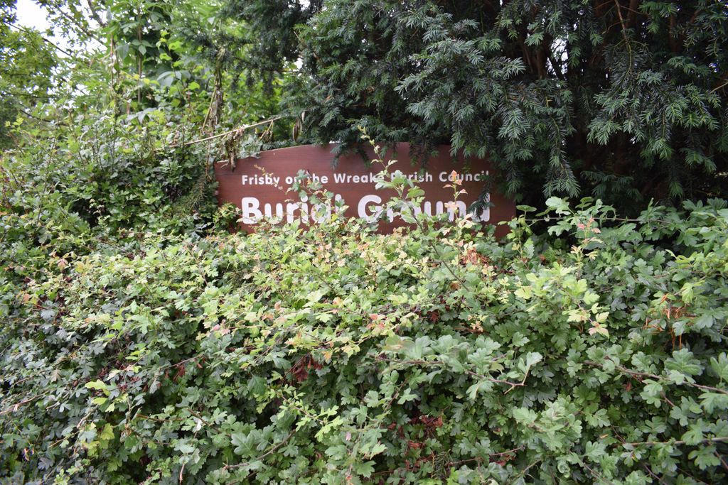
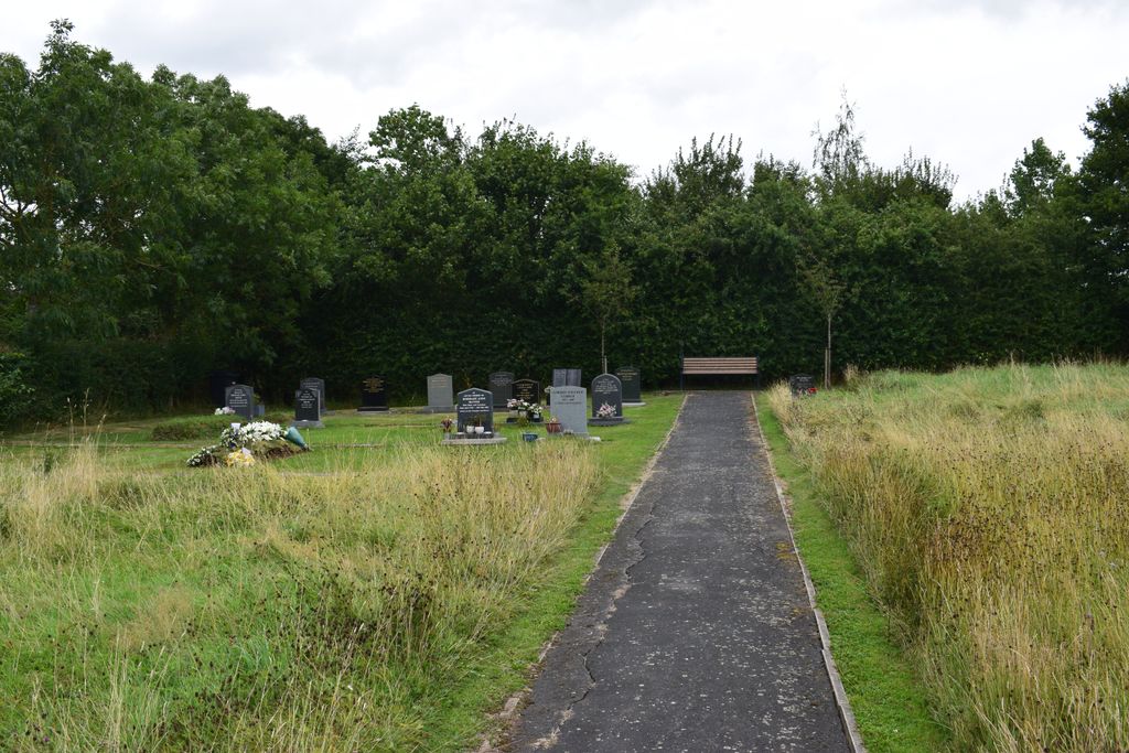
| Description | : | Sign to enter the cemetery is rather small and easily missed, particularly as bushes are prone to grow over it; more obvious are the gates across the parking area for the cemetery - if closed, find space just off the road and then walk into the cemetery. Cemetery is on the left when driving away from Frisby on the Wreake. A small cemetery than has not been in use for long, located in countryside a short walk out of the village. |
frequently asked questions (FAQ):
-
Where is Frisby on the Wreake Parish Council Burial Ground?
Frisby on the Wreake Parish Council Burial Ground is located at Rotherby Lane Frisby on the Wreake, Melton Borough ,Leicestershire , LE14 2NWEngland.
-
Frisby on the Wreake Parish Council Burial Ground cemetery's updated grave count on graveviews.com?
0 memorials
-
Where are the coordinates of the Frisby on the Wreake Parish Council Burial Ground?
Latitude: 52.7480480
Longitude: -0.9801370

Nearby Cemetories:
1. St Thomas of Canterbury Churchyard
Frisby on the Wreake, Melton Borough, England
Coordinate: 52.7531250, -0.9706940
2. St Thomas of Canterbury Churchyard Extension
Frisby on the Wreake, Melton Borough, England
Coordinate: 52.7537270, -0.9698390
3. All Saints Churchyard
Rotherby, Melton Borough, England
Coordinate: 52.7423100, -1.0013400
4. All Saints Churchyard
Hoby, Melton Borough, England
Coordinate: 52.7496100, -1.0101660
5. St Michael and All Angels Churchyard, Brooksby Hall
Melton Mowbray, Melton Borough, England
Coordinate: 52.7375450, -1.0076900
6. Asfordby Loughborough Road Cemetery
Asfordby, Melton Borough, England
Coordinate: 52.7654300, -0.9626900
7. All Saints Churchyard
Asfordby, Melton Borough, England
Coordinate: 52.7635100, -0.9523300
8. St Peter Churchyard
Kirby Bellars, Melton Borough, England
Coordinate: 52.7569830, -0.9376920
9. All Saints Church
Melton Borough, England
Coordinate: 52.7728570, -1.0209240
10. All Saints Churchyard
Melton Mowbray, Melton Borough, England
Coordinate: 52.7728700, -1.0209400
11. St Peter's Churchyard
Saxelbye, Melton Borough, England
Coordinate: 52.7817900, -0.9626700
12. Holy Trinity Churchyard
Thrussington, Charnwood Borough, England
Coordinate: 52.7359030, -1.0381780
13. Saint Luke's Churchyard
Gaddesby, Melton Borough, England
Coordinate: 52.7107200, -0.9805300
14. St Michael and All Angels Churchyard
Rearsby, Charnwood Borough, England
Coordinate: 52.7255100, -1.0373500
15. St John the Baptist Churchyard
Grimston, Melton Borough, England
Coordinate: 52.7902720, -0.9850350
16. Grange Lane Churchyard Extension, Sysonby
Melton Mowbray, Melton Borough, England
Coordinate: 52.7627410, -0.9077140
17. St. Leonards Churchyard Sysonby
Melton Mowbray, Melton Borough, England
Coordinate: 52.7633900, -0.9076000
18. St. Bartolomew's Churchyard, Welby
Melton Mowbray, Melton Borough, England
Coordinate: 52.7814860, -0.9263090
19. Ashby Folville Church of St Mary
Melton Mowbray, Melton Borough, England
Coordinate: 52.7009720, -0.9555180
20. St Swithun Churchyard
Great Dalby, Melton Borough, England
Coordinate: 52.7224510, -0.9027190
21. Queniborough Cemetery
Queniborough, Charnwood Borough, England
Coordinate: 52.7011860, -1.0315250
22. St. Michael's Churchyard
Wartnaby, Melton Borough, England
Coordinate: 52.8012220, -0.9447660
23. St Mary Churchyard
Queniborough, Charnwood Borough, England
Coordinate: 52.7023900, -1.0382700
24. St Botolphs Churchyard
Ratcliffe on the Wreake, Charnwood Borough, England
Coordinate: 52.7248680, -1.0680400